Deluxe Hiking Coast to Coast – A Wilderness Ireland Hiking Tour
July 6, 2025 July 17, 2025
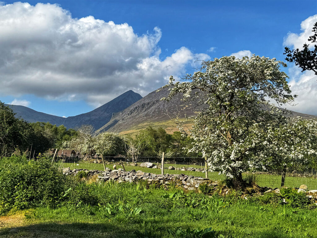
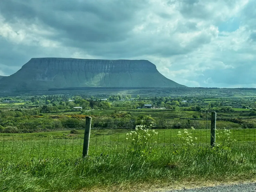
This was my second week of a two week hiking adventure in Northern Ireland and the Republic of Ireland. My Northern Coast hiking trip with Wilderness Ireland ended in Derry, Northern Ireland and my second week of hiking with Wilderness Ireland would be starting in Galway, Ireland the following morning. I had originally booked a seat on the Expressway 64 bus from Derry to Galway, which was to be a six hour bus ride. Nicola, a fellow hiker from the Northern Coast tour, offered me a ride in her rental car instead as she was driving to Limerick in the Republic of Ireland to visit family and I graciously accepted. Our route took us south through Letterkenny and into County Donegal, then past the impressive Benbulbin, a flat topped mountain with sheer sides and an elevation of 1726 feet, before passing through Sligo. We stopped at the Yeats County Inn for a late lunch, where I filled up on a hearty seafood, pie and chips, deciding then and there to skip dinner altogether.
Benbulbin
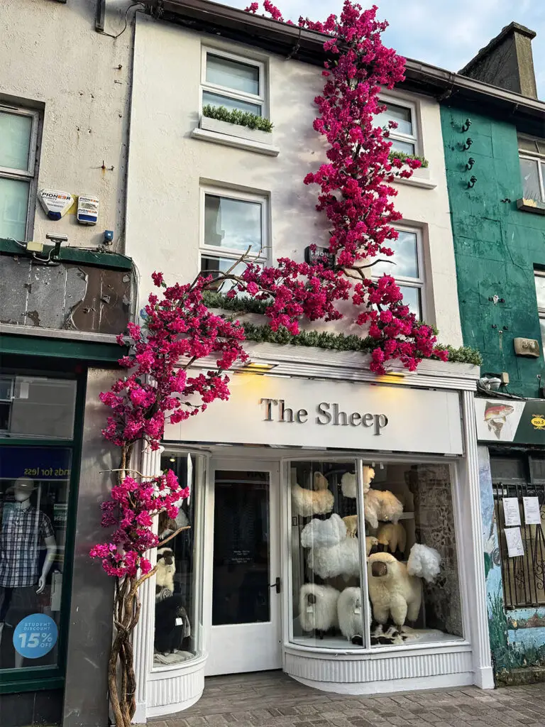
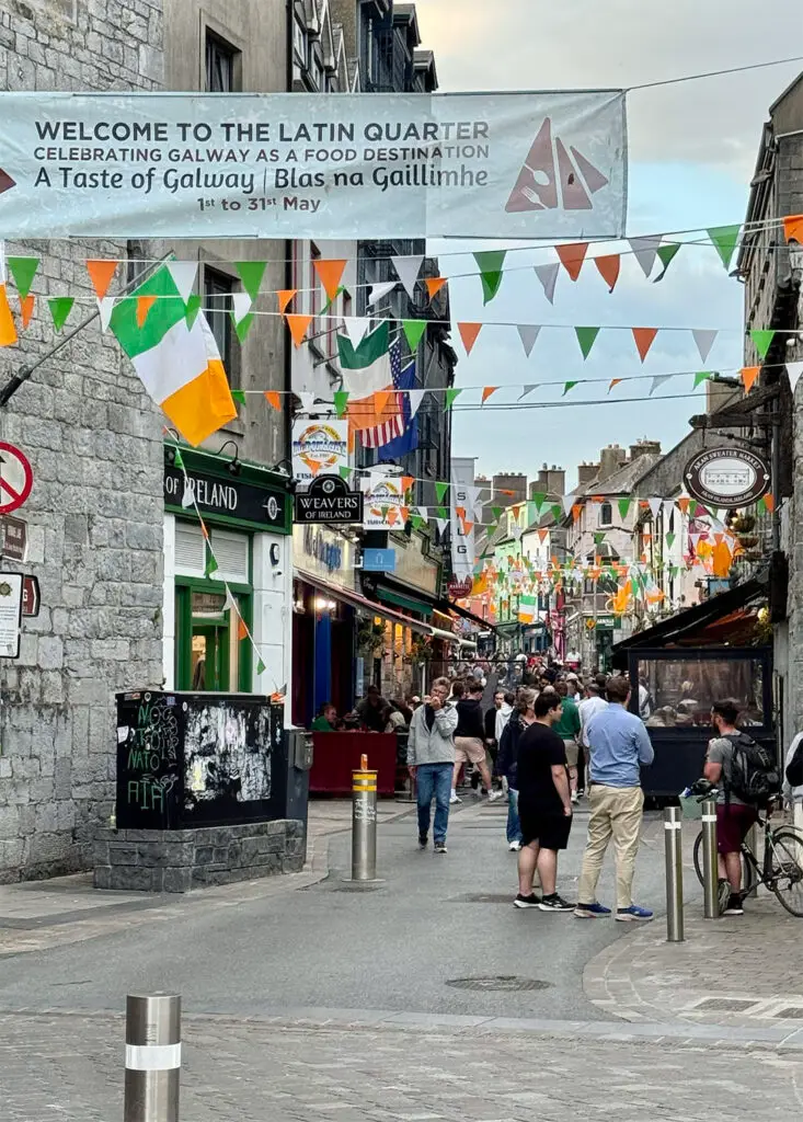
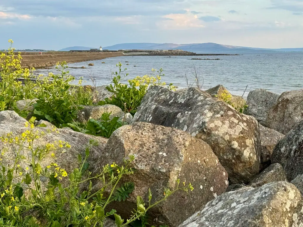
We reached the Victoria Hotel in Galway around 6:15 PM. After settling in, I headed out to explore Galway. The city was buzzing, full of useful energy. It was Friday evening, the weather was perfect, and the streets were alive – no doubt due in part to the presence of several universities in the area. I popped into a souvenir shop to stock up. From there, I made my way down to where the River Corrib flows into Galway Bay, then followed the long, scenic Mutton Island Causeway toward the Mutton Island Lighthouse. The causeway was popular with walkers and cyclists, taking advantage of the coastal breeze and setting sun. I didn’t realize until I reached the end, however, that access to the lighthouse itself was restricted – it’s part of a wastewater treatment facility. So I turned back and retraced my steps to the hotel. It was an early bedtime for me, as tomorrow I would meet a brand new group for the Deluxe Hiking Coast to Coast tour – a new adventure on the horizon.
Galway
The Latin Quarter in Galway
Mutton Island Lighthouse
Day 1 Galway to Connemara
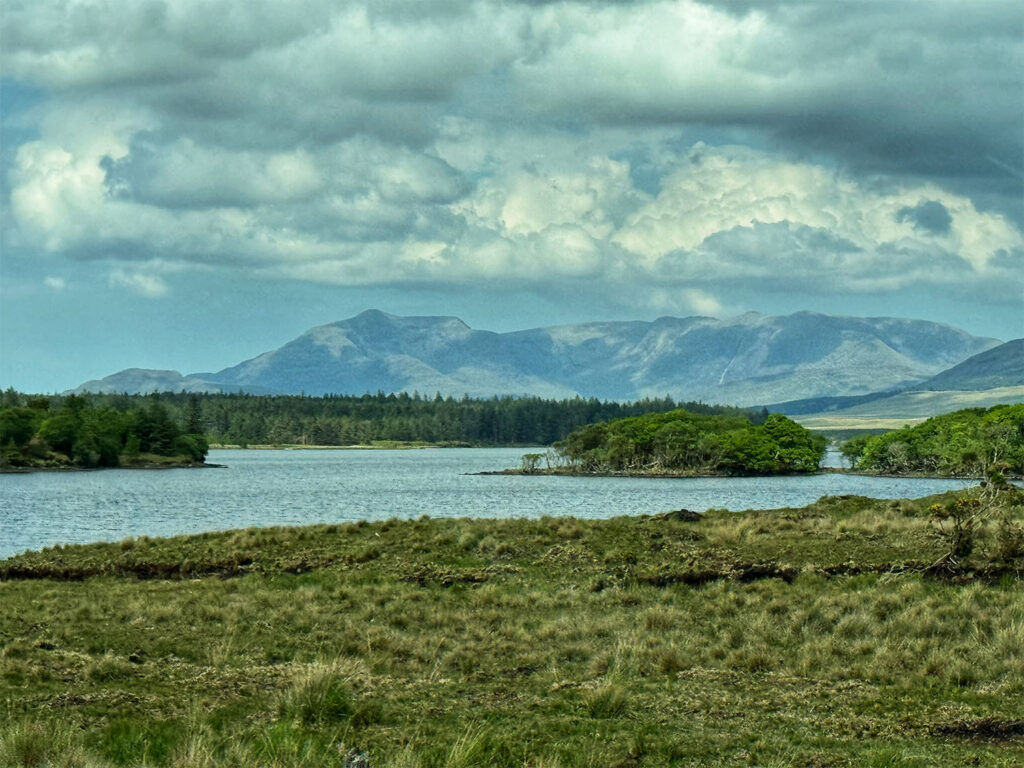
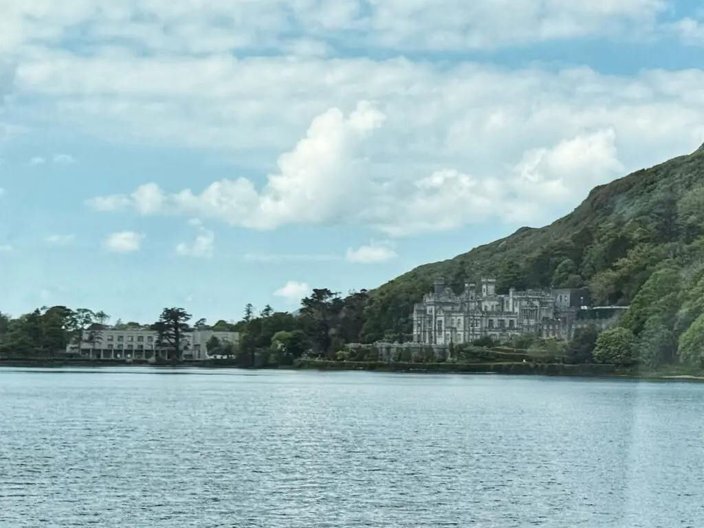
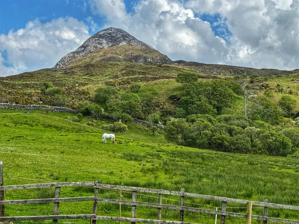
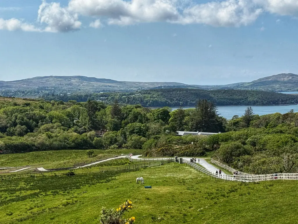
This new adventure began on May 10 at 11 AM outside the Hardiman Hotel in Galway, Ireland. Our group consisted of seven people, including myself: Calliam – our Wilderness Ireland guide from County Wicklow, Ireland; Pete and Marlene – a married couple from Maine; Erin and Beatrice – a mother & daughter duo from Toronto, Canada; and Mike – a retired, US citizen currently living in Mexico. We departed Galway and drove northwest towards Connemara, stopping for lunch at The Olive Tree Kitchen, part of the Wildlands Adventure Park. Eating outdoors, while watching zip liners and climbers whiz above us was a fun touch. Continuing our journey, we passed the Maumturk Mountains, and the stately Kylemore Abbey, with the Twelve Ben’s forming a majestic backdrop. Eventually, we reached the town of Letterfrack, where we parked behind the Letterfrack Country Shop and set out on our first hike: Diamond Hill (Bengooria), with an elevation of 1450 feet.
View of the Twelve Bens and Connemara
The Kylemore Abbey
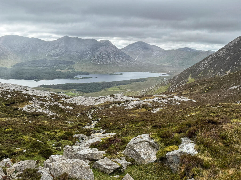
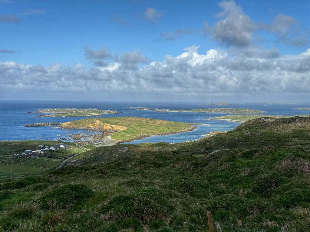
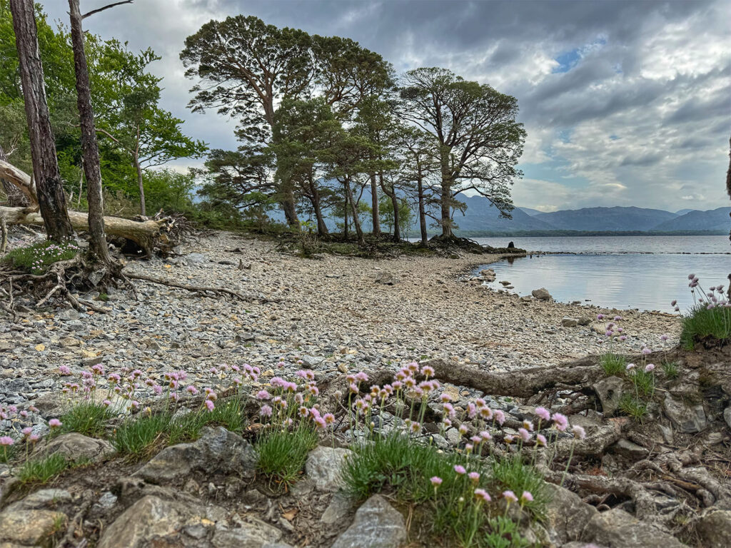
It was a glorious afternoon, and the views were spectacular. To the northwest, we gazed out over Barnaderg Bay and the islands of Inishturk and Inishbofin. To the west, the Twelve Bens loomed in rugged beauty. In the distance, we could see Mweelrea – the peak scheduled for our hike the following day. The trail was well-maintained, mostly stone steps, and noticeably busier than the trails I had encountered the previous week. Instead of retracing our steps from the summit, we completed a loop lollipop route, spending about 2 1/2 hours hiking – likely giving Calliam a chance to assess everyone’s fitness level.
Diamond Hill
Looking back at the start of the Diamond Hill Trail
Almost to the summit of Diamond Hill
The descent on Diamond Hill
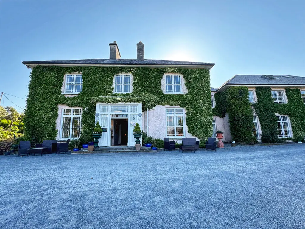
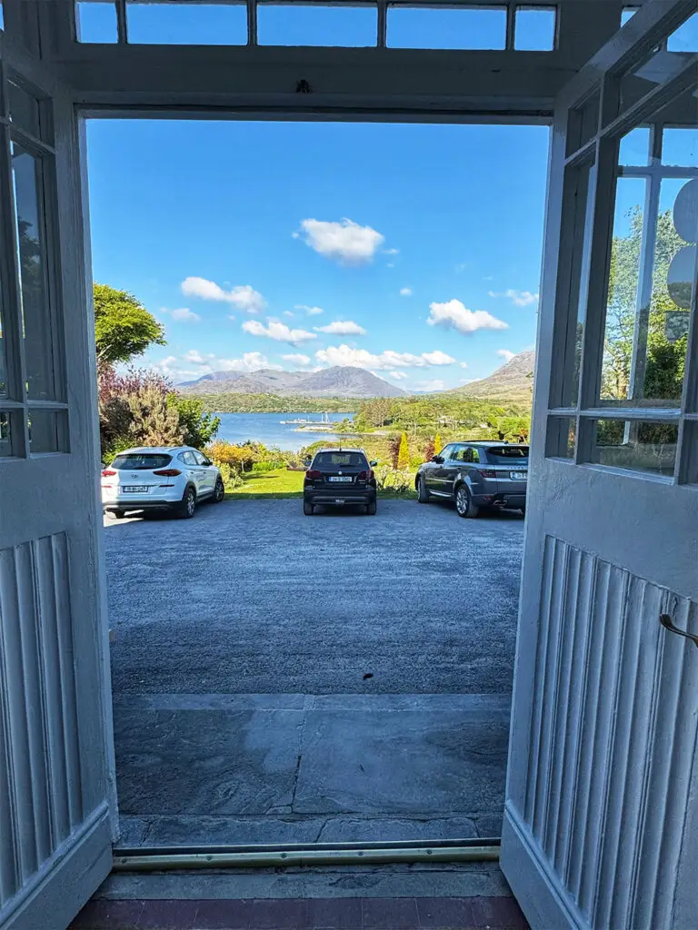
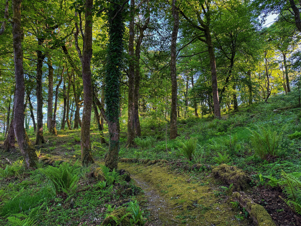
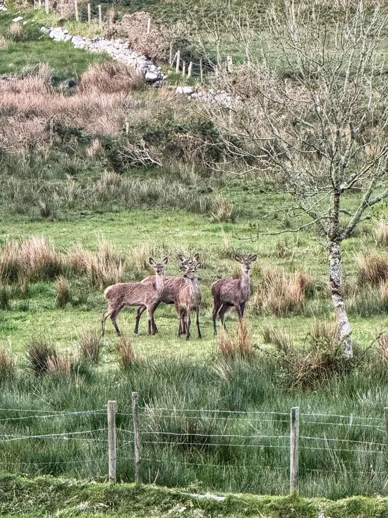
After the hike, we drove about 10 minutes to our accommodation for the next two nights: Rosleague Manor. This place was absolutely stunning! Before dinner, I took a stroll around the property. The grounds included manicured lawns with seating areas, forested paths leading down to the water, and even a blooming rhododendron garden. We gathered for pre-dinner cocktails in the hotel’s glass atrium before sitting down at 7 PM for a delicious dinner. I stepped back outside around 9 PM in hopes of catching the sunset. Unfortunately, the midges were out in full force, and quickly drove me back indoors. Still, I did spot some red deer quietly grazing on the property – a lovely end to a full and rewarding day.
Rosleague Manor
View out the front door at Rosleague Manor
Forested trail on Rosleague Manor grounds
Red deer at Rosleague Manor
Day 2 Maumturk Mountains
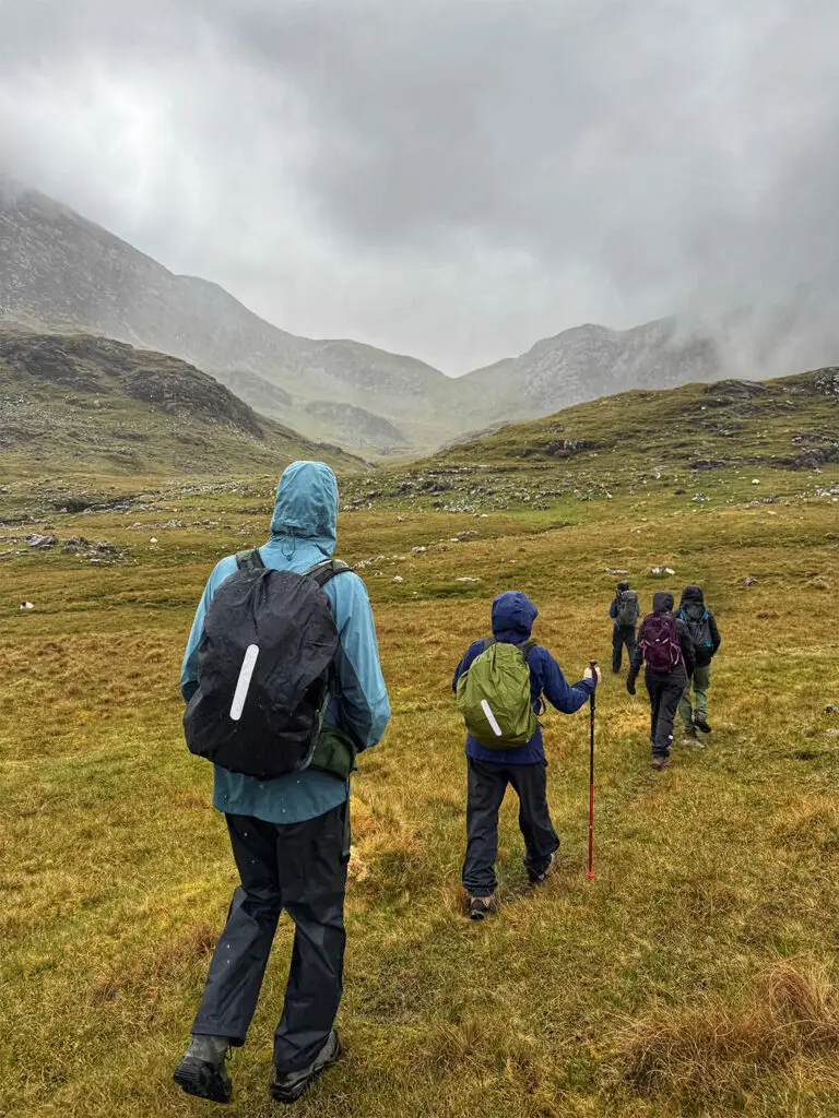
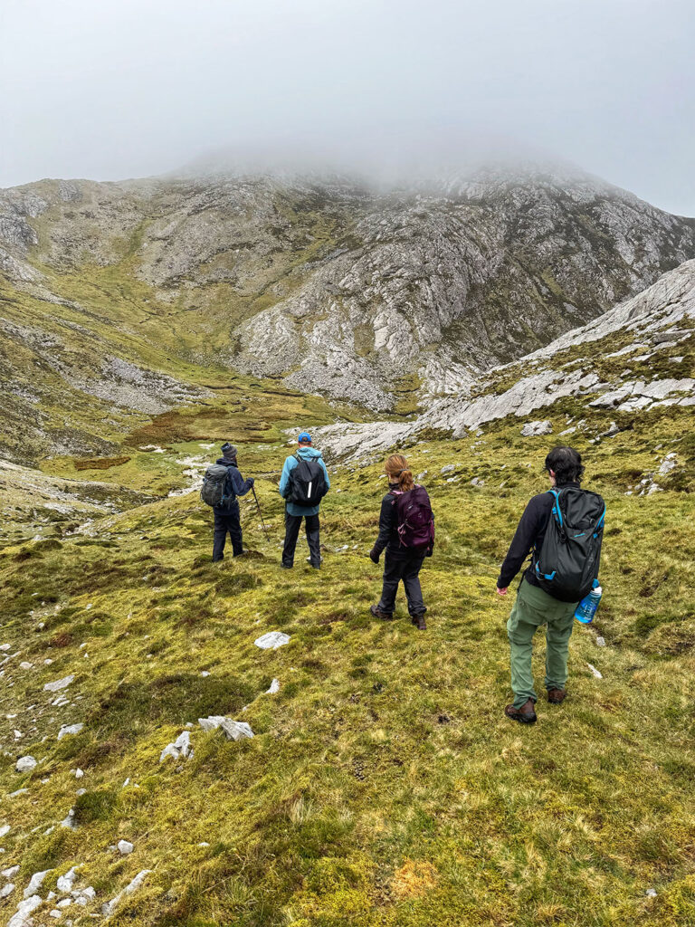
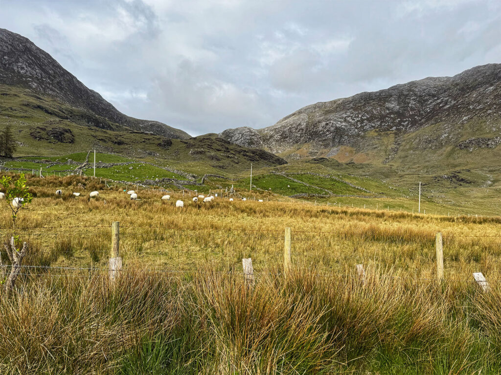
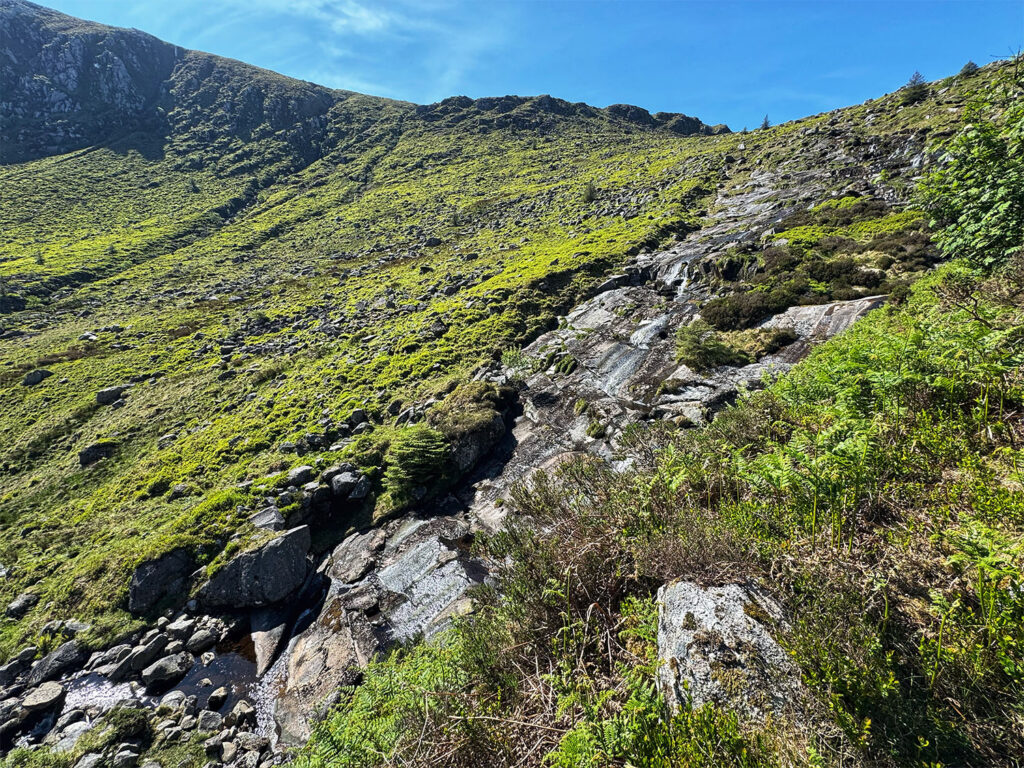
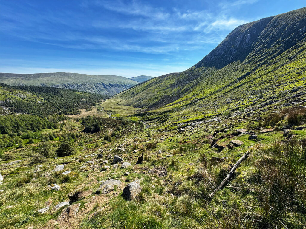
Today was meant to mark the summit of my second peak in the Ireland Four Peaks challenge. While the traditional challenge is completed over two days, I had opted for a more leisurely two week version. The goal: to hike the highest peak in each of Ireland’s four provinces – Mweelrea (Connacht),Carrauntoohil (Munster), Slieve Donard (Ulster), and Lugnaquilla (Leinster). I had already conquered Slieve Donard the previous week during my Northern Coast tour, and today was intended for Mweelrea. Unfortunately, the weather had other plans. Before picking us up, Calliam had checked the mountain forecast, which had only worsened since the night before. Rather than pushing forward, regardless, he suggested an alternate plan. The real reward of climbing Mweelrea, he explained, was the summit view – and with visibility expected to be near zero, it didn’t make sense to drive an hour and a half, only to climb a challenging trail with no payoff. Instead, he proposed a hike closer to home: the Maumturk Mountains, known for their rugged terrain and dramatic landscape.
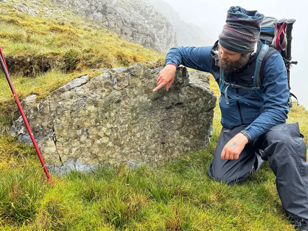
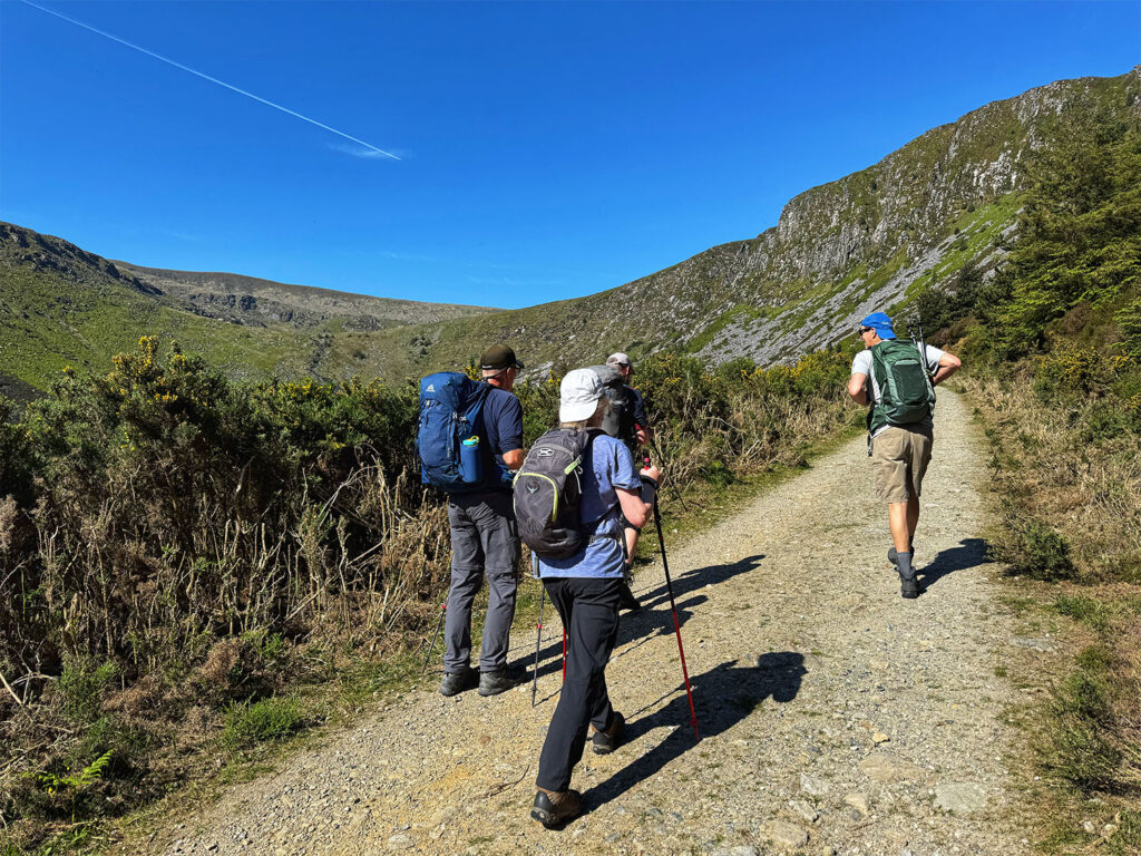
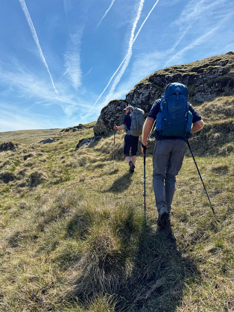
We departed around 9 AM stopping to pick up trail sandwiches along the way. Calliam parked the van along a narrow country road – Sli Chonamar – opposite the Maumturk range. As soon as we stepped out, we had to don our rain gear and cover our packs. The hike was demanding from the start, and I was grateful for my trekking poles. The ascent was continuous and steep, with little resembling a defined trail. The terrain was wild and untamed. As we climbed, Calliam paused often to share stories from Irish mythology and to point out, curious details along the way – including carnivorous plants and unusual lichens..
Heading off into the Maumturk Mountains
Calliam pointing out map lichen
We reached our first summit with no views, the mist, thick and unrelenting. Pressing onward along the undulating ridge line, we eventually reached a second peak. I’m confident this one was Letterbreckaun, though I remain unsure about the first – possibly Bonn I dir an Da Log. As we began our descent, the skies finally began to clear, revealing a breathtaking panorama of Lough Inagh and the Twelve Bens. It was a rewarding contrast after the foggy start. The descent, however, proved tough on everyone’s knees, with steep drops and uneven footing.
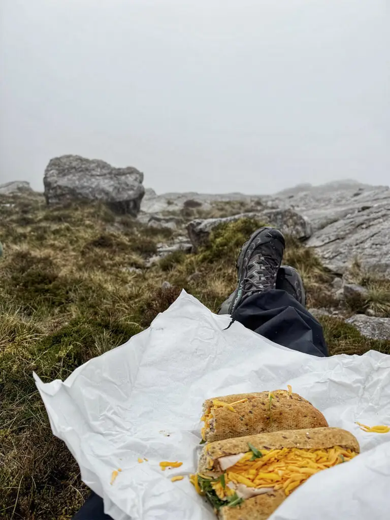
Lunch with no view
Summit with no view
Descent from the Maumturk Mountains
Clouds beginning to lift
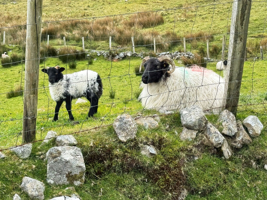
We ended the hike on the same country road, about a mile and a half north of where we had begun. The walk back to the van took us past picturesque farms and fields scattered with sheep – a peaceful coda to an otherwise rugged day.
Sheep with her lamb
Clear view of where we were hiking in the Maumturk Mountains earlier in the day
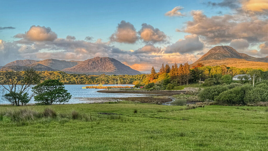
Dinner for the next four nights wasn’t included in our tour package, but options in the area were limited. Fortunately, Calliam had made dinner reservations for our group at Veldon’s Seafarer Bar and Restaurant. I ordered the lamb stew, hearty and comforting, followed by a raspberry crème brûlée for dessert. The restaurant was lively and bustling, with live music adding to the atmosphere. We returned to Rosleague Manor just in time for the sunset. While I couldn’t actually see the sun did below the horizon – it set on the far side of the peninsula, beyond my reach – I was still able to capture the golden light spilling across the landscape. A quiet, beautiful end to an unexpectedly memorable day.
View from Rosleague Manor during the golden hour
Day 3 Connemara to Killarney
We bid farewell to the charming Rosleague Manor, and began our journey back toward Galway. Calliam opted for the scenic route, guiding us along the stunning Sky Road en route to the town of Clifden. The drive, treated us to breathtaking views of Clifden Bay, Turbot Island, and Inishturk, their rugged beauty bathed in morning light. At one point, we encountered a “cow jam “– a delightfully Irish traffic delay – as Calliam shared the captivating story of Grainne O’Malley (also known as Grace O’Malley or Grace the Pirate), the formidable 16th century chieftain of the O’Maille dynasty who ruled the western seas of Ireland.
View from the Sky Road near Clifden
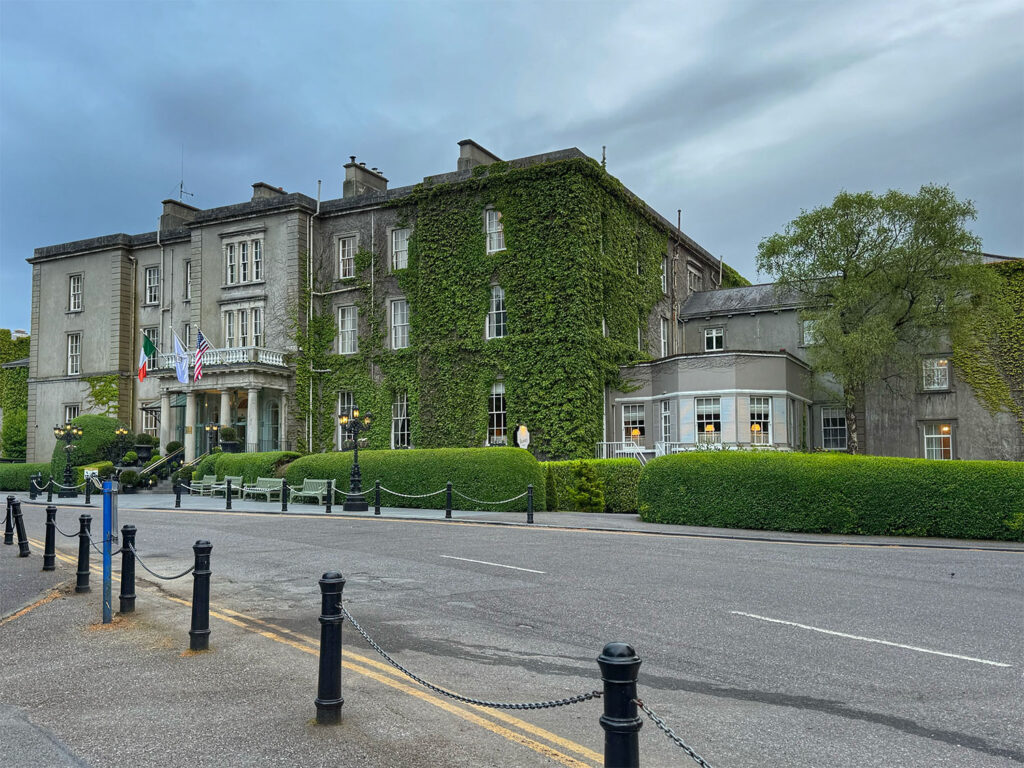
Upon reaching Galway, we turned south, passing through Limerick before arriving in the lively town of Killarney in County Kerry. The entire journey took approximately 4 1/2 hours. Our destination was The Great Southern Killarney, a grand and historic hotel, where we would be staying for the next two nights. As it was too early to check in, we enjoyed a leisurely lunch at Brownies, a cozy pub within the hotel. The Great Southern Killarney has been a proud member of Historic Hotels Worldwide since 2019. Originally commissioned by the Great South and Western Railway, the hotel was designed by architect Frederick Darley, who also contributed to the architecture of Trinity College Dublin. Since it’s opening in July 1854, it has earned a reputation as one of Ireland’s premier holiday retreats, even hosting Queen Victoria. During the Irish Civil War, the hotel was seized by the free state army and used to house political prisoners. It was later acquired by the Irish state and underwent extensive renovations to become the elegant property it is today.
The Great Southern Killarney
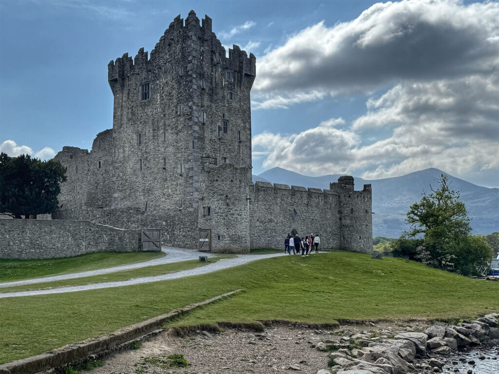
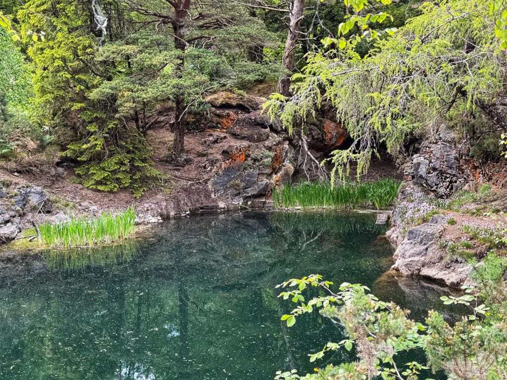
After lunch, we set off to explore Killarney National Park. Our first stop was the picturesque Ross castle, perched at the edge of Lough Leane. This 15th century fortress was once the stronghold of the O’Donoghue chieftains. We wandered around the castle grounds before continuing along a wooded path on Ross Island, historically significant for its ancient copper mines. Mining activities here date back to the early Bronze Age (circa 2400 –1800 BC), making it the oldest known copper mining site in Ireland and likely in Northwestern Europe. Remarkably, between 1804 and 1829, nearly 5000 tons of copper ore were extracted and shipped to smelters in Britain.
Ross Castle
Pond near copper mine in Killarney National Park
Our walk offered sweeping vistas of Lough Leane and the majestic McGillycuddy‘s Reeks, Ireland’s highest mountain range. Towering among them is Carrauntoohil the country’s tallest peak, and our goal for the next days hike. The Reeks are renowned for their dramatic ridges and lofty summit, making them a highlight for any hiking enthusiast.
Lough Leane
Dinner was left to our own discretion that evening, and the bustling town of Killarney offered no shortage of enticing options. I dined at Murphy’s pub, a quintessential Irish establishment where I enjoy a satisfying plate of fish and chips.
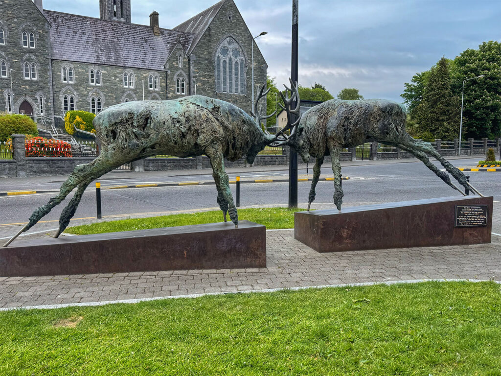
Red Deer Statue in Killarney
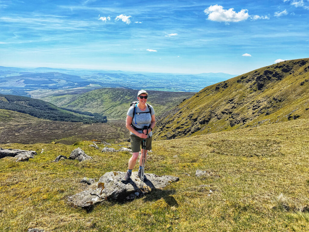
Day 4 Carrauntoohil
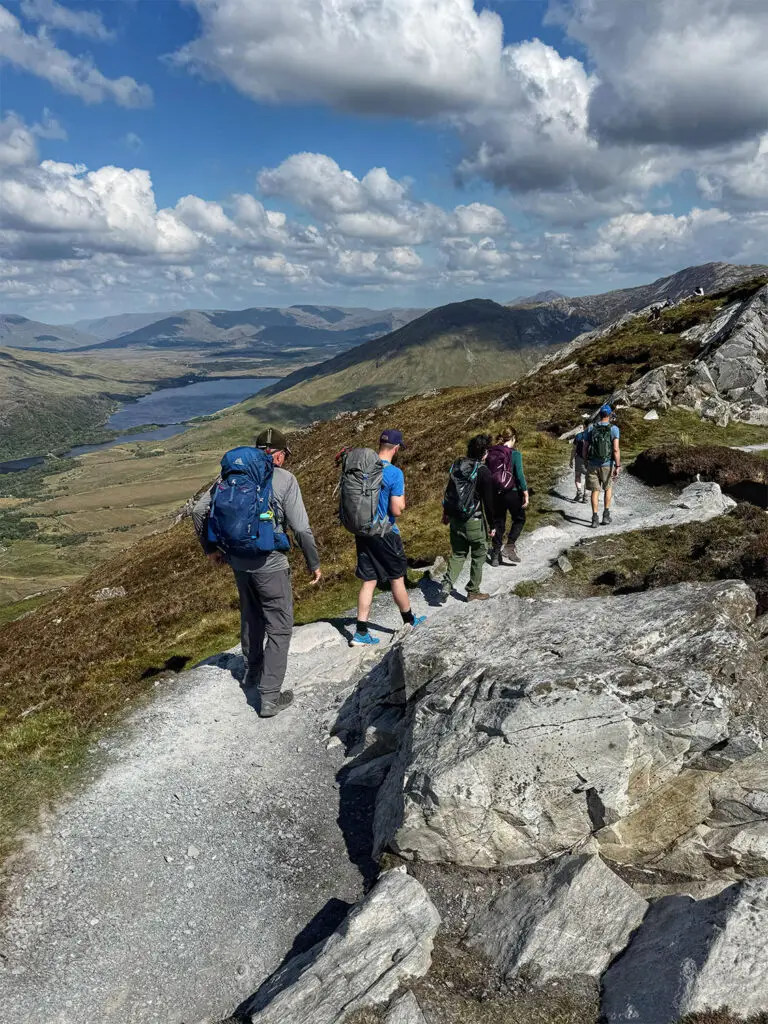
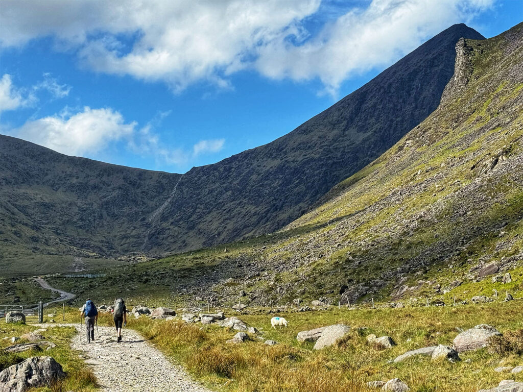
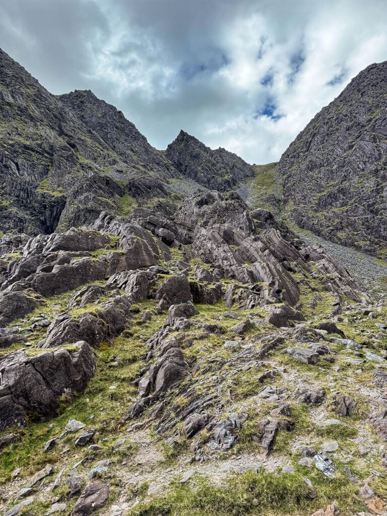
We got an earlier start than usual, as Calliam estimated that our hike could take anywhere from 6 to 11 hours, depending on conditions and pace. We left the hotel at 8:30 AM and arrived at Cronin‘s Yard, the trailhead for Carrauntoohil, around 9 AM. There, we picked up our packed lunches – simple but satisfying: a sandwich, a slice of fruit cake, and a piece of fresh fruit. The weather was ideal – clear, calm, and already beginning to warm – so I made the wise call to unzip my convertible hiking pants into shorts before setting off. Our hiking group – Calliam, Mike, Erin, Beatrice, and I set off around 9:30 AM. From the parking lot, Carrauntoohil’s distinctive peak was already in view, rising like a sentinel over the valley. The first 1 3/4 miles followed a gently ascending gravel road beside a stream – an easy and pleasant warm-up. There are several routes to the summit, and while the Devil‘s Ladder is perhaps the best known, Calliam described it as a steep and tedious trudge once you reach the saddle. Instead, he selected O’Shea‘s Gully for us – a more demanding path, but one that rewards the effort with dramatic scenery, including a close-up view of the mountains imposing northeast face.
Mike & Calliam on the gravel road towards Carrauntoohil
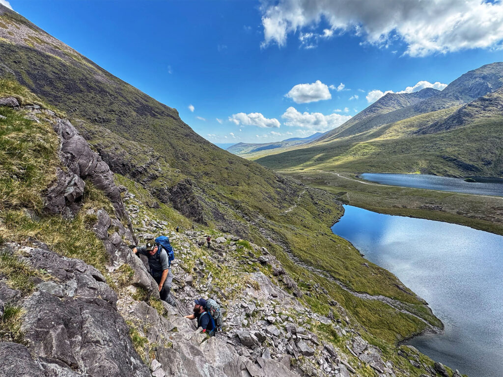
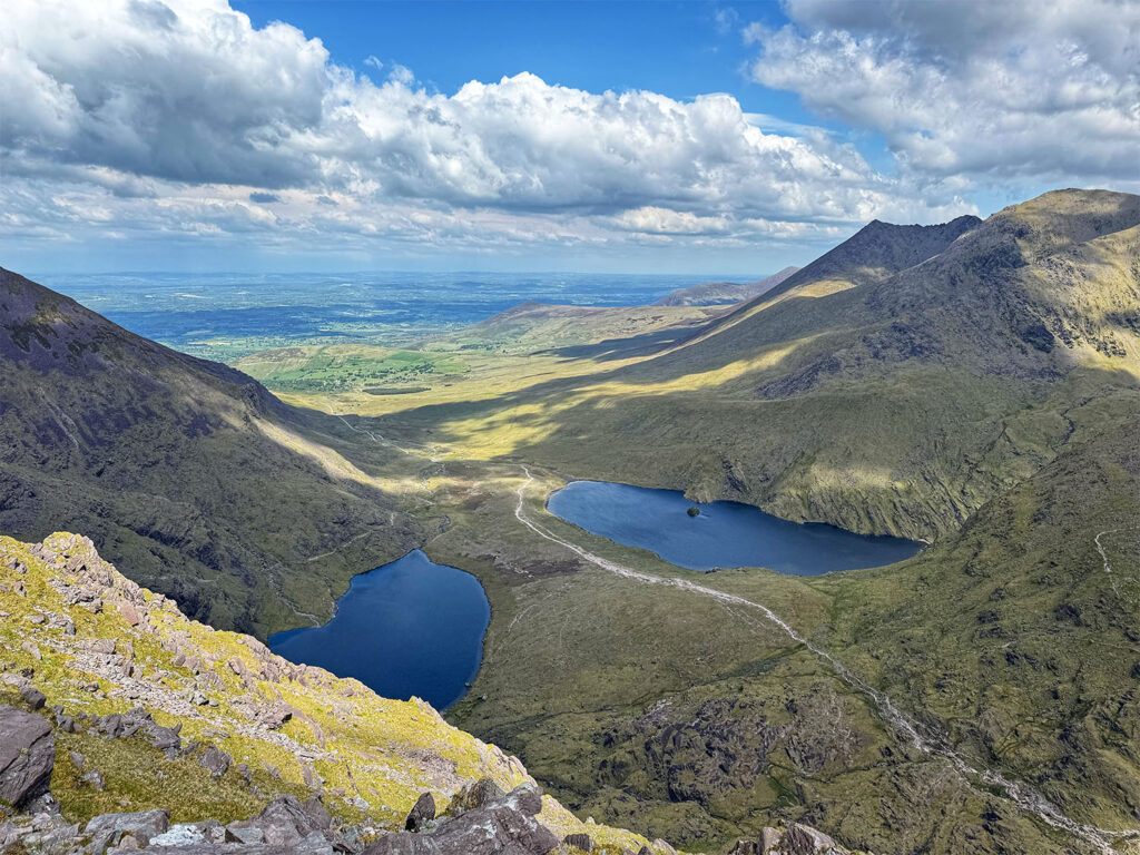
As we climbed, we passed striking landmarks, like the jagged “Hag’s Tooth “and the twin mountain lakes known as “The Hag‘s Lungs“ (Lough Gouragh and Lough Callee). The terrain became increasingly challenging, with some exposed scrambles and a steep, unforgiving scree field. We also passed by Lough Cummeenoughter, Ireland’s highest lake, sitting at an elevation of 2320 feet. I found the route, exhilarating and deeply rewarding.
The scramble begins towards O’Shea’s Gully
O’Shea’s Gully
Lake Cummeenoughter, highest lake in Ireland as seen from the top of O’Shea’s Gully
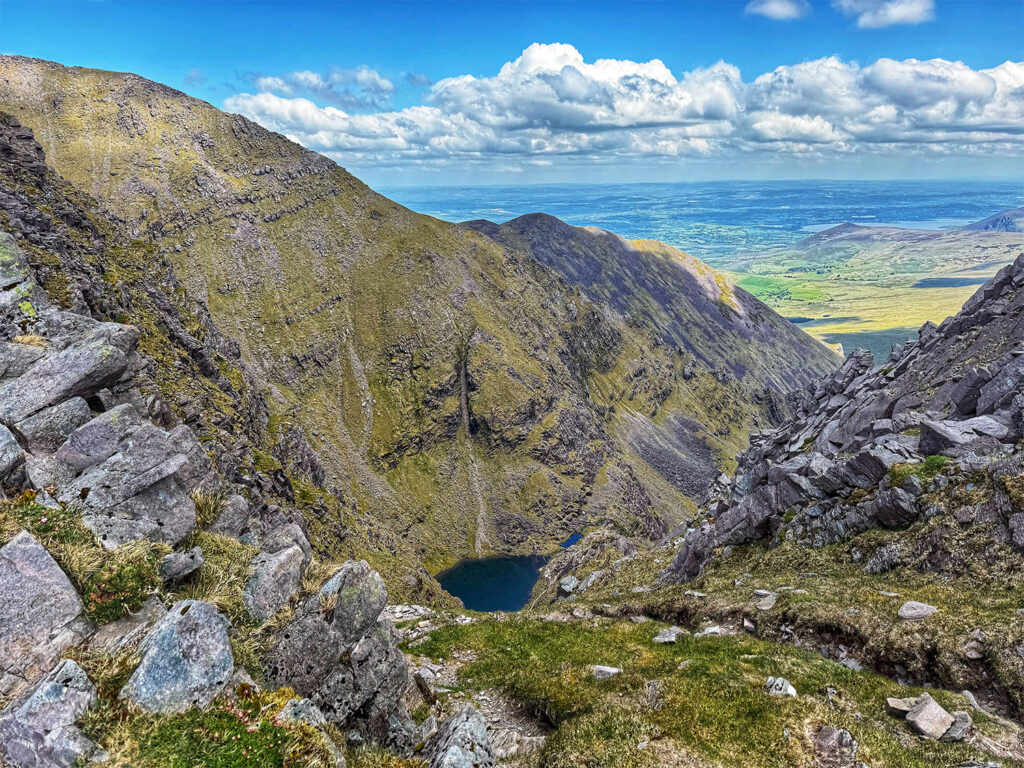
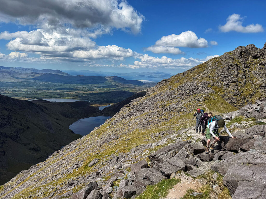
The screen field, proved particularly tough – like slogging up sand dunes in Death Valley – but once we reached the top of O’Shea’s Gully. We were rewarded with panoramic views that took our breath away. To the west, we could see Lough Eager, Lough Coomloughra, Lough Eighter, and Lough Acoose, while to the northwest the Dingle Peninsula stretched toward the sea. The wind picked up at this elevation, so I added a knit hat and a merino quarter- zip for warmth.
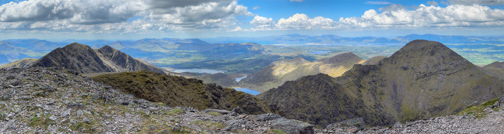
The final ascent to the summit, at 3415 feet, was somewhat easier than the gully, but still steep. We reached the top at 1:45 PM, 4 1/4 hours after starting. The wind was sharp and the temperature noticeably cooler, so we found a sheltered spot near the summit cairn and enjoyed our well earned lunches. I pulled on my puffy jacket, though I stayed in shorts – stubbornly or sensibly, depending on one’s view. During lunch, Calliam laid out our decent options. One, was a longer but more gradual route near the Devil‘s Ladder, which would take us around and above the Hag’s Lungs. The other was, in his words, “a spectacular route,” involving some scrambling, and a narrow traverse along a goat path that passed through a dramatic gap in the cliffs known as The Heavenly Gates. As soon as I heard, “spectacular, “I was sold.
Almost at the Carrauntoohil summit
Panoramic Carrauntoohil summit view
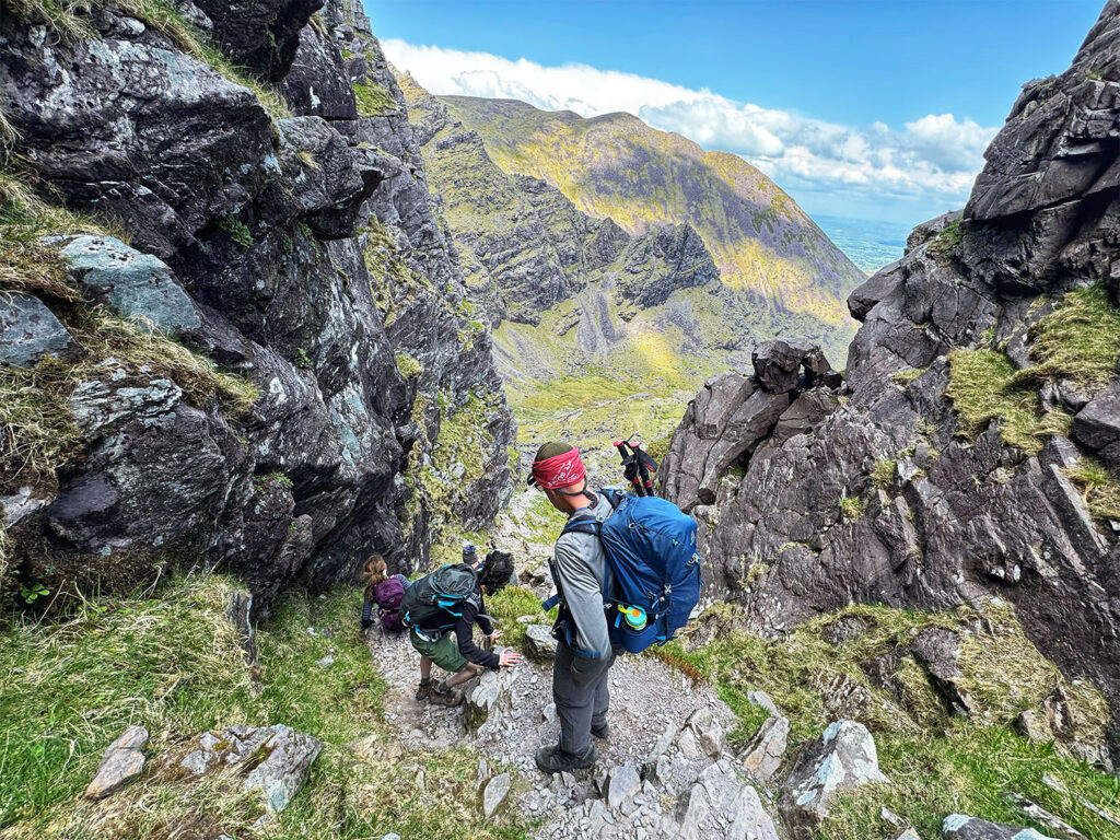
The first part of the descent was relatively gentle, but the narrow goat path that followed, ran along a steep drop off, requiring full attention. At one point, we had to stop and let a group of sheep cross – an only- in–Ireland moment that made me smile. When we reached The Heavenly Gates, the trail became dramatically steeper. In places we had to descend backwards, using both hands for stability. The views of the Hag’s Lungs below were absolutely stunning – glistening in the afternoon light, framed by the rugged cliffs and the rolling green of the Kerry landscape. This descent turned out to be my favorite activity of the entire two week trip, rivaled only by the Coastal Causeway hike on the Northern Coast tour. The descent took longer than expected. We finally reached the van at 6:25 PM, making the total hike just shy of nine hours – 4 1/4 hours up and roughly 4 down.
“The Hag’s Lungs” on the Carrauntoohil descent
Descending through The Heavenly Gates
Dinner tonight was at Kitty O’Se’s. I celebrated the day’s achievement with a glass of Malbec, pan fried hake with roasted potatoes, and an indulgent slice of Twix bar cheesecake. It was, without a doubt, one of the most memorable days of the entire trip.
Day 5 Killarney to County Wicklow
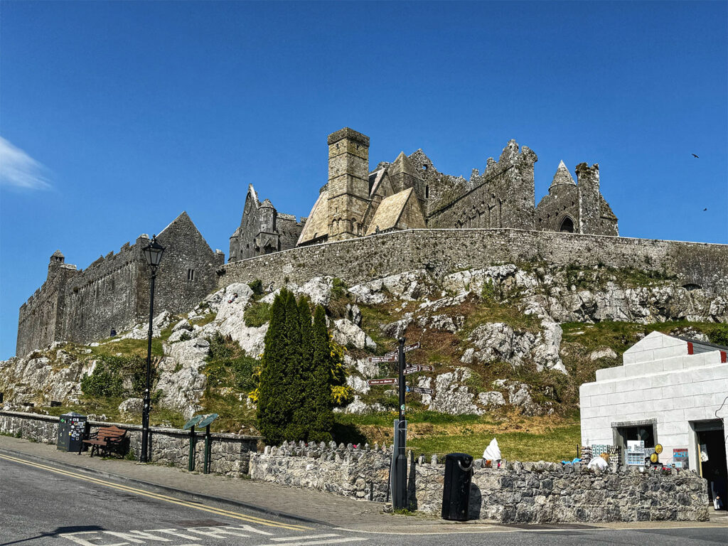
Today marked the beginning of our journey to County Wicklow for the final “big” hike of our trip. After checking out of The Great Southern Killarney, we set off northeast toward the small town of Aughrim. Roughly 2 1/2 hours into the drive, we paused for a brief rest stop at one of Ireland‘s most iconic historic sites – the Rock of Cashel. Perched dramatically atop a limestone outcrop in County Tipperary, the Rock of Cashel– also known as Saint Patrick’s Rock or the Cashel of Kings – was once the seat of the Kings of Munster, with its origins dating back as early as the fourth century. The structures that remain today are largely from the 12th and 13th centuries, and include Cormac’s Chapel, the Cathedral, and a towering round tower, all steep in medieval gravitas. Though we didn’t have time to take a guided tour, simply walking the grounds offered a sense of awe. Dark- winged crows circling the towers lent the place an eerie, almost cinematic atmosphere – like something out of a Gothic novel.
Rock of Cashel
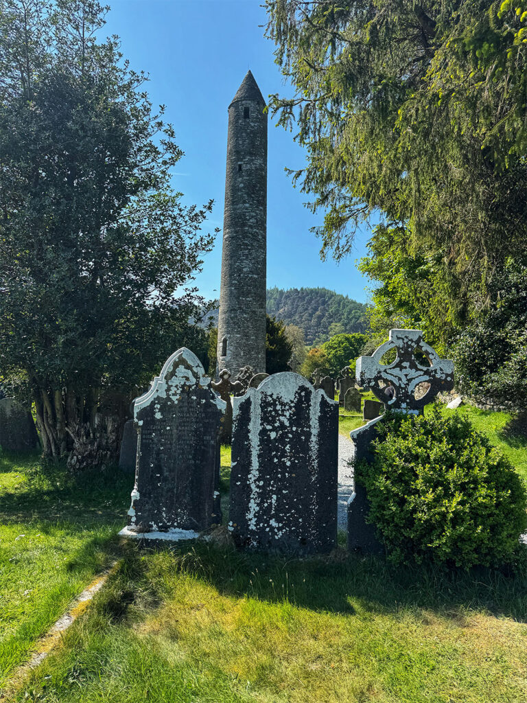
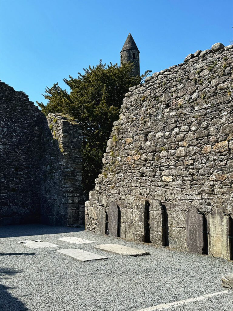
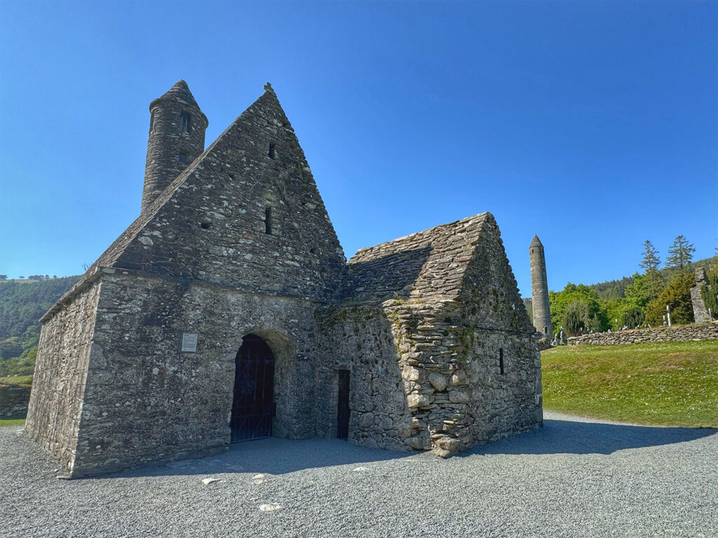
We continued on and arrived in Glendalough around 2 PM for a late lunch at the Wicklow Heather Restaurant. Glendalough, meaning “the glen between two lakes”, is nestled in a serene valley of immense natural beauty. After lunch, we made our way to the nearby Glendalough monastic site, founded by Saint Kevin in the sixth century. As one of Ireland’s earliest Christian settlements, the monastery served as a center for learning and spiritual devotion for centuries. Though it flourished for generations, the site was eventually destroyed by Norman forces in 1214. The ruins that remain – dating primarily from the 10th to 12th centuries our hauntingly beautiful. Highlights include the Cathedral of Saint Peter and Saint Paul, the iconic round tower, and Saint Kevin‘s Church, affectionately known as “Saint Kevin‘s Kitchen”.
The Round Tower at Glendalough
St Peter and St Paul’s Cathedral
St Kevin’s Church
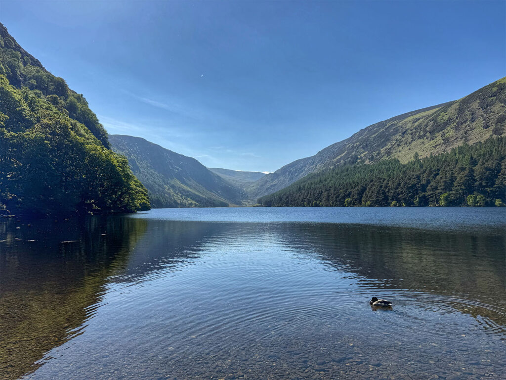
With the golden afternoon light spilling across the valley, we followed a tranquil nature trail that wound its way toward the Upper and Lower Lakes. We paused at the visitor center, and then continued our walk, surrounded by the quiet majesty of the Wicklow Mountains. It was especially meaningful to hear our guide, Calliam reflect on his childhood here, sharing fond memories and local lore with us as we walked.
Upper Lake at Glendalough
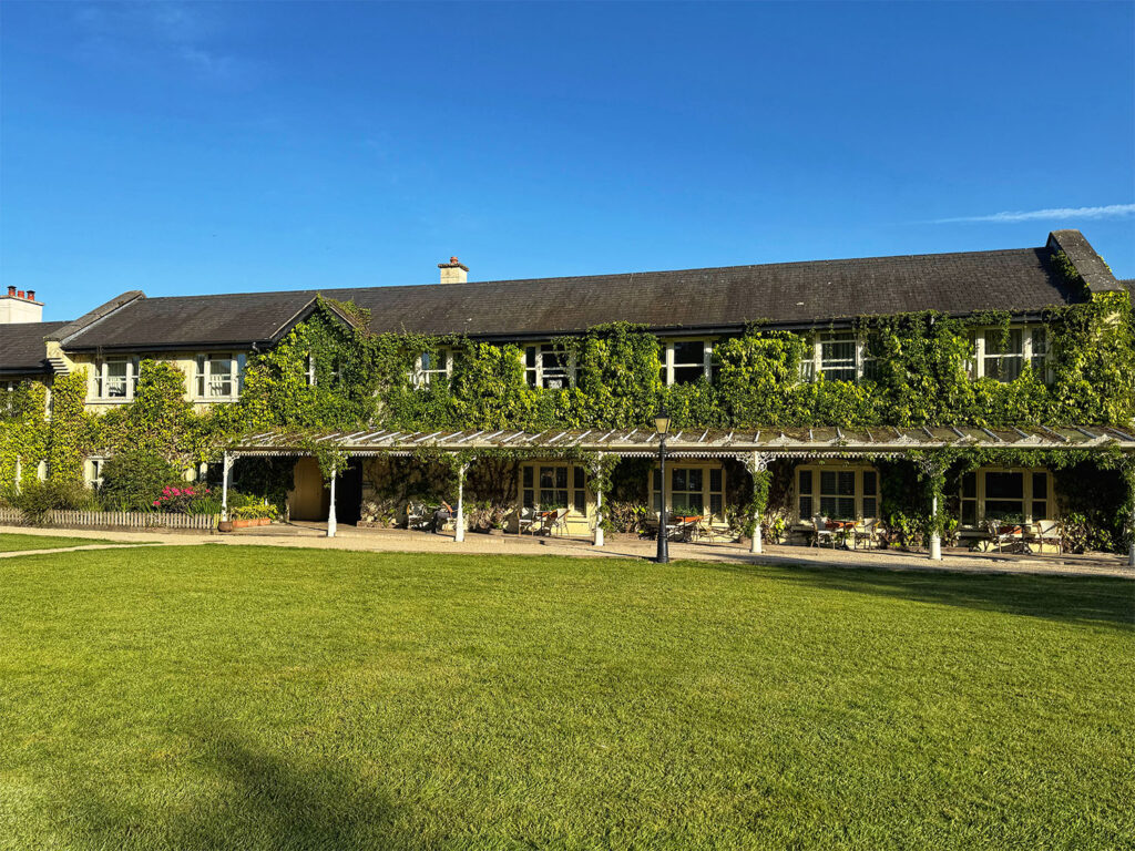
A short drive later brought us to our lodging for the next two nights. – BrookLodge at Macreddin Village, just outside Aughrim. This charming hotel, set in a remote and peaceful corner of the countryside, caters to both spa goers and golfers. My room had a particularly inviting window seat, which quickly became my favorite spot. That evening, our group dined together (though dinner wasn’t included in the trip package) at La Taverna Armento, the hotel’s Italian restaurant. The only reservation we could get was for 8 PM, but the setting, a light- filled atrium, was well worth the wait. I had the pizza Armento, topped with prosciutto, Parmesan, and fresh rocket (arugula). It was delicious – simple and elegant. The evening’s highlight, however, was Calliam‘s storytelling. He captivated us with tales of how Halloween originated in Ireland.
BrookLodge at Macreddin Village
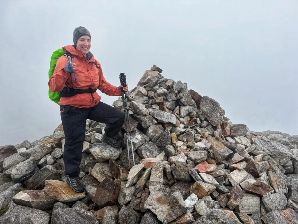
Day 6 Lugnaquilla
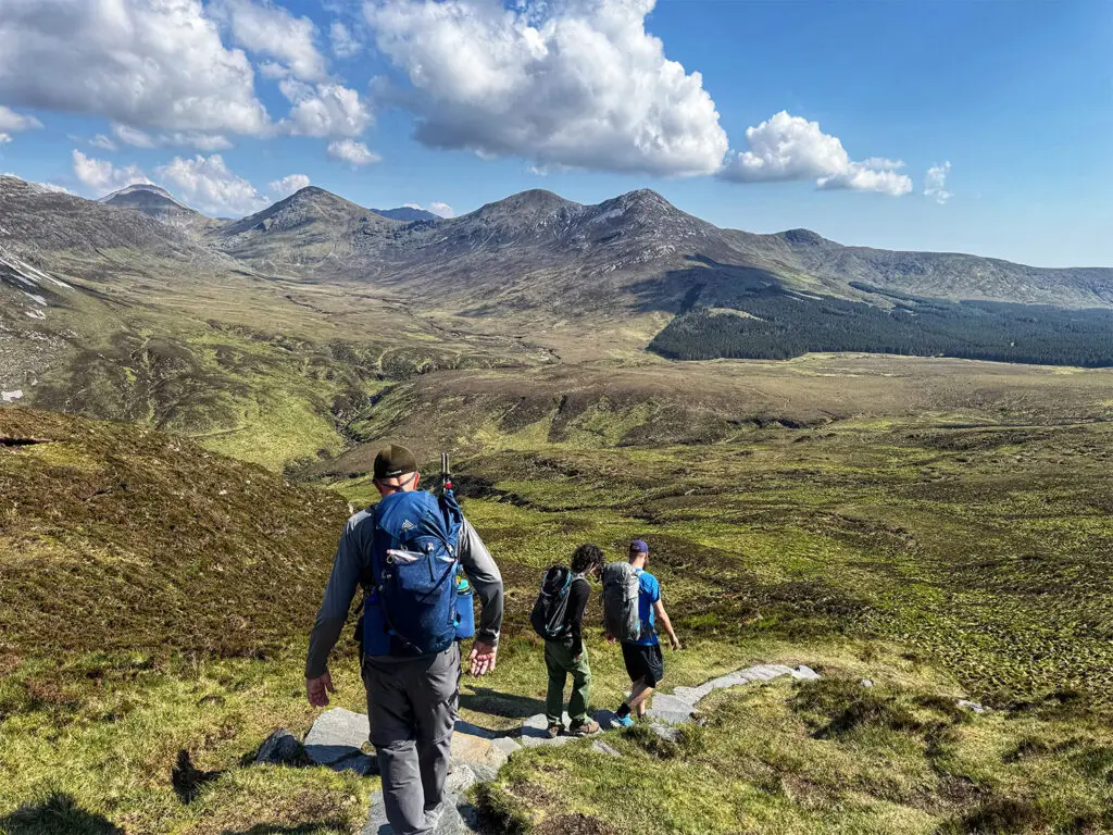
After breakfast, we re-grouped with Calliam for our final major hike of the trip: Lugnaquilla, the highest peak in the province of Leinster, standing at 3035 feet. At 9 AM our group set off, driving along the historic Old Military Road. This scenic, winding route was constructed by the British around 1800 as a strategic response to ongoing uprisings by Irish clans. Its purpose was to connect remote military barracks through the Wicklow Mountains, providing better access to otherwise unreachable rebel hideouts. The road itself seemed to echo those distant tensions, carved through dramatic landscapes that once sheltered defiant warriors.
View along the Old Military Road
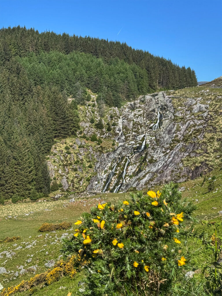
Our hike began at the Baravore Car Park, near the 1798 Rebellion Memorial. The trail opened through a shaded forest where we unexpectedly encountered a few wild goats before the path gave way to the rocky and rugged terrain of Fraughan Rock Glen. Though not as relentless as the Carrauntoohil ascent, this portion of the hike was still a serious climb, following a cascading stream through an uneven, stony gorge. With wildlife all around – deer in the distance, and sheep and goats grazing nearby – the scene felt both wild and timeless.
Start of the Lugnaquilla hike
Waterfall along the way
Soon the trail all but disappeared, and we veered left onto a less-defined route, navigating a more circuitous path along a ridge line. The terrain became boggy under foot as we gradually approached the summit plateau, known as Percy‘s table. Named after an 18th century landowner, Colonel Percy, this broad flat expanse resembled an oversized football pitch and afforded sweeping views in every direction– well worth the effort.
Hiking through the bog
Looking back along the ascent
Almost at the summit
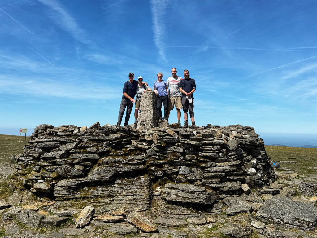
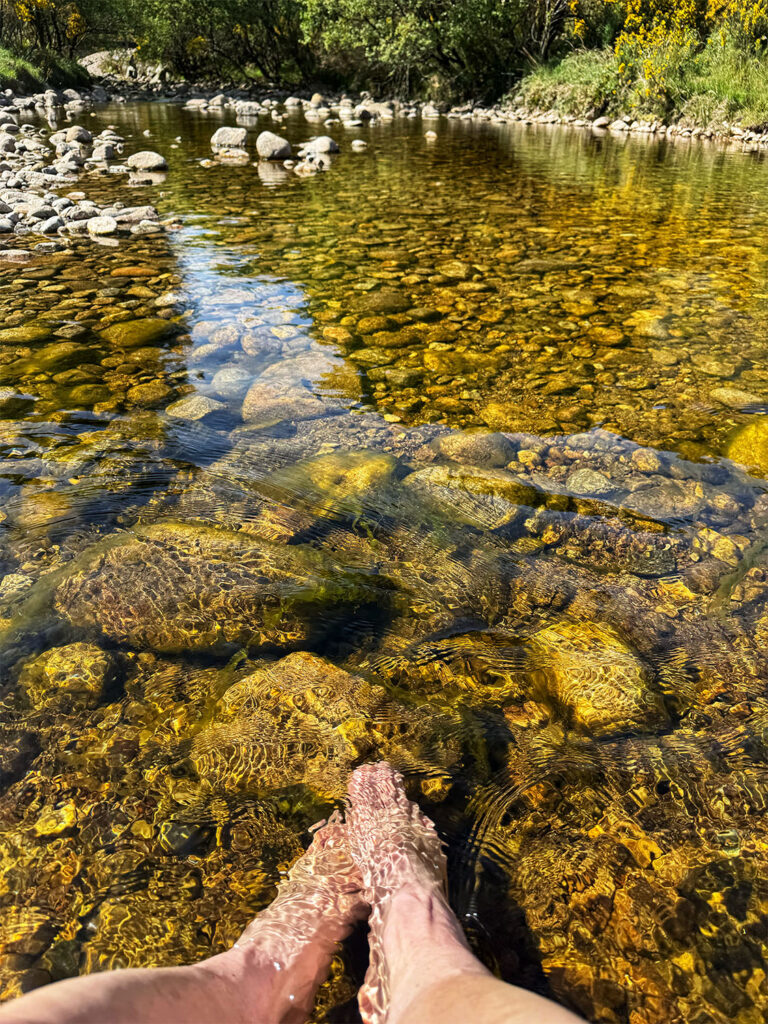
At the summit, we were joined by a few other hikers, and one kindly took a group photo for us a small but memorable souvenir. We lingered for lunch, enjoying both the food and the setting before beginning our descent. The route down, let us through deep bogland – fortunately dry that day, but I could imagine it becoming quite challenging in wet weather. After over two hours of careful descent, we arrive back at the car park where we gladly removed our boots and soaked our tired feet in the refreshing stream. The cold water was an invigorating reward for a hike that had taken just over five hours in total – three hours up, and a little more than two hours down. To celebrate, Calliam treated us all to a well earned pint at the cozy Glenmalure Pub.
The group at the Lugnaquilla summit
An invigorating post hike soak in the river
That evening, we gathered for our farewell dinner back at La Taverna Armento, this time seated in the main dining room, rather than the atrium. I ordered a glass of Merlot and a spicy linguine dish with prawns, cherry tomatoes, chili, olives, and wild garlic pesto. It was bursting with flavor and the perfect end to our journey. Afterwards, we capped off the evening with one last stop at Acton‘s Country Pub, savoring the final hours of camaraderie before the trips close.
Day 7 County Wicklow to Dublin
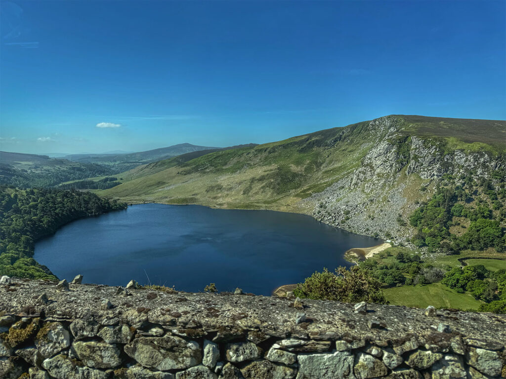
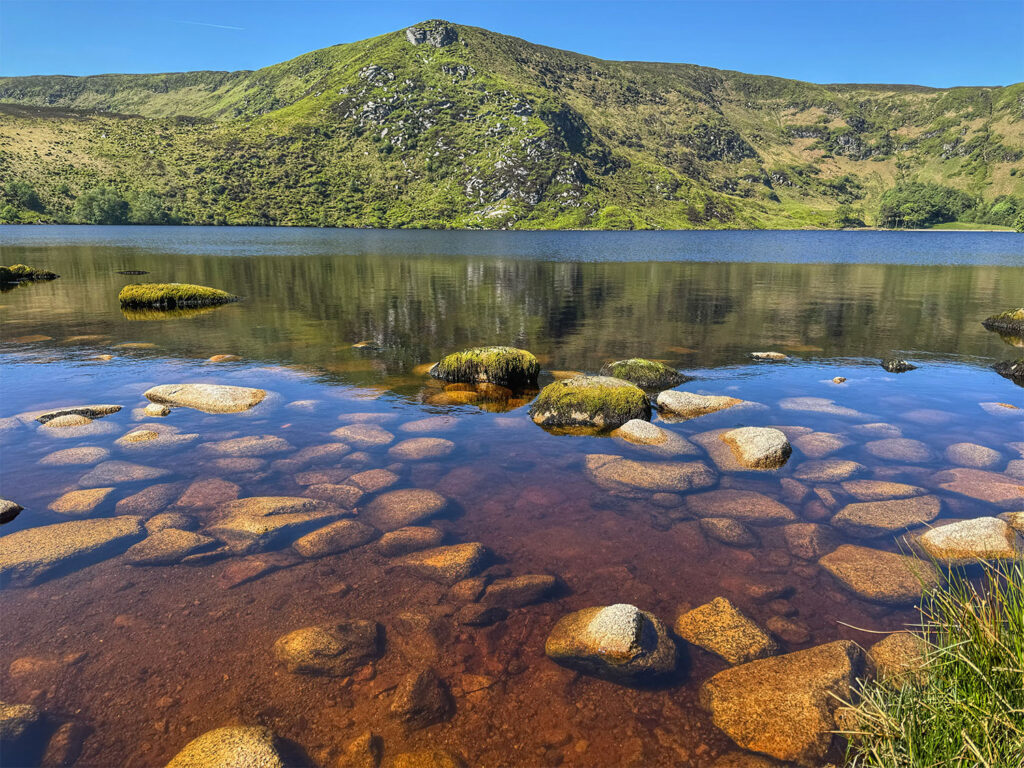
Today marked my last full day in Ireland. Over the course of 16 unforgettable days, I experienced only eight hours of rain –a near miraculous weather streak that felt like a blessing from the travel gods. At 9:15 AM Calliam picked us up for our return journey to Dublin. Though the itinerary originally included a short hike, Calliam proposed an alternative: a longer, scenic drive through the Wicklow Mountains National Park along the Old Military Road, complete with a few picturesque stops. The group unanimously agreed – none of us were ready to say goodbye to Ireland’s natural beauty just yet. We made several scenic stops along the way. First was Glenmacnass Waterfall, cascading 240 feet down the rugged cliffs. Next was the Lough Tay viewpoint – also known as Guinness Lake – so named because the Guinness family once owned the estate it sits on. Finally, we paused at Lough Bray Lower, a spot filled with nostalgia for Calliam, who visited often during his childhood. As we made our way toward Dublin, the rugged mountains gradually gave way to city streets, street lights, and the rhythm of urban life.
Glenmacnass Waterfall along The Old Military Road, Wicklow Mountains National Park
Lough Tay
Lough Lower Bray
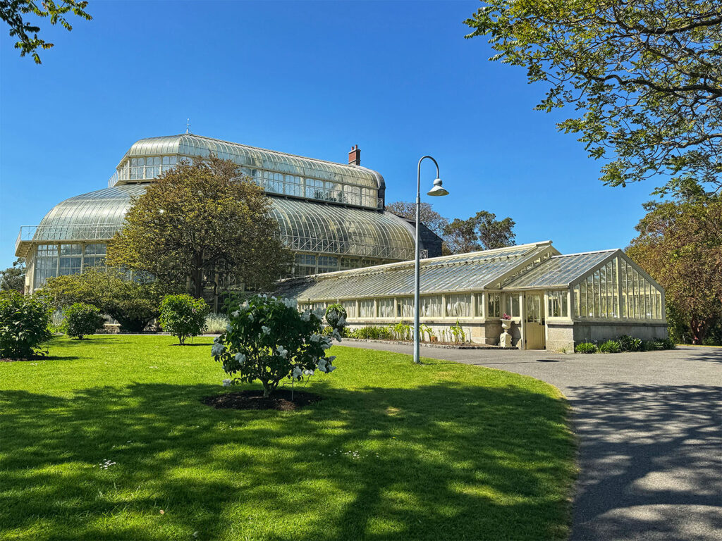
Callum dropped us off at Saint Stephen’s Green in the heart of Dublin. I grabbed a cab and continued on another 10 minutes north to Glasnevin, a quieter neighborhood close to the airport. My final lodging was an Airbnb located directly across from the National Botanic Gardens. The space was lovely – serene and minimalist, like having my own private Zen retreat. The National Botanic Gardens were spectacular – much larger than those in Belfast, though I think the Royal Botanic Garden in Edinburgh still holds my top spot. The weather was gorgeous, and the grounds were filled with families many dressed up for first communion photos. The greenhouses were especially impressive, a welcome contrast to those in Edinburgh, which were under renovation during my visit.
Greenhouse at the National Botanical Gardens, Glasnevin, Dublin
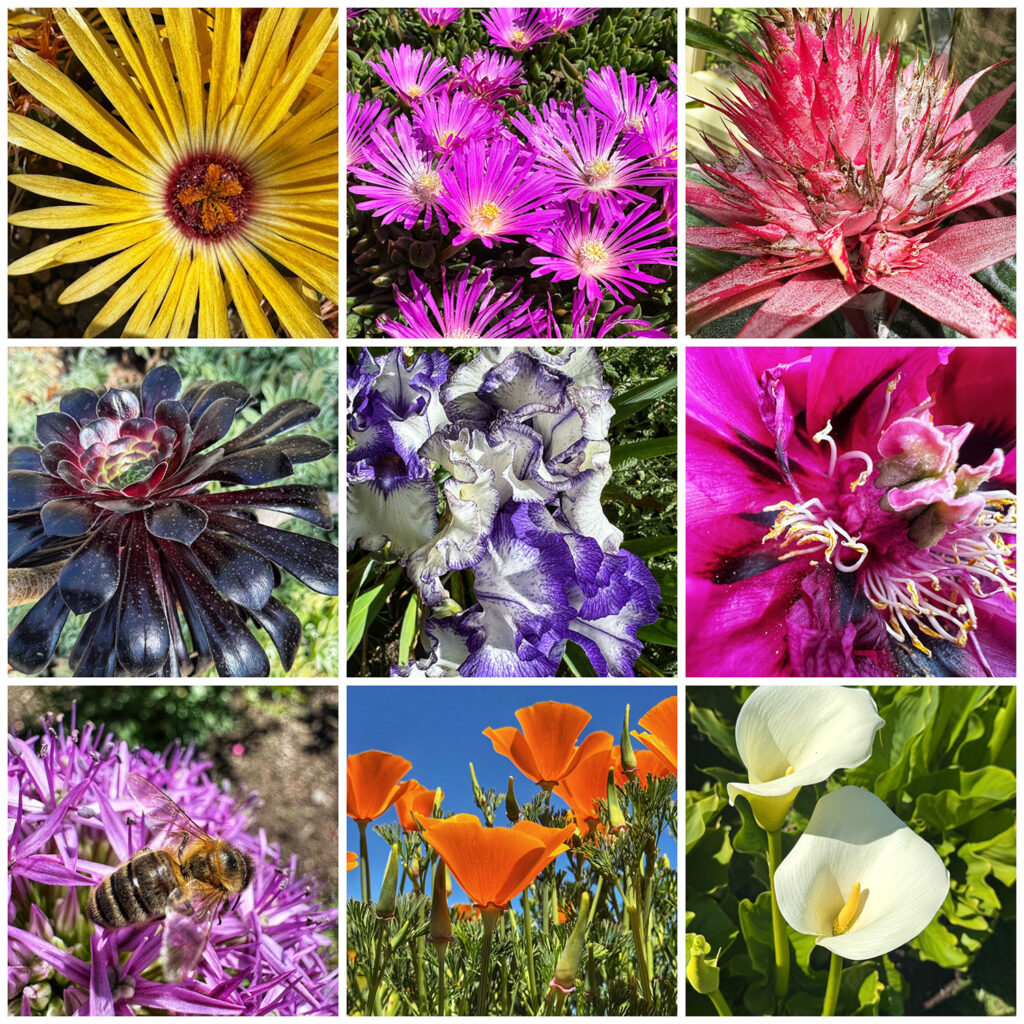
Flowers at the National Botanical Gardens in Glasnevin, Dublin
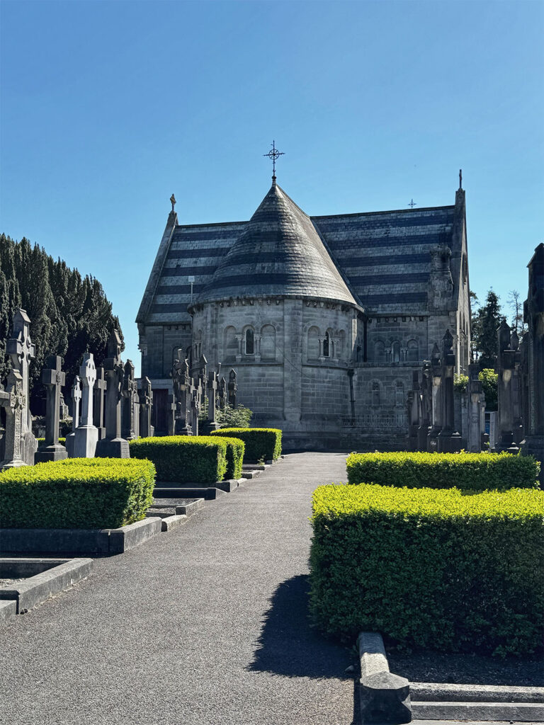
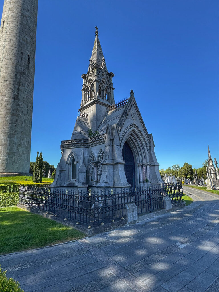
After a couple of hours, wandering through the gardens, I walked over to the adjacent Glasevin Cemetery (the National Cemetery). Opened in 1832, the cemetery is the final resting place of many prominent figures in Irish history. I joined a guided tour (a few minutes late, saving myself five euro in the process) and found myself the only American in the group. It was an engaging and educational experience, one that deepened my understanding of Ireland’s complex past. I only wished I had done it earlier in the trip
Glasnevin Cemetery, Dublin
Glasnevin National Cemetery, Dublin
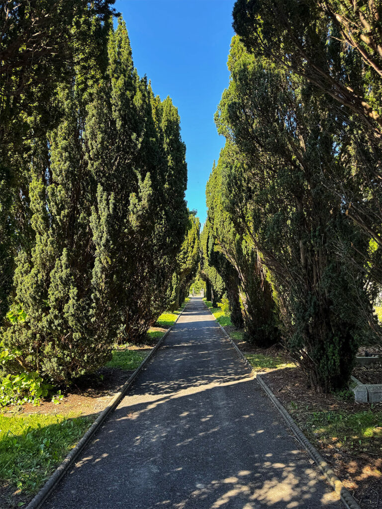
Hedges at the Glasnevin National Cemetery, Dublin
The following morning, I called an Uber around 8:30 AM for the short ride to Dublin Airport. One of the perks of flying out of Dublin is its US Pre-clearance facility – meaning you pass through American customs and immigration before boarding. Upon arrival in the US, the flight is treated like a domestic flight; all that’s left is to retrieve your luggage. I gave myself a generous buffer, arriving 3 1/2 hours early, but the process went smoothly and without delay.
Another incredible adventure for the books – one filled with breathtaking landscapes, meaningful history, new friends, and unforgettable memories. Ireland, you were magic. Until next time.