A 15 day itinerary exploring Reykjavik, the Highlands, the Snæfellsness Peninsula, & the South Coast
During the COVID -19 pandemic, while stuck at home, I dreamed of all the places I wanted to visit when I could finally travel again. Iceland was at the very top of my list. In 2022, with restrictions easing up, I debated traveling to Iceland, but I was still a little nervous about planning such a big trip and then having it fall apart do to unexpected restrictions again. Instead, we traveled to the Pacific Northwest region of the USA and had a wonderful time. However, the day after we returned from Washington I began planning this Iceland adventure for 2023. Below, I give the overall itinerary and highlights of our 15 day trip. I will make separate entries going into more detail about the sites we saw and tours we took. Iceland is a gorgeous country and very diverse as far as landscapes go. Iceland is already back on my list of places to return to, there are so many things to see and just not enough time. I was traveling with my two adult sons, Colin who was with me for the entire trip, and Ryan who joined us on Day 8. Iceland is a very expensive country to visit. We did our best to save money with lodging & food but splurged on experiences, car rental, and souvenirs. Below is a summary of our 15 day adventure that was taken the last week of August into the first week of September 2023
Day 1 – Exploring Reykjavik
On the prior day, we departed Boston’s Logan International Airport early afternoon and arrived at Keflavik International Airport at 9:45 pm on an IcelandicAir direct flight. The airport is a 45 minute drive from downtown Reykjavik. My Icelandic pen-pal Helga (& her husband) picked us up at the airport and drove us to our Air B&B located halfway between Hallgrimskirkja (the iconic Reykjavik church) and the BSI Bus terminal. It was a perfect location for our needs. The apartment was very nice with a mudroom, a large eat-in kitchen, a bathroom, and a living room/bedroom separated from each other by a blackout curtain.
Our first day in Iceland, we woke to a cloudy, rainy day. Colin & I donned our rain gear and headed out for some sightseeing. Our first stop was at the Einar Jonsson Museum Sculpture Garden near Hallgrimskirkja. The sculpture garden opened in 1984 and has 26 bronze casts of Einar Jónssons work. We then walked over to the sculpture of Leif Erikson located in front of Hallgrimskirkja, the largest church in Iceland (Lutheran). The statue was a gift from the United States to Iceland in 1930 to commemorate the 1,000th anniversary of the Alþingi, the national parliament of Iceland, and the oldest parliament in the world. We then entered the church. The church is 244 ft tall and is named after an Icelandic poet and cleric Hallgrímur Pétursson (1614-1674). It was designed to resemble the columnar basalt columns seen throughout Iceland.
After leaving the church we walked the streets of Reykjavik stopping in various gift shops. We came across the famous “Rainbow Street” (Skólavörðustigur). If you stand at the bottom of the street you get a nice view of the Rainbow Street with Hallgrimskirkja in the background. Unfortunately, the night after we visited someone threw white paint on the street and wrote demeaning words on it.
Next on the list of sites was Harpa. Harpa is a beautiful modern looking glass building that is home to the Iceland Symphony Orchestra, the Icelandic Opera, and the Reykjavik Big Band. There are many concerts held there throughout the year. There is also a restaurant and at the back of the building a nice view of the harbor. During certain occasions the building is lit up with murals on the glass panels (i.e. the Icelandic Flag, the Ukraine flag in support). For lunch we stood in line for 45 minutes in the pouring rain to eat the world famous Icelandic hotdogs at Bæjarins Beztu Pylsur. They are made mostly of Icelandic lamb along with pork and beef. I got mine with “the works”, which included raw white onions, crispy fried onions, ketchup, sweet brown mustard (pylsusinnep), and remoulade (a sauce made with mayo, capers, mustard, and herbs).
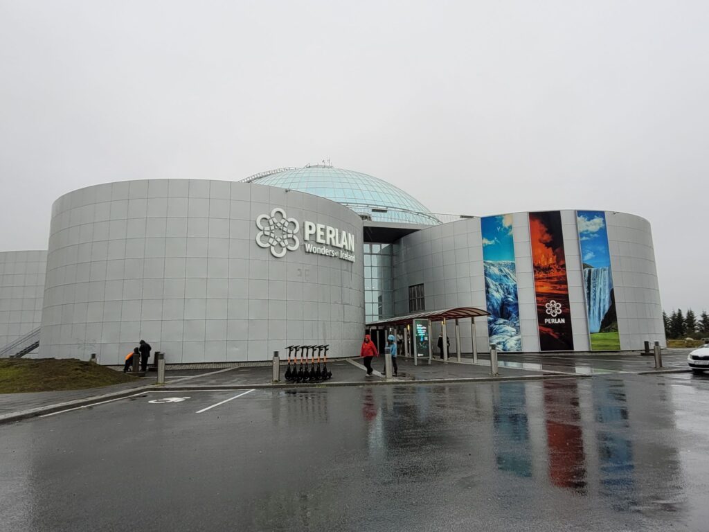
Since it appeared that the rain was not going to let up, we decided to go visit the Perlan Museum (as did every other tourist in Reykjavik). The Perlan Museum was opened in 1991 and consists of a huge glass dome that rests on top of six heating water tanks. There are various exhibits including: an indoor ice cave, a northern lights show, a lava show, a forces of nature interactive exhibit, a model of the Látrabjarg cliff (bird nesting area), and other natural history related exhibits. There is also a restaurant and café, as well as an observation deck (which we skipped due to the weather). In the evening we dined at Reykjavik Fish Restaurant. Our next stop after dinner was the Sun Voyager. The Sun Voyager is a sculpture by Jón Gunnar Árnason. This stainless steel sculpture sits along the harbor, down the street from Harpa. It was unveiled in 1990 on the 200th birthday of the city of Reykjavik. It is a fabulous place to catch a sunset, but we weren’t so lucky. Our final stop for the day was back at Hallgrimskirkja around 10PM to take some pictures of the church all lit up.

Day 2 – Inside the Volcano Tour
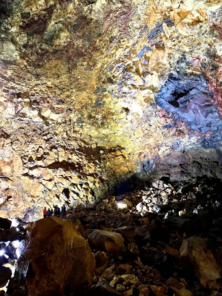
Sunny skies greeted us first thing in the morning. After walking 3 blocks down the hill to the BSI Bus Terminal, we were picked up at 9:30 am by a Grayline bus and were transported to another bus terminal where we transferred to a smaller bus that would take us to the start of the Inside the Volcano tour 30 minutes away. The tour began at the base of the ski resort known as Bláfjöll. The dormant volcano that we would be visiting is called Þríhnúkagígur, which translates to “Three Peaks Crater”. It is the only magma chamber in the world that can be entered and has a depth of 699 ft.
The hike to the crater is approximately 4 miles round trip. It is quite easy elevation wise except for the final ascent to the crater opening. The hike took about 45 minutes to reach the base camp as we walked thru a lava field stopping a few times so the guide could give us some information/history about the area. At one point we crossed over between the Eurasian and North American tectonic plates (that is what makes this area such a geologic hotspot). At the opening of the crater we were “clipped in” and had to walk across a narrow bridge to the lift. The lift reminded me of the contraption used by window washers on skyscrapers. The lift took about 6-8 minutes to reach the bottom of the chamber.
Once at the bottom, we had 30 minutes to walk about the magma chamber. There is a circular path to follow. The different colors of the rocks were amazing. After returning to the surface we were treated to lamb stew for lunch. We saw two Arctic foxes (one black and one white) that live in the area. The hike back to the starting point was on our own. At 2:30 pm the bus picked us back up and returned us to Reykjavik.
Upon our arrival back in Reykjavik, we again visited Hallgrimskirkja and this time went up in the bell tower. In the evening our Icelandic friends took us to the opposite side of the harbor in Reykjavik which is where the fishing industry is located. We looked at Harpa from the water. We wound are way on a circular path up to the top of Þúfa, a 24 ft high hill that was designed in 2012 by an Icelandic artist named Ólöf Nordal. We then stopped at the Kvika Foot Bath, a natural hot spring that you can stand in. Unfortunately, there were already people in it, so we didn’t get to try it out. The next stop was to see Gróttuviti Lighthouse. We saw the lighthouse from a distance but the tide was coming in and you can get cut off from the mainland if you don´t time it correctly. Our last tourist site for the day was Bessastaðir, the Icelandic President´s house. Dinner that evening was in the town of Hafnarfjörður, where our Icelandic friends lived.
Days 3 – 7 Exploring the Icelandic Highlands via the Laugavegur Trek
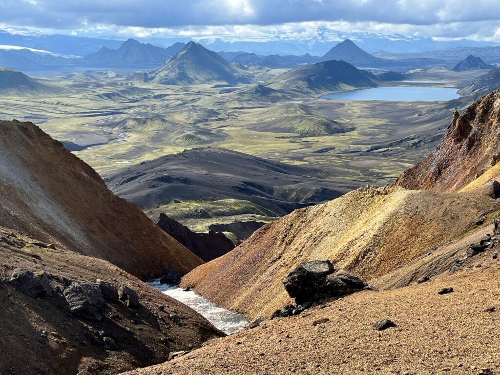
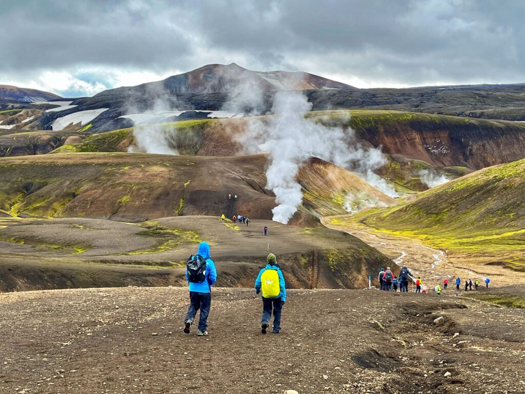
The Laugavegur Trek is a 34 mile (55 km) hut to hut trek from Landmannalaugar to Þórsmörk in the Icelandic Highlands. It is consistently listed as one of the “20 Best Hikes in the World” by National Geographic. The trek passes thru hot springs, multicolored rhyolite mountains, lava fields, geothermal areas, obsidian rock fields, snow fields, canyons, and a black sand desert. While the trek can be done on your own, we chose to join a guided 5 day tour with Icelandic Mountain Guides. We had an early start, getting up at 5:30AM. We had packed most of our belongings the night before. At 6:15AM, we suited up in our rain gear (it was pouring again) and walked the 3 blocks downhill to the BSI Bus Terminal where our 5 day adventure began. We ended the tour on Day 7 back at the Keflavik International Airport at the Aurora Hotel.
Day 8 – Visiting the Snæfellsness Peninsula
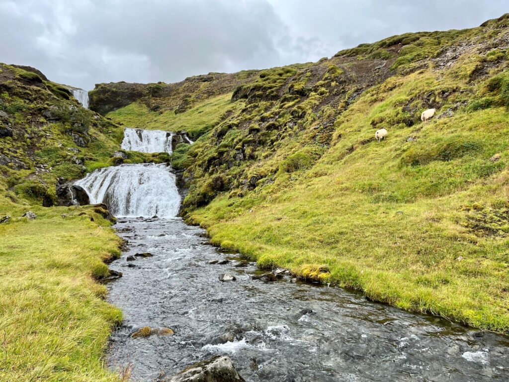
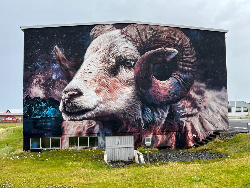
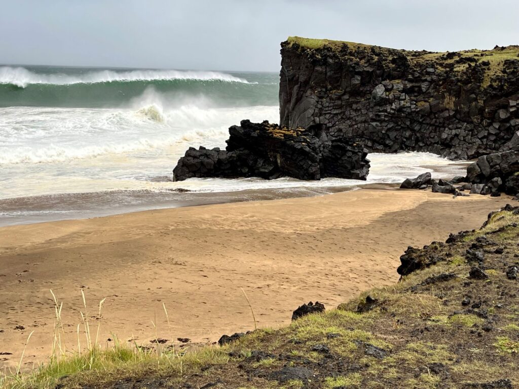
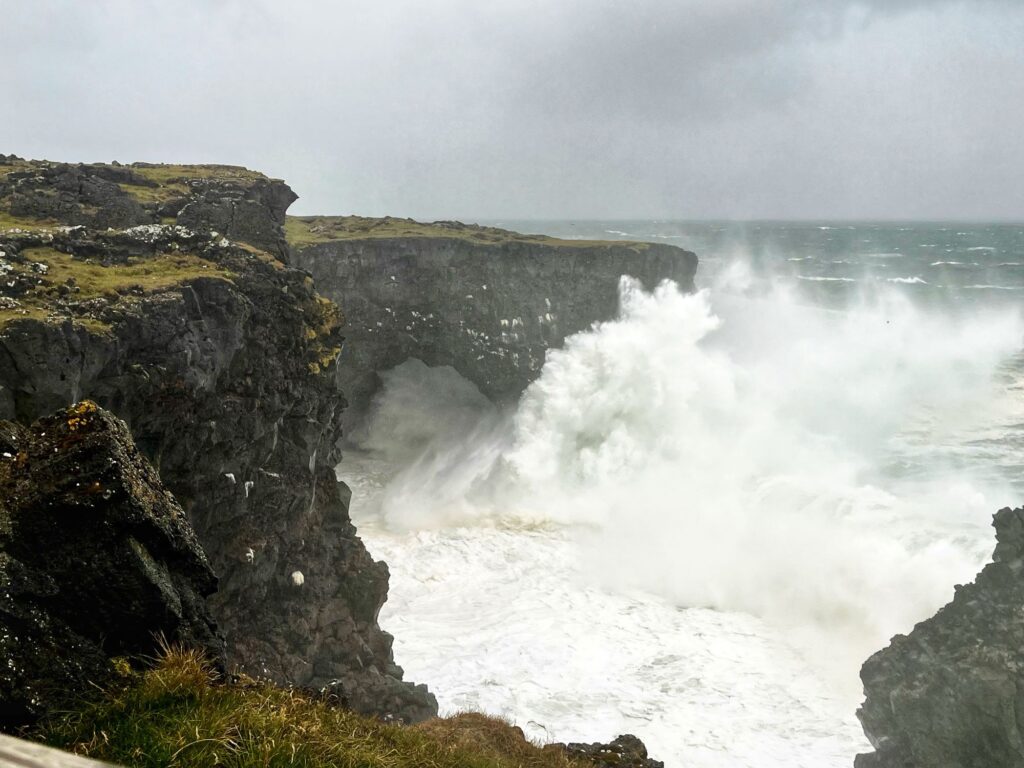
Today our journey would take us from Keflavik on the Reykjanes Peninsula up to Snæfellsjökull National Park on the Snæfellsness Peninsula. The Snæfellsness Peninsula is known as “mini Iceland” because it offers a wide sampling of the best Iceland has to offer in a relatively small, drivable area. We picked up our rental car from Lotus Car Rentals and headed north, passing thru the Hvalfjörður Tunnel. On this day we would visit: Selvallafoss, the Beserkjahraun lava field, Hellisandur (Street Art Capital of Iceland), Skarðsvik Beach, Öndverðarnes lighthouse, and Svortuloft lighthouse. There was a “yellow” weather alert due to high winds (over 50 mph). While we could have done without the rain, the surf was an incredible sight to see along the coast. Our lodging for the night was in Grundarfjörður at the Kirkjufell Guesthouse.
Day 9 – Another day on the Snæfellsness Peninsula
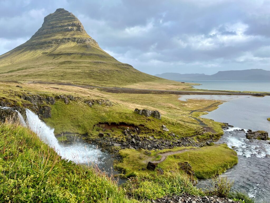
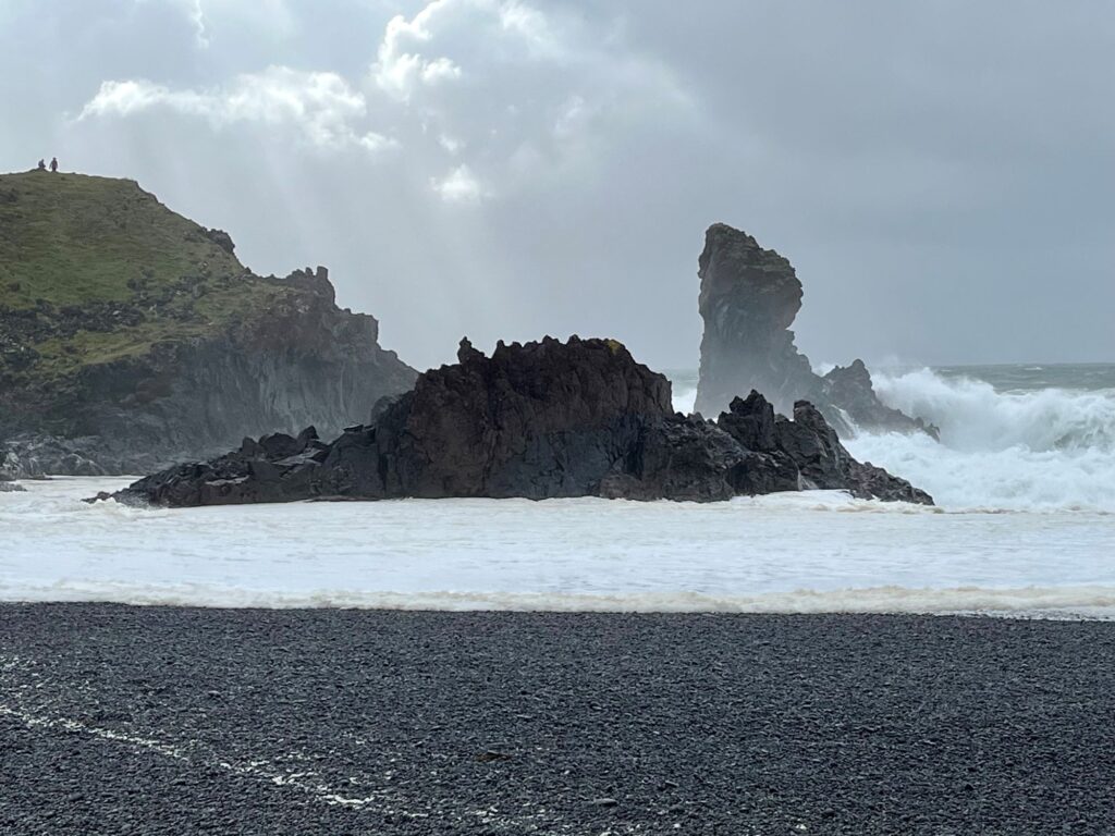
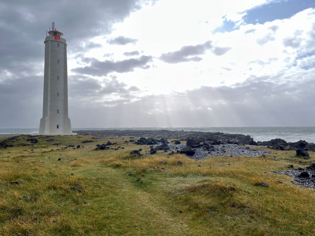
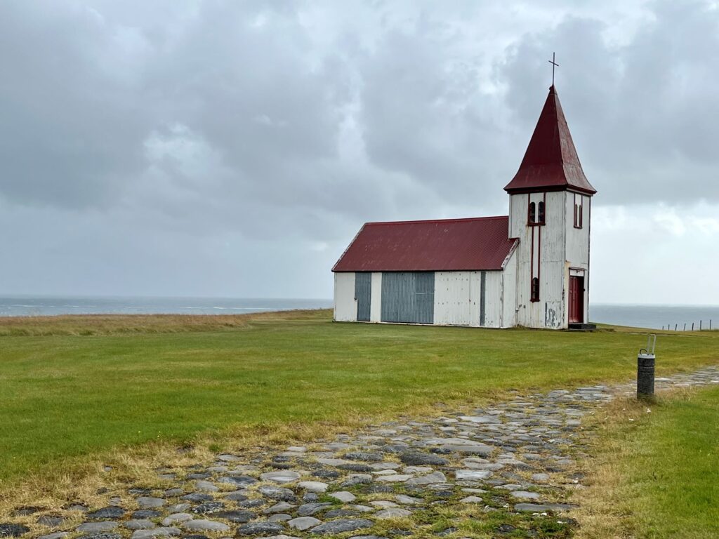
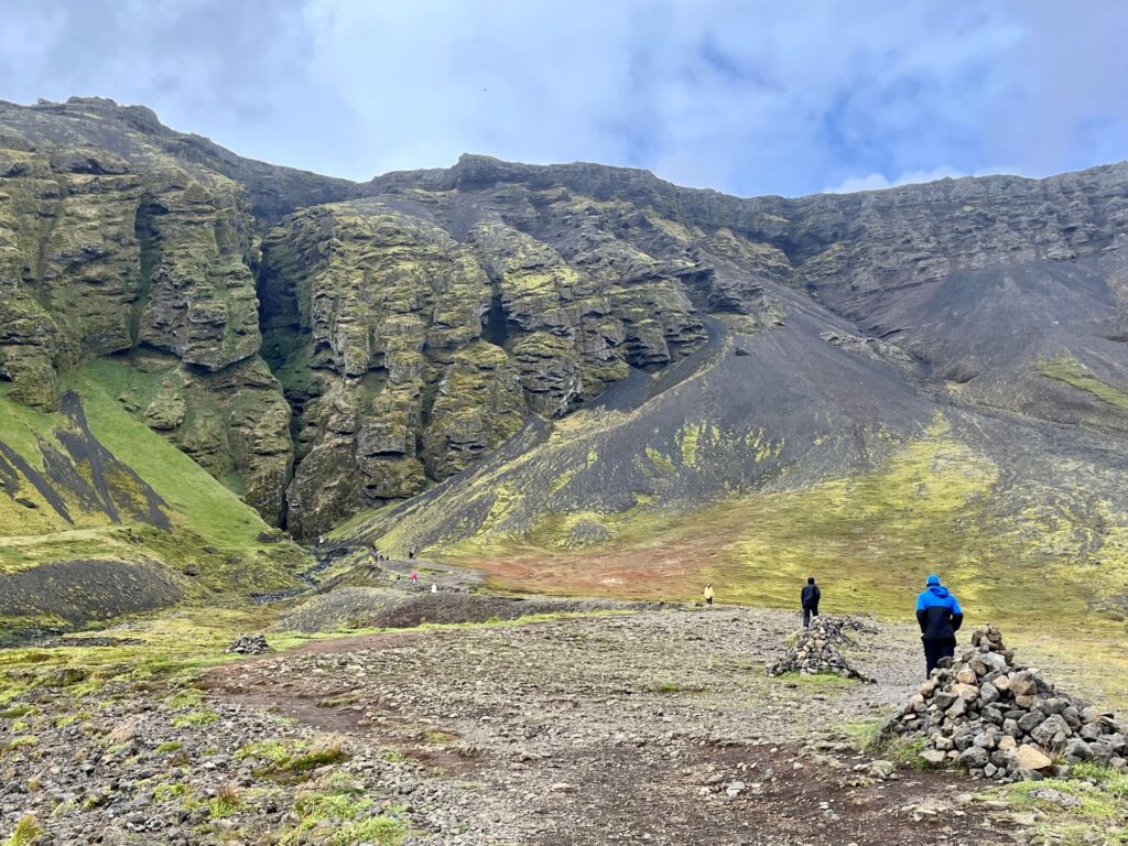
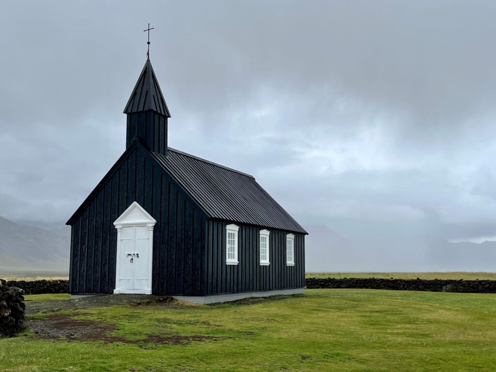
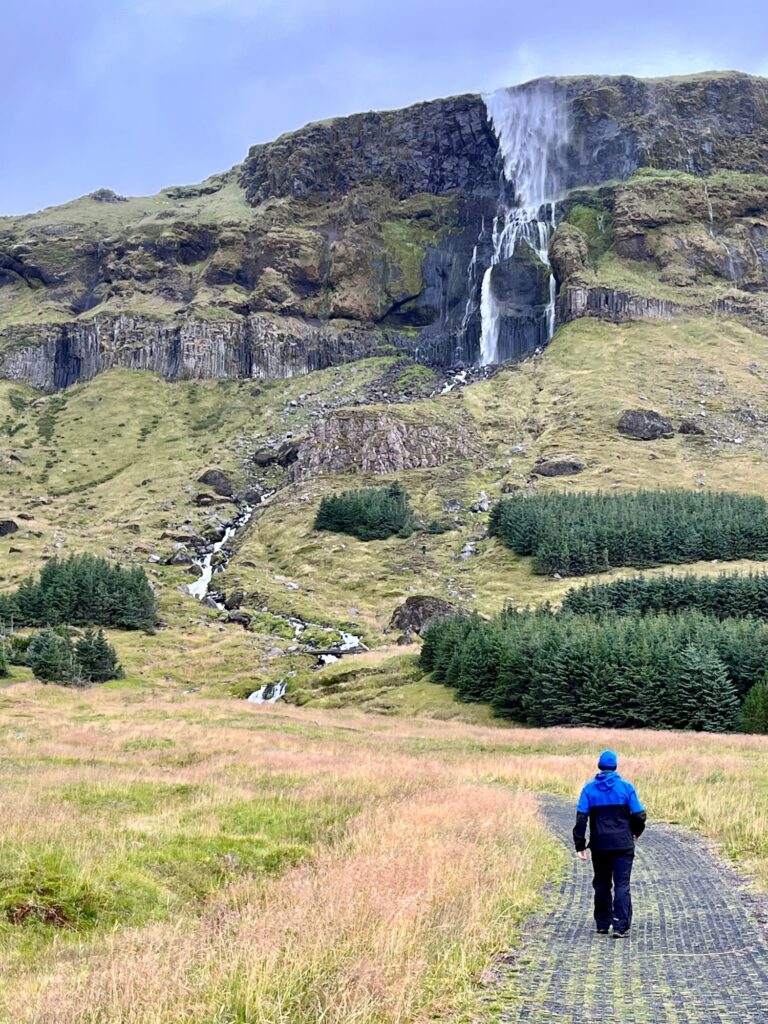
We checked out of the Kirkjufell Guesthouse in the morning with our goal being to continue counterclockwise around the Snæfellsness Peninsula before heading to the South Coast of Iceland. On this day we would visit: Kirkjufellsfoss, Saxhóll Crater, Djúpalónssandur Beach, Malarrif lighthouse, Lóndrangar cliffs, Hellnar, Arnarstapi, Rauðfeldsgía Ravine, the Buðir Church, Bjarnafoss, and Ytri Tunga Beach. The weather was slightly better than yesterday, the wind wasn´t as strong but we still had rain off and on throughout the day, with the sun peaking out on occasion. We arrived at our Air B&B on the South Coast at 7:45pm. It was a lovely farmhouse (Vallnatún) located off the Ring Road (Route 1) between two major attractions (Seljalandsfoss and Skógafoss). The farmhouse had a mudroom, a utility room with a shower, washer, & dryer, a nice size kitchen, a dining room, a living room, a bathroom, and a bedroom with a double bed. There was a ladder to reach the second floor that had 2 bedrooms each with 2 twin beds in them. This would be our home for the next 3 nights. After all of the bad weather, we were treated to a beautiful sunset.
Day 10 – The Golden Circle & Seljalandsfoss
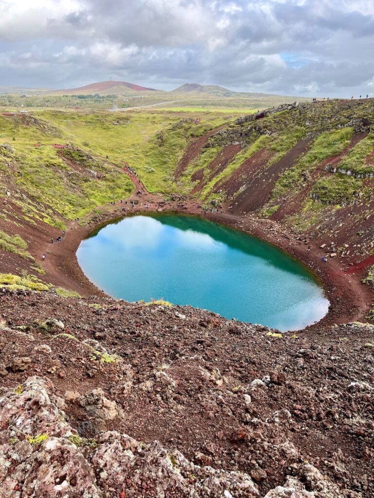
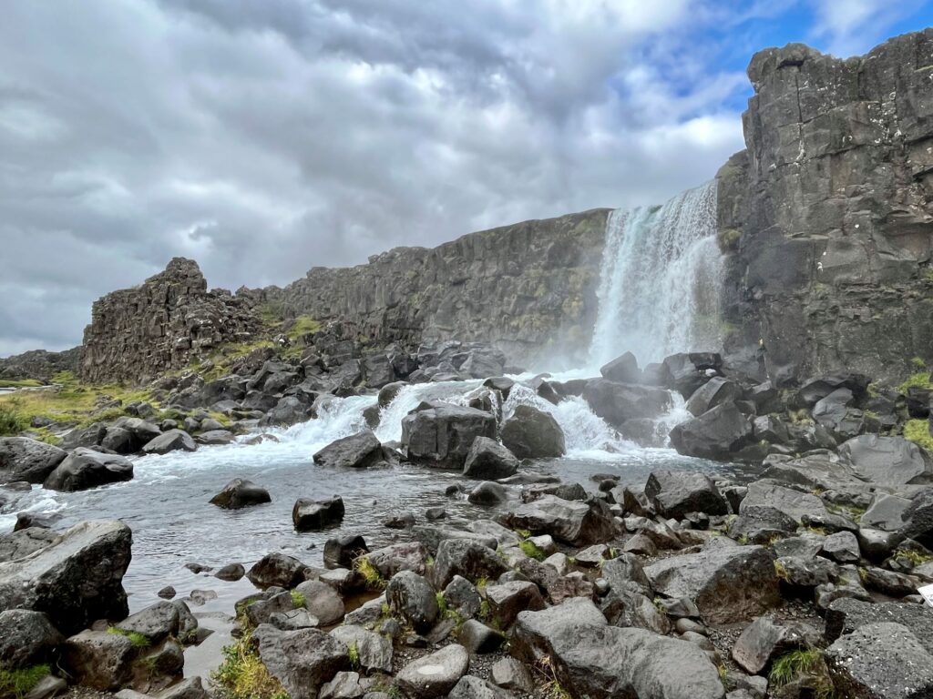
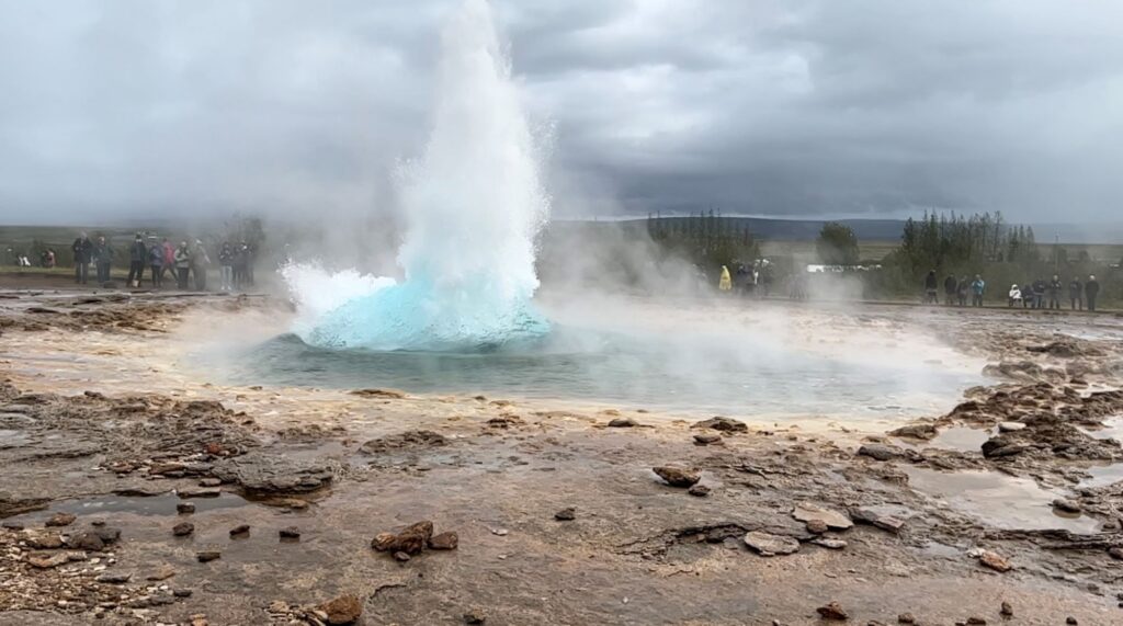
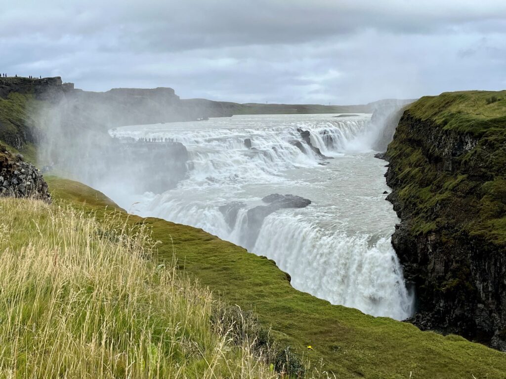
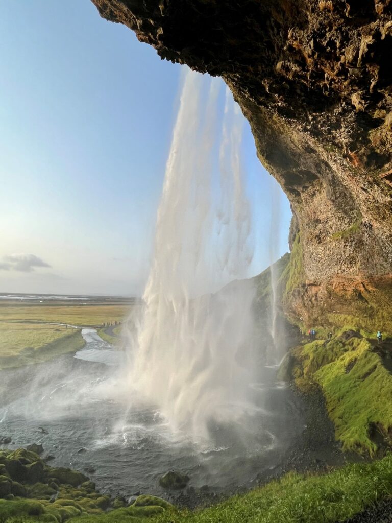
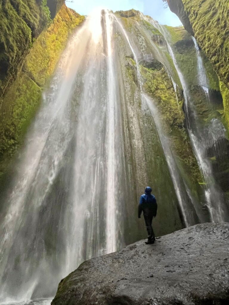
Today was our “tourist” day. The attractions we visited this day are included on most day tours out of Reykjavik and were very crowded with cars and tour buses. We started at the Kerið Crater, a crater with reddish colored walls and aquamarine water. You can walk both around the top of the crater and also take a path and walk down and around the lake at the bottom of the crater. Our next stop, Þingvellir National Park, would be the first stop on what is known as “The Golden Circle”. Þingvellir National Park is where the first Icelandic parliament was held. It holds a lot of historical significance. It was extremely crowded but we did walk a few of the paths and visited Öxarárfoss, a beautiful waterfall. The second stop on “The Golden Circle” is Geysir. This is a geothermal area famous for Strokkur, a geyser that erupts every 6-10 minutes with spray that normally reaches 45 – 60 ft in height. Ryan had never seen a geyser before so that is why we stopped here. If you have ever been to Yellowstone National Park in the USA, you will probably not be quite as impressed with this geothermal area. The last stop on “The Golden Circle” was Gullfoss, translated means “Golden Falls”. Gullfoss is located another 10 minutes east of Geysir. It is a gorgeous waterfall and was extremely crowded. There are walking paths with multiple viewing platforms at both the upper and lower falls. After spending quite a bit of time at Gullfoss we headed back to our Air B&B but not before making one last stop along the South Coast. We stopped at Seljalandsfoss just as the sun made an appearance. Seljalandsfoss is a very popular waterfall but since we were there later in the day it wasn‘t quite so crowded. It has a 200 ft single drop from the Seljalandsá river and you can walk behind the waterfall, which we did. Less than a ¼ mile walk to the north is Gljúfrabúi. Gljúfrabúi is a waterfall hidden behind a rock face. You have to step your way across stones in the stream to access it and a lot of visitors to Seljalandsfoss don‘t take the time to visit this waterfall. The drop is 131 ft and it is quite impressive.
Day 11 – Waterfall Way, Dyrhólæy, & Reynisfjara
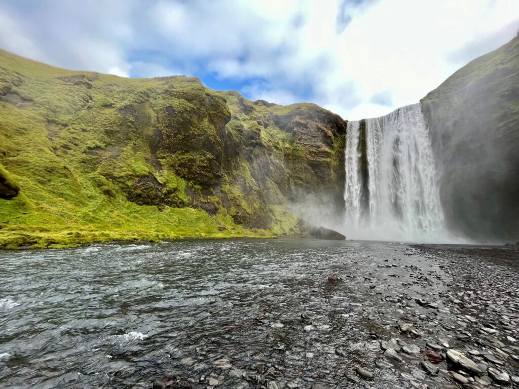
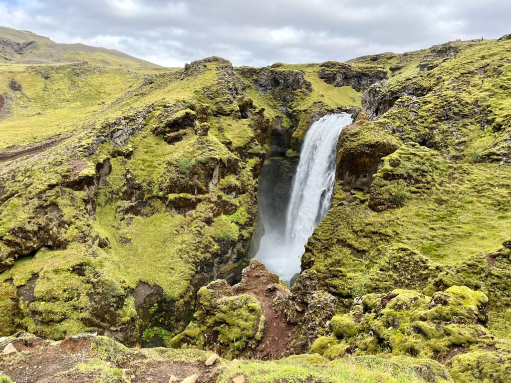
Today would be a short day distance traveled-wise, but not short on beautiful sites. Our first stop was Skógafoss, located only 10 minutes from our Air B&B. Skógafoss is a beautiful single drop 82 foot wide waterfall on the Skógá river. It has a drop of 197 feet. The waterfall can also be viewed from the top as there is a steep staircase that goes up the east side of the waterfall. We climbed the stairs and then continued hiking along the Skógá river which is known as Waterfall Way. This is also the start/end to the famous Fimmvörðuháls trail, a 14 mile trail that takes you along the Skógá river, between two glaciers, Mýrdalsjökull and Eyjafjallajökull, before ending in the Þórsmörk valley. A lot of people add this trail on to the end of the Laugavegur Trek. We chose to walk the first 2.5 miles of the Waterfall Way before turning around. We encountered numerous waterfalls and the crowds disappeared which was wonderful.
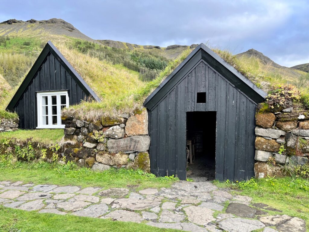
Our next stop was right down the road at the Skogar Museum. It has 3 floors of exhibits inside and an open-air section showing how Icelanders lived in the turf houses. Additionally, there was a separate building housing Icelandic technology and transportation.
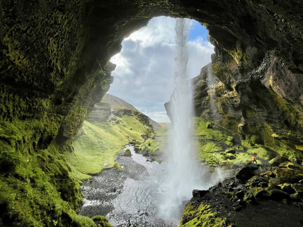
A short walk from the Skogar Museum was another beautiful waterfall, Kvernufoss. This is another waterfall that you can walk behind. It is much less crowded and just as picturesque as Seljalandsfoss. It drops 98 feet along the Kverna river.
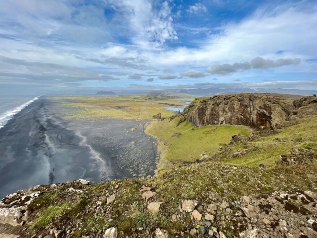
Our next stop was Dyrhólæy, further east along the Ring Road. Dyrhólæy is the southern most point of the Iceland mainland. Its name translates to “Door Hill Island“. Dyrhólæy is home to a historic lighthouse, a rock arch that bears the same name, and is home to a wealth of birdlife. There are two viewpoints at Dyrhólæy that are connected to each other by a footpath.
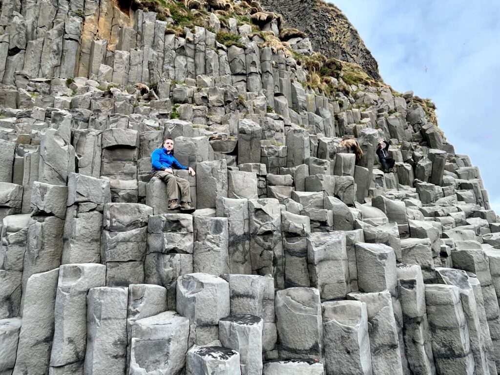
Our last scenic stop for the day was Reynisfjara, the most famous Icelandic black sand beach. It is known for the basalt columns that line the shore. It is also known for its “sneaker waves”, strong waves that come out of nowhere and sweep people out into the ocean. Numerous visitors have died here. There are warnings everywhere but visitors tend to ignore them. This was an extremely crowded area but very beautiful. The tide seemed to be out so we were able to explore the basalt cave and walk quite a ways on the beach.
Day 12 – Fjaðrárgljúfur Canyon, Svartifoss, & Múlagljúfur Canyon
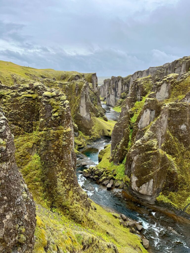
We checked out of our wonderful Air B&B this morning and were on the road by 9 am. We headed east on the Ring Road and drove for about 1 ½ hours before our first stop of the day, Fjaðrárgljúfur Canyon. It was formed by the Fjaðr river thru progressive erosion about 9,000 years ago. The canyon became quite the tourist attraction in 2015 when a Justin Bieber video for “I’ll Show You” was released, showing footage of Bieber in the canyon. They actually had to shut down access to the canyon at times because the foot traffic was causing damage to the vegetation. There are now dedicated footpaths and roped off areas to protect this fragile area. The area was very crowded when we were there, with cars lined up alongside the road for at least a quarter of a mile. We hiked out and back to the furthest point on the trail where a beautiful waterfall is located.
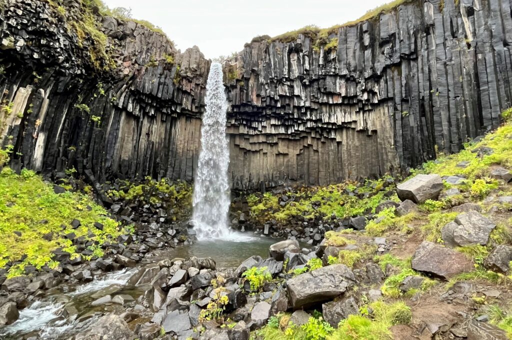
Our journey continued back along the Ring Road for another hour where the Vatnajökull glacier loomed in front of us. Our next stop was the Skaftafell Nature Reserve Visitor Center. We would be returning to this area the following day for a glacier hike but wanted to do the short 2 ¼ mile hike to Svartifoss today in case we didn’t have time the following day. The hike was on an easy, uphill trail that passed by 3 other waterfalls. Svartifoss is an 80 ft tall waterfall that is surrounded by beautiful basalt columns. These columns formed in a lava flow that cooled very slowly forming the hexagonal shapes.
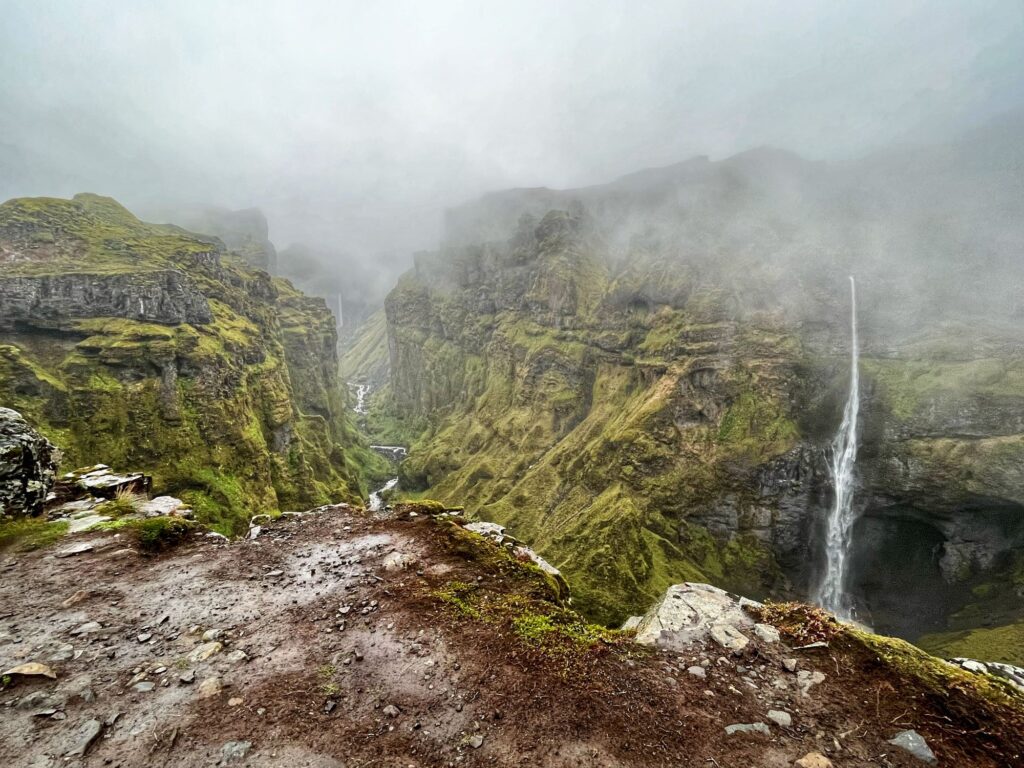
It was back to the Ring Road as we continued to drive east another 40 minutes to Múlagljúfur Canyon. This canyon was on an unmarked gravel road in poor condition. It was now raining quite hard, but we were not going to let this stop us. There were still quite a few cars in the parking lot even though it was later in the day (after 3:30 pm). The hike is approximately 2 ¼ miles each way, although because of the rain and lack of visibility we did not hike to the endpoint. The trail was quite muddy and slippery because of the weather. We were glad we had our hiking poles, for stability if nothing else. The hike is almost all uphill on the way out and surprisingly we did come across quite a few people, although I would not say it was crowded (the one positive outcome of the poor weather). We finally reached a great viewpoint of Hangandifoss, the 5th highest waterfall in Iceland (404 ft drop). The canyon was absolutely gorgeous with its moss covered walls and steep drop-offs. The rain made the green color of the vegetation pop even more. There were 2 other waterfalls in view: one to the west (cannot find the name of this one) and one to the north, Múlafoss.
After hiking back to the car we stripped out of our rain gear and tried to get warm. We headed back to the Ring Road and continued east to our final destination, our lodging at the Vagnsstaðir Guest house which was another 35 minutes away. Our room had 2 twin beds and a set of bunk beds along with our own bathroom. Breakfast was included in our stay. Unfortunately, there was no restaurant on site and a very limited number of restaurants in the nearby vicinity without having to drive an hour in either direction. We decided on driving 10 minutes back west along the Ring Road and eating at another guesthouse/hotel – Hali Country Hotel. We were very hungry and it was a good choice, but quite expensive. We returned to the guest house and tried to dry out our boots and socks while getting our gear ready for the glacier trek the next day.
Day 13 – Only the Brave Glacier Hike
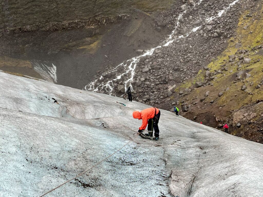
The weather forecast was not good for today and I thought that they might cancel our glacier hike to an ice cave. Apparently, they rarely cancel these tours due to weather, especially rain. Usually if they cancel the tour it is due to wind or road closures. We met our guide Andres from Icelandic Mountain Guides (the same company we used for the Laugavegur Trek) at the base camp near the Skaftafell Visitor Center. Andres was from Italy and was awesome! We were outfitted with crampons, harnesses, helmets, and ice axes. There were a total of 8 hikers in our group.
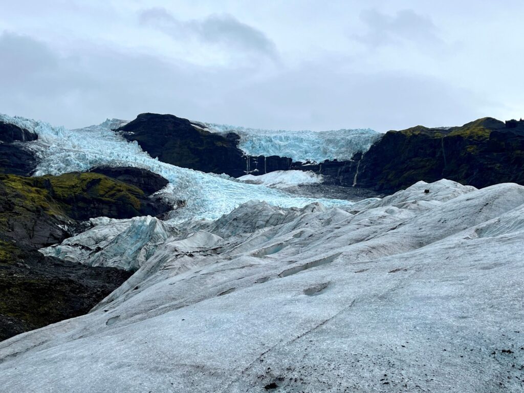
The trip started off with a 30 minute bus ride to the base of the glacier. Vatnajökull glacier is the largest glacier in Iceland as well as in Europe. It covers 8% of Iceland and has many tongues, one of which we would be hiking on. To the right of the glacier lies Hvannadalshnúkur, the highest peak in Iceland at 6,900 ft. The hike started out crossing a moraine, a mass of rocks and sediment that has been carried down and deposited by the glacier. We did not need any equipment for this part of the hike. After crossing the moraine, it was time to put on our crampons. We had a short lesson on how to put them on and Andres checked everyone’s before we continued. Once we had the crampons on, Andres went over how to hike with the crampons on, depending on whether your were hiking up or downhill, or traversing across a slope. We practiced the different techniques. In certain sections we were attached to an anchor rope with our harness.
It was pouring rain during our hike. While our rain gear did a pretty good job keeping us dry, our gloves were soaked thru and we couldn’t keep our hands dry so it was difficult to take photos with our phones. The ice was a gorgeous blue color. It is difficult for photos to capture the scale of what it was like being on the glacier.
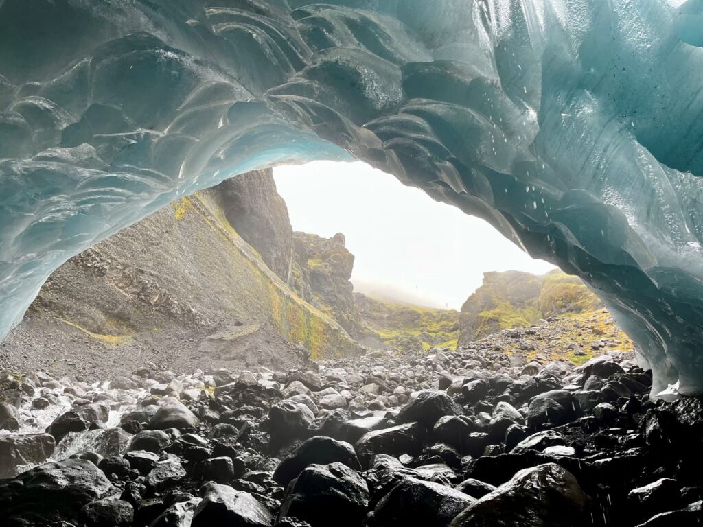
We had to scale down a very steep slope to get to the ice cave. During this section, multiple guide ropes were anchored into the glacier and we had to “clip-in” and traverse the area like a “via ferrata”. We reached the ice cave and it was beautiful. Most ice caves that people visit on the glacier are formed by glacial waters flowing out of the glacier. This ice cave is formed by water flowing into the glacier so is accessible year round. After taking photos in the cave we started our journey back to the bus. We took a different route so the scenery was different. We were on the glacier for a total of 4.5 hours and it was totally worth the time.
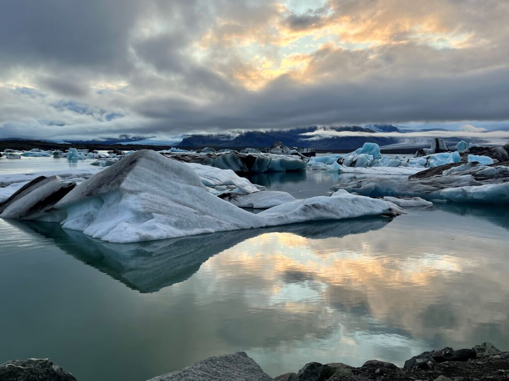
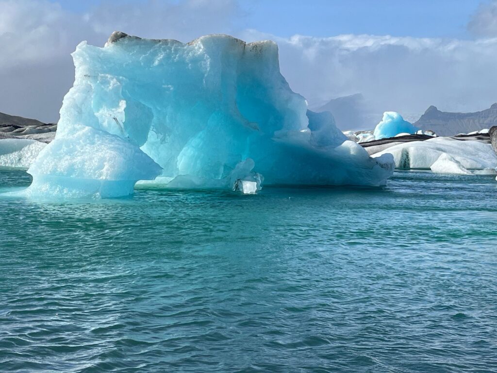
On our way back to the guest house the sun broke thru the clouds just as we were passing the Jökulsárlón Glacial Lagoon so of course we had to stop. We had a great time walking along the lagoon photographing the icebergs. At one point we heard a loud sound and when we looked over we saw one of the icebergs rising out of the lagoon looking like it was ready to flip over. It didn’t, but it now had a mushroom shaped appearance. It was a great way to end the day.
Day 14 – Stokksnes Peninsula, Diamond Beach, Jökulsárlón Glacial Lagoon, Nauthúsagil
Today would be our last full day in Iceland. The previous evening I checked the weather forecast and it showed that the skies would be clearing in the Höfn area the following morning. The Stokksnes Peninsula had been on my radar since I first started planning the trip. There is a Viking settlement movie set located there along with the iconic Vestrahorn (“Batman mountain”). I really wanted to visit this area even though it was a 55 minute drive east of the Vagnsstaðir guest house sot it would add almost 2 hours on to our already 4 hour drive west back to Reykjavik. With the positive weather forecast, I decided to get up at 6:15am and drive the 55 minutes, returning back to the Vagnsstaðir guest house by 10 am for checkout.
We left at 6:15 am to somewhat cloudy skies and started the drive east. The further east we drove the more remote the area became but we could see blue sky. We arrived at the Viking Café around 7:40 am and paid a fee to access the road down to the Viking village.
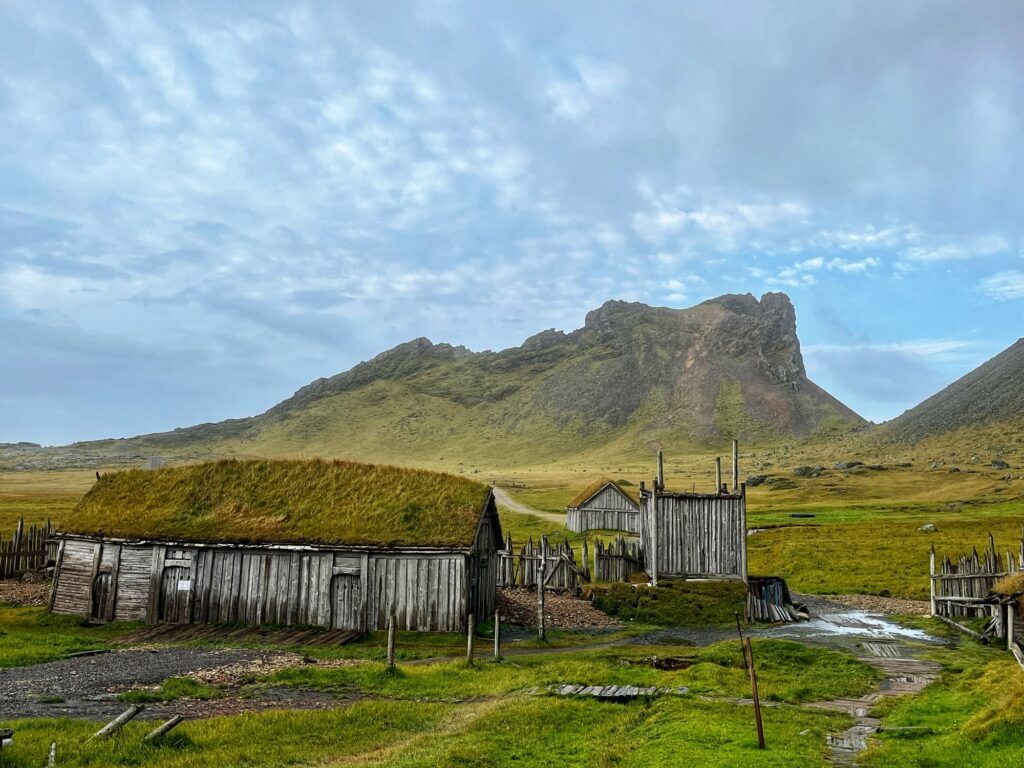
The Viking village was built in 2010 by Universal Studios to be used as a movie set. The movie was never made. We walked around the village taking photos and then we continued down the road to another parking area. You cannot drive to the tip of the peninsula as the H-3 Radar Station Stokksnes is located there which is used by Iceland Air Defense System to monitor Iceland’s airspace.
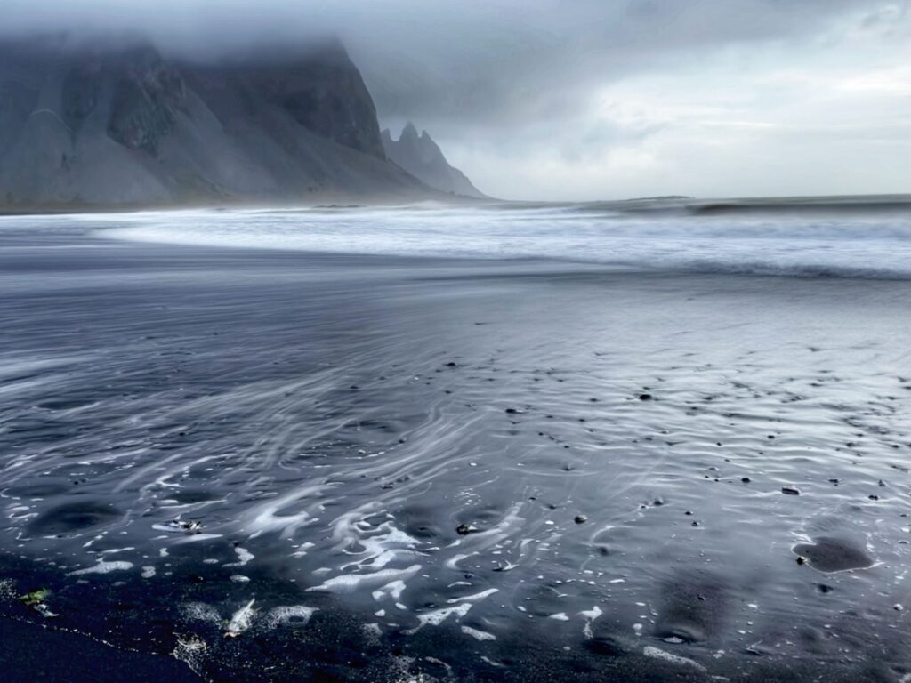
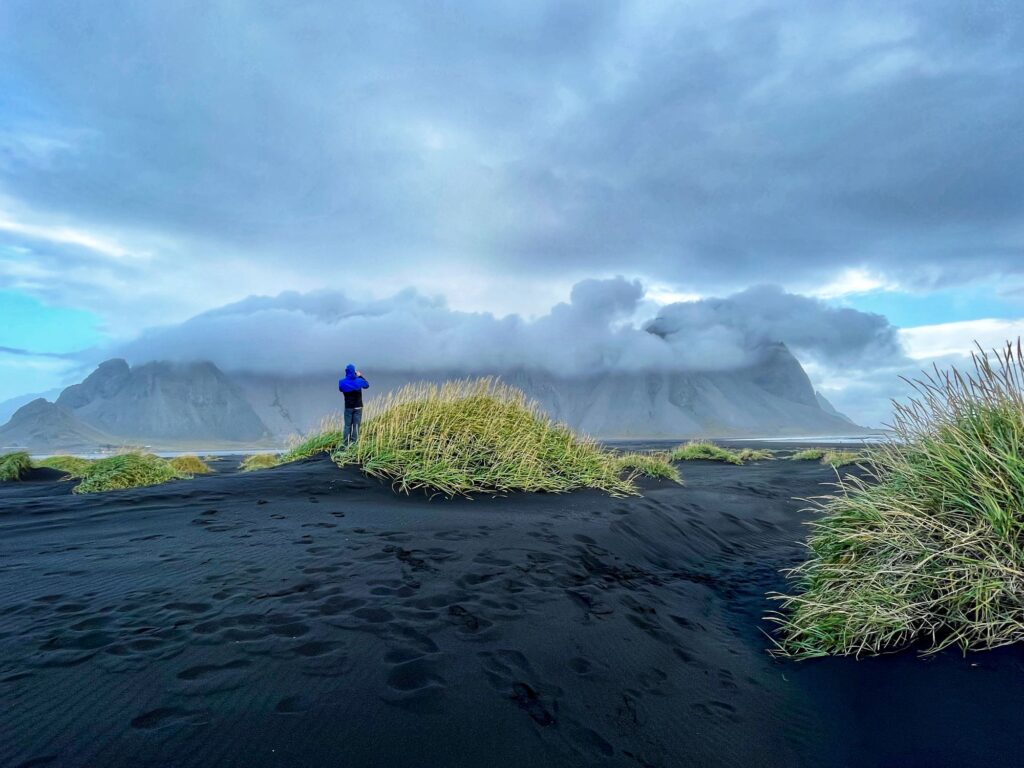
Appearing in front of us was a beautiful black sand beach with bright green grass tufts and the crashing surf – no mountains to be seen. We were pretty disappointed and thought we might have been in the wrong place. There was a huge gray cloud bank in front of us and apparently that is where Vestrahorn lies. The Vestrahorn dramatic peaks reach 1,490 ft. It was very, very windy and we could see blue sky over the North Atlantic Ocean. We decided to wait it out for a little while and see if the clouds would blow away. Colin got a great time lapse video showing the movement of the clouds. While we never got to see Vestrahorn in all of its glory, it was still a beautiful area. I think if we had stayed another hour or two, we would have gotten the iconic photo.
Our first stop heading back west towards Reykjavik was Diamond Beach and the Jökulsárlón Glacial Lagoon. There were plenty of “diamonds” on the black sand beach. The “diamonds” are actually pieces of the icebergs from the Jökulsárlón Glacial Lagoon. The icebergs travel from the lagoon thru a channel, they are then tumbled in the surf as the tide goes in and out and eventually pieces wash up on shore. It is best to go during low tide to see the most “diamonds”. When visiting on a sunny day, the pieces of ice really do shine like diamonds.
From Diamond Beach we walked along the channel to the Jökulsárlón Glacial Lagoon. We watched seals swimming in the channel and you can see where the brownish sea water meets the freshwater blue lagoon water. We took plenty more photos of the lagoon which is constantly changing (even within the 18 hours since we had last been there).
Our journey continued westward and we stopped in the town of Kirkjubæjarklaustur to visit two waterfalls: Stjórnarfoss and Systrafoss.
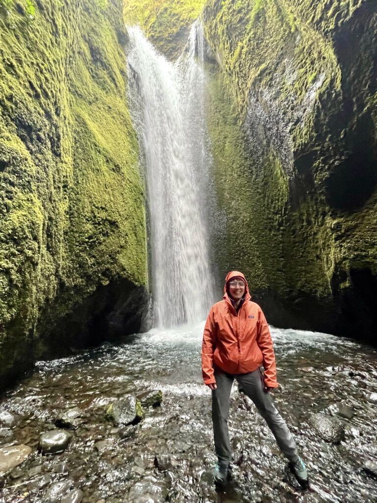
As we drove west the weather changed every 15 minutes. We were in no rush to get to Reykjavik as Colin and I had already spent plenty of time there and we still had the following morning to explore with Ryan. We decided to stop at Nauthúsagil, a moss filled, “fairytale-like” canyon, a location that we had removed from Day 10 of our itinerary due to lack of time. As we approached the turnoff from the Ring Road to Nauthúsagil it started to rain but we decided to go anyway and we are so glad we did.
Nauthúsagil was gorgeous! We had the entire trail to ourselves. It was only 1.2 miles round trip. The trail follows a stream into a very narrow canyon. At one point you come across a small waterfall (~3 ft) and it looks like the trail ends. However, upon closer inspection there was a chain on the left side of the canyon that allows you to continue with some maneuvering. Colin and I took on the challenge and continued until we reached the end of the trail at a much larger waterfall.
We had another 1:45 hours to go on the Ring Road before reaching Hotel Múli, our lodging for the evening. We reached our self-service hotel around 7:30 pm. We walked to the nearby Hotel Island and had dinner there at the Hekla Restaurant.
Day 15 – Reykjavik & flight home
We were able to sleep in this morning since most shops in Reykjavik didn‘t open until 10 am. We ate at the included breakfast buffet at Hotel Múli and then drove downtown where we parked the car in a parking garage. We went back to Hallgrimskirkja so Ryan could see the church. We spent a large part of the morning shopping for souvenirs along the streets of Reykjavik. Our last stop in Iceland was the Icelandic Phallological Museum. The boys enjoyed shopping in the gift shop and bought a few “souvenirs”. The museum was actually very well done and was informative, more like a natural history museum. In addition to the gift shop there was also a nice café that offered a few interesting beer selections along with coffee and waffles (shaped like penises but smelled absolutely delicious).
We returned the rental car at 2 pm with 2,393 km on it. We drove 2325 km (1,445 miles) in 8 days. We took the shuttle back to the airport, submitted our VAT refund forms, mailed a few postcards, checked our luggage, and headed to the gate. When we first arrived at Terminal D there was hardly anyone there. By the time we had to board the flight home, it was a madhouse.
Our direct flight to Boston was delayed about half an hour after boarding the plane, but landed in Boston on time. It was a wonderful vacation!! Can’t wait to go back – so much more to see: Westfjords, Westmann Islands, North & East coast, Northern Lights…..
