I can still recall my first introduction to the South American continent with remarkable clarity. I was seated cross-legged on the rug in Mrs. Fuller’s first-grade classroom when she unfurled an enormous map of South America before us. My eyes were immediately drawn to the long, slender country tracing the continent’s western edge. By second grade, that fascination had taken root so deeply that I asked for a globe for Christmas. The one I received was a relief globe, and I vividly remember running my fingers across the raised contours of the Andes and the distant Himalayas, marveling at the vastness of the world.
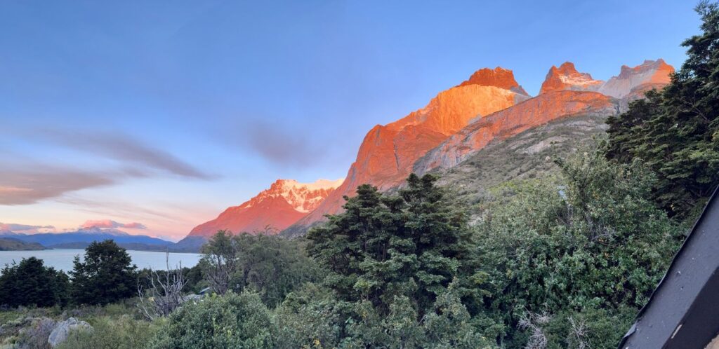
Who could have imagined that, fifty years later, that same globe would tell such a different story—no Soviet Union, no Czechoslovakia, no Zaire, no Yugoslavia, and a reunified Germany. Yet one constant endured: the quiet pull of Patagonia, the “Land of the Giants.” In my mind’s eye, I pictured what I now know as the Torres del Paine—the “Towers of Blue”—rising starkly against the sky. I had long dreamed of visiting this remote corner of the world, though I never truly believed that dream would materialize. And yet, here I am—having traveled 6,572 miles, crossed the equator, and arrived in one of the most wild and rugged landscapes on Earth.
From the outset, I knew I wanted to hike in Torres del Paine National Park. Having fallen in love with multi-day trekking in the Dolomites, I was drawn to the idea of another extended journey on foot. I chose the “O” Circuit over the more popular “W” Trek—longer, more remote, and far less crowded. To simplify the logistics, I partnered with Pygmy Elephant, a company specializing in self-guided trekking itineraries, and in June 2025 secured our adventure for March 2026. While it would have been more economical to arrange everything independently, the peace of mind—knowing the details were handled and support was available if needed—was well worth it.
Day 1 Boston to Santiago, Chile
Our South American adventure began on Saturday, March 7, 2026 and was supposed to feature flights from Boston to Puerto Natales, Chile with layovers in New York and Santiago, Chile. Our initial flight departed Boston on time and arrived in New York around 2:30 p.m. at Terminal 4, anticipating a three-hour layover that unfortunately stretched into six due to unscheduled aircraft maintenance. It quickly became clear that we would miss our connecting flight in Santiago, Chile. At last, LATAM departed at 9:20 p.m. The ten-and-a-half-hour journey traced a sweeping path down the U.S. coastline, over the Bahamas, Cuba, and Panama, then along the shores of Ecuador, Peru, and Chile, before arriving in Santiago at 9:30 a.m. Upon arrival, a LATAM representative greeted us at the gate and provided a shuttle voucher to the Airport Marriott Courtyard, where the airline had arranged accommodations. They also covered our meals—lunch, dinner, and breakfast the following morning—as well as our return shuttle to the airport for the rescheduled flight to Puerto Natales.
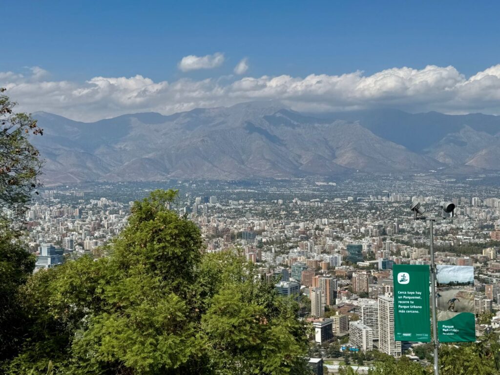
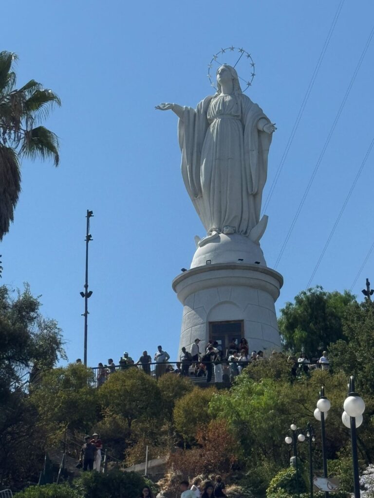
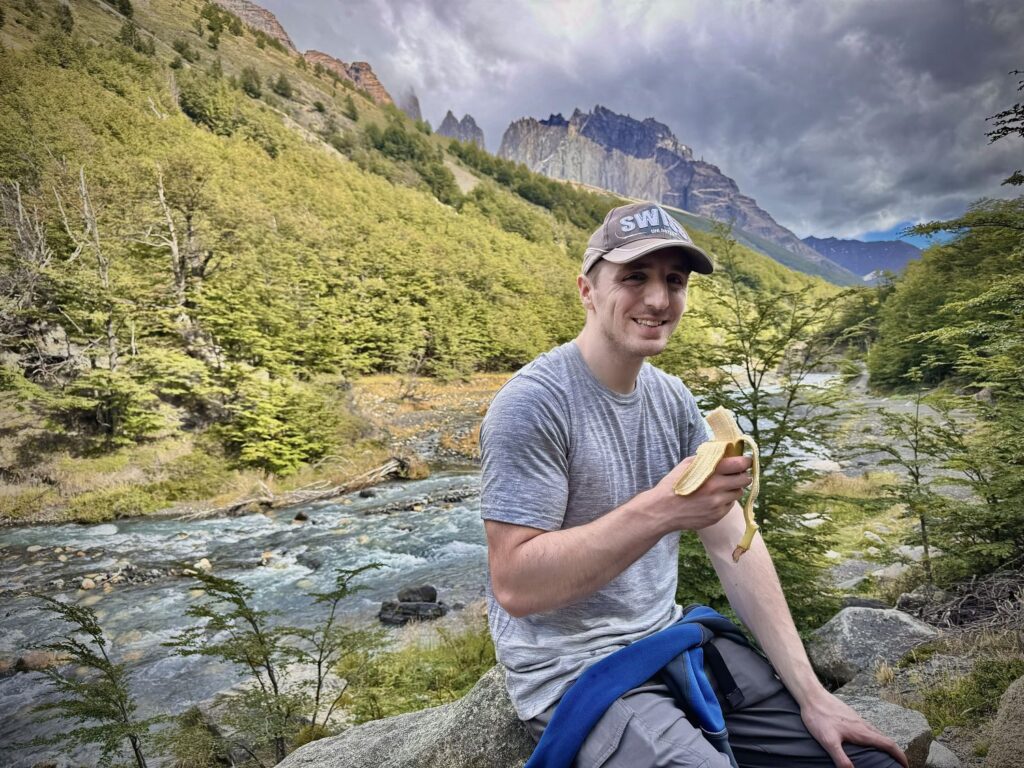
In Santiago, where temperatures hovered in the 80s, Colin and I changed into lighter clothing. As Chile’s capital and largest city, Santiago is a vibrant metropolis, home to nearly seven million people and one of the largest urban centers in the Americas. We enjoyed a leisurely lunch at the hotel—salad, Alfredo pasta with ham, and panna cotta for dessert—before requesting an Uber into the city. We asked to be dropped at Santiago Metropolitan Park, one of the largest urban parks in the world. One of the park’s highlights is the funicular ride up San Cristóbal Hill, where a towering statue of the Virgin Mary overlooks the city, offering sweeping panoramic views. After exploring the summit, we crossed the park by cable car, taking in even more of Santiago’s skyline. We eventually retraced our route, wandered the surrounding streets for about an hour, and then returned to the hotel by Uber. Following a brief but much-needed nap, we dined again at the hotel restaurant—cheese soup, a meat-and-rice dish, and panna cotta to finish. It was an early evening for us, as a 4:00 a.m. wake-up awaited in preparation for the 4:30 a.m. shuttle back to the airport the next morning.
Day 2 Santiago to Puerto Natales, Chile
After a 4:30 a.m. shuttle ride back to Santiago’s Arturo Merino Benítez International Airport (domestic terminal), we were at last ready to continue our journey south to Puerto Natales. Our LATAM flight departed promptly at 6:45 a.m. Though we paused briefly in Puerto Montt for a 45-minute stopover—remaining on the same aircraft and simply changing seats—we soon resumed our course, arriving in Puerto Natales at 11:30 a.m. The Puerto Natales Airport is modest in scale. We disembarked via both the front and rear exits of the plane, stepping directly onto the tarmac before walking a short distance to the terminal. Once inside, Colin waited for our luggage while I purchased shuttle tickets to our hotel. The ride took just 20 minutes, with two stops along the way, before delivering us to Hotel Aquaterra. After dropping our bags, we set out immediately in search of lunch, settling on La Guanaca Pizzeria. There, we shared a Guanaca pizza—topped with cheese, prosciutto, and arugula. While satisfying, it must be said that Chilean pizza falls short of the standards set by its counterparts in the United States, Italy, and Croatia.
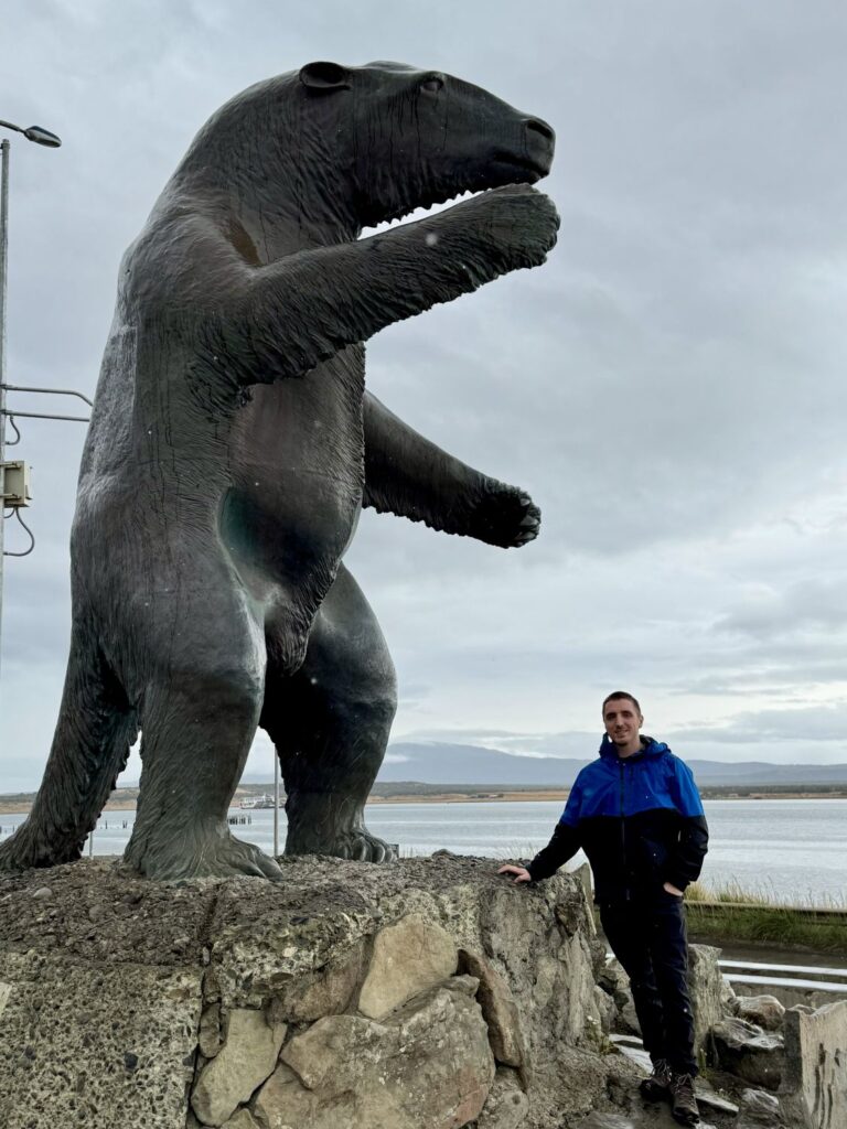
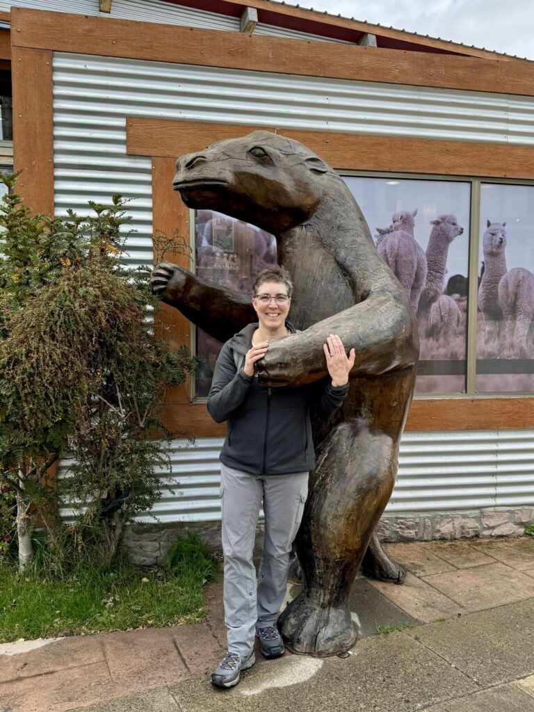
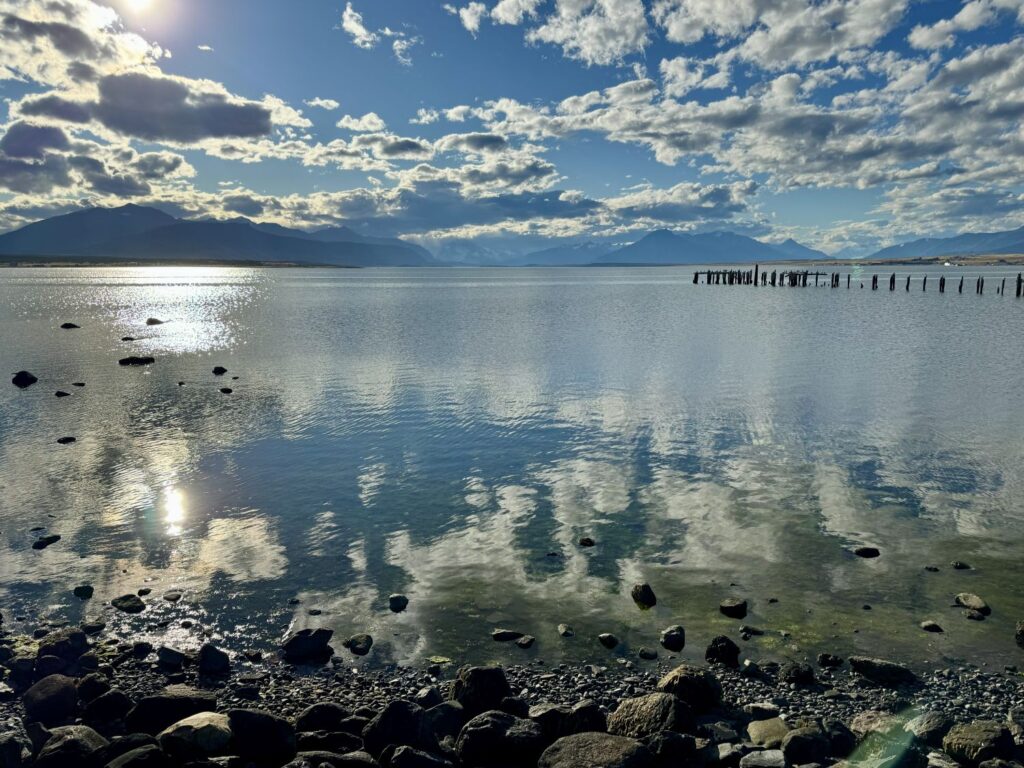
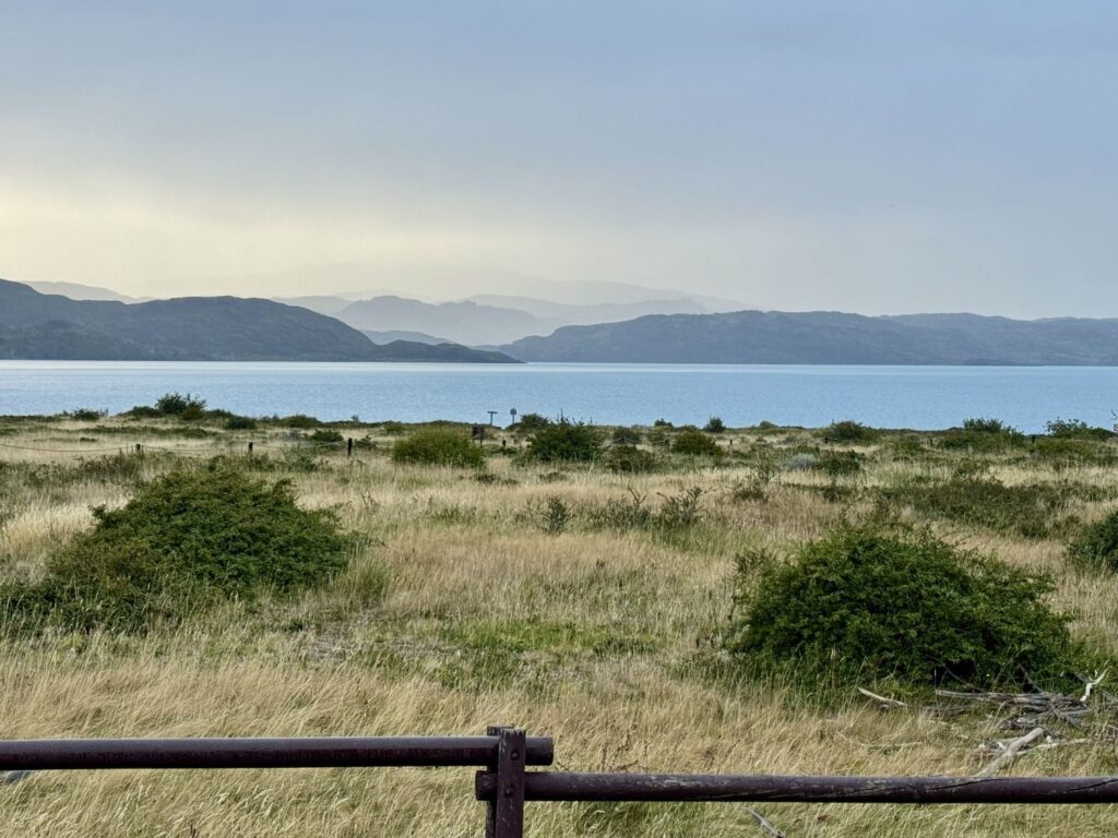
A light rain began to fall, but equipped with our rain gear, we made our way to the waterfront. Puerto Natales lies along the shores of Última Esperanza Sound and serves as the primary gateway for travelers bound for Torres del Paine National Park. Though the rain obscured the distant views, we strolled along the coast until we reached the city’s welcome sign. Behind it stood a striking statue of a Mylodon—a prehistoric giant ground sloth distinguished by its kangaroo-like tail. These remarkable creatures once measured between nine and twelve feet in length. About fifteen miles from Puerto Natales lies a cave where, in 1896, Hermann Eberhard discovered the first Mylodon remains, confirming its existence. After pausing for photos, we retraced our steps along the shoreline, eventually turning inland toward the town center and returning to our hotel for a brief, restorative nap.
The rain intensified while we rested, but by evening the skies had cleared, giving way to bright sunshine. For dinner, we visited a small café called Café Artimaña, where I ordered mushroom risotto and Colin chose beef skewers with vegetables. Afterward, we returned once more to the waterfront, now transformed under clear skies. Across the sound, the peaks and glaciers revealed themselves in full splendor. With another early start ahead—a 6:10 a.m. taxi to the bus station—we retired for the night.
Day 3 Puerto Natales to Torres Del Paine National Park and the Mirador Las Torres Hike
- Distance: 10.8 miles
- Elevation gain: 3,953 ft
- Elevation loss: 3963 ft
- Highest elevation on the trail: 2,897 ft
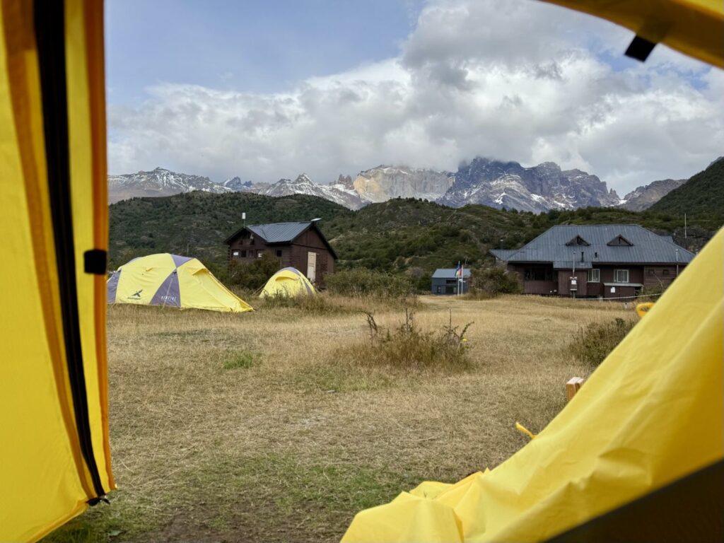
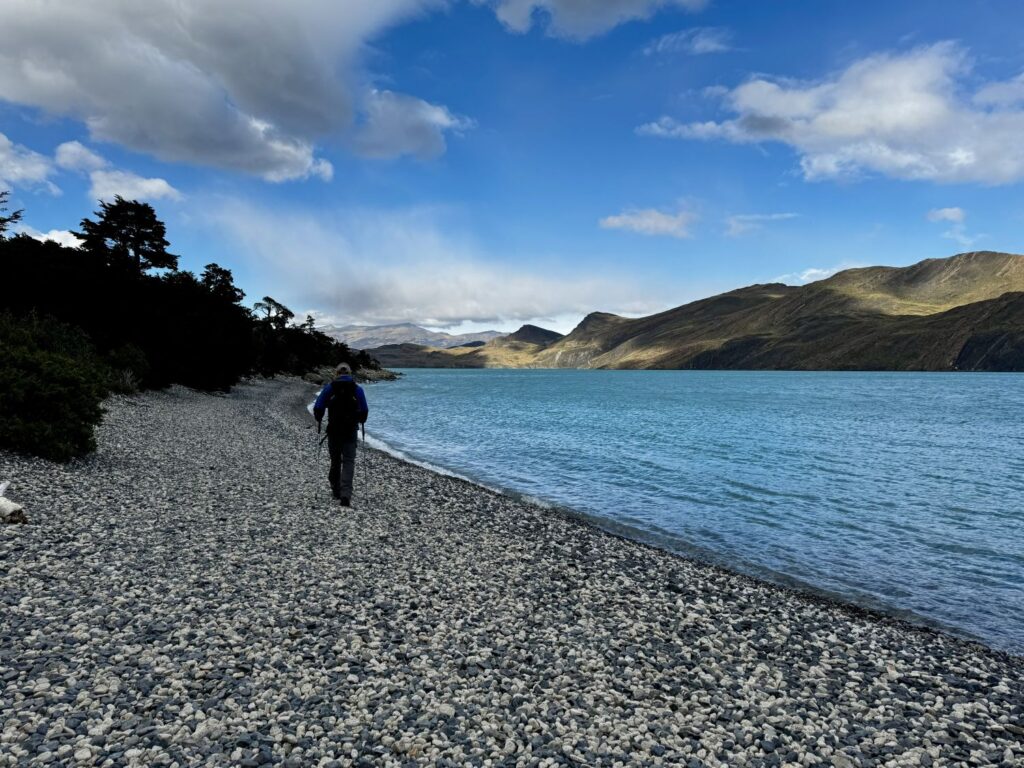
Today marked the true beginning of our adventure—the first steps of the famed “O” Trek in Torres del Paine. This demanding 75–85 mile circuit encircles the Paine Massif, encompassing the well-known “W” route while venturing into the quieter, more remote northern reaches on the park’s far side. Our morning began early, with a taxi collecting us from Hotel Aquaterra at 6:10 AM and delivering us a short distance to the Puerto Natales bus station. There, we joined nearly a hundred fellow hikers, most bound for Torres del Paine National Park. We boarded the 6:50 AM Bus-Sur service to Laguna Amarga, the park’s main entrance. The journey, lasting about an hour and forty-five minutes, carried us through striking Patagonian landscapes—though the opportunity for photographs was thwarted by stubbornly dirty windows. Colin slept peacefully the entire way, while I, too energized with anticipation, remained wide awake. Along the route, I spotted several herds of guanacos, and then, almost without warning, the iconic towers—Las Torres—rose dramatically into view.
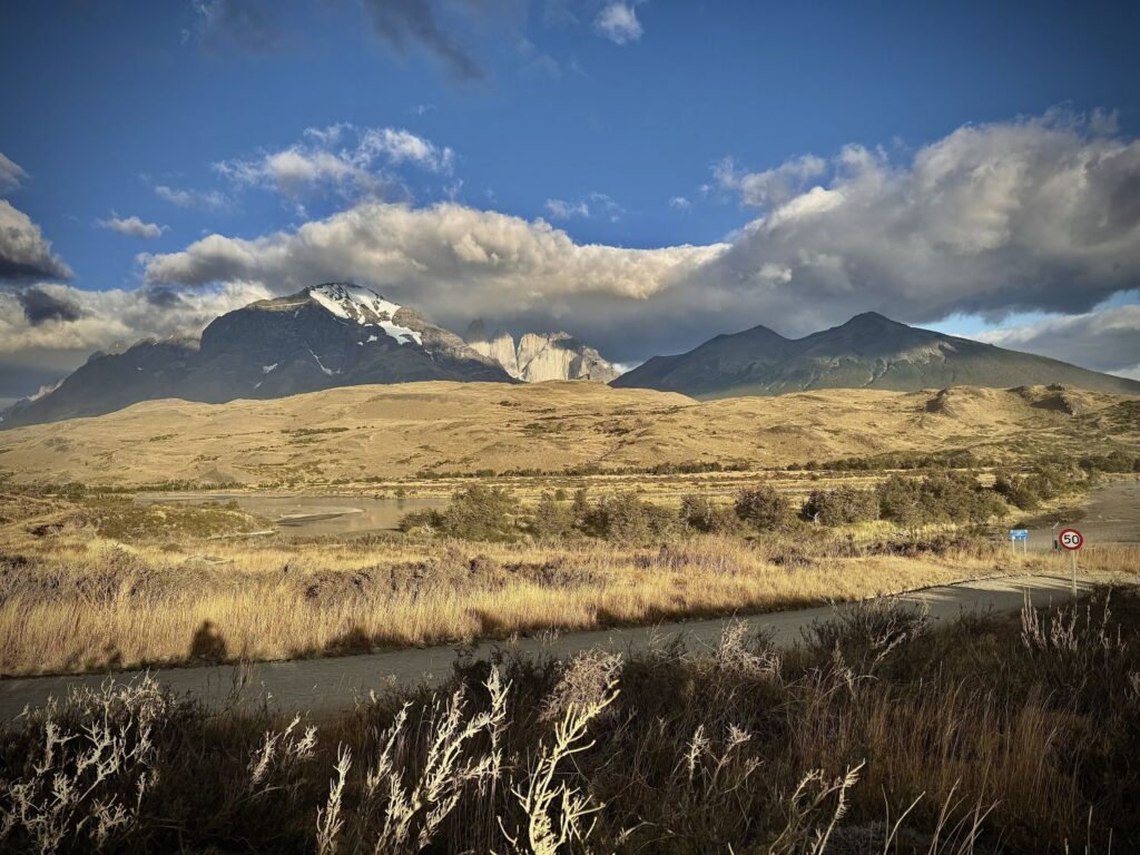
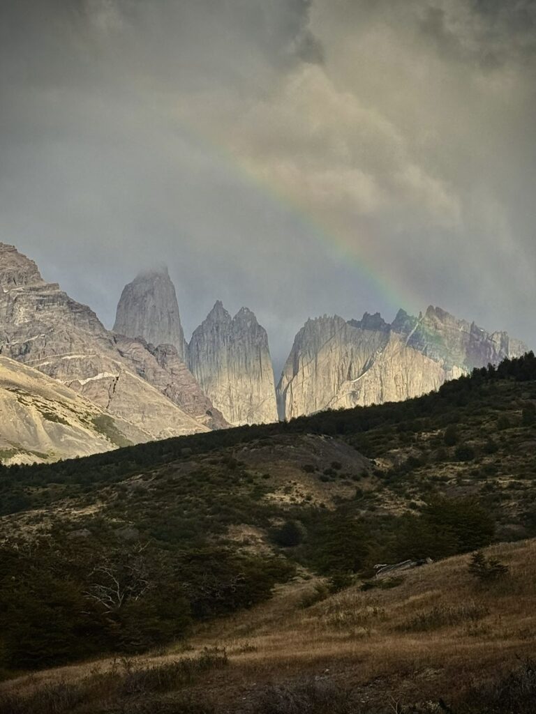
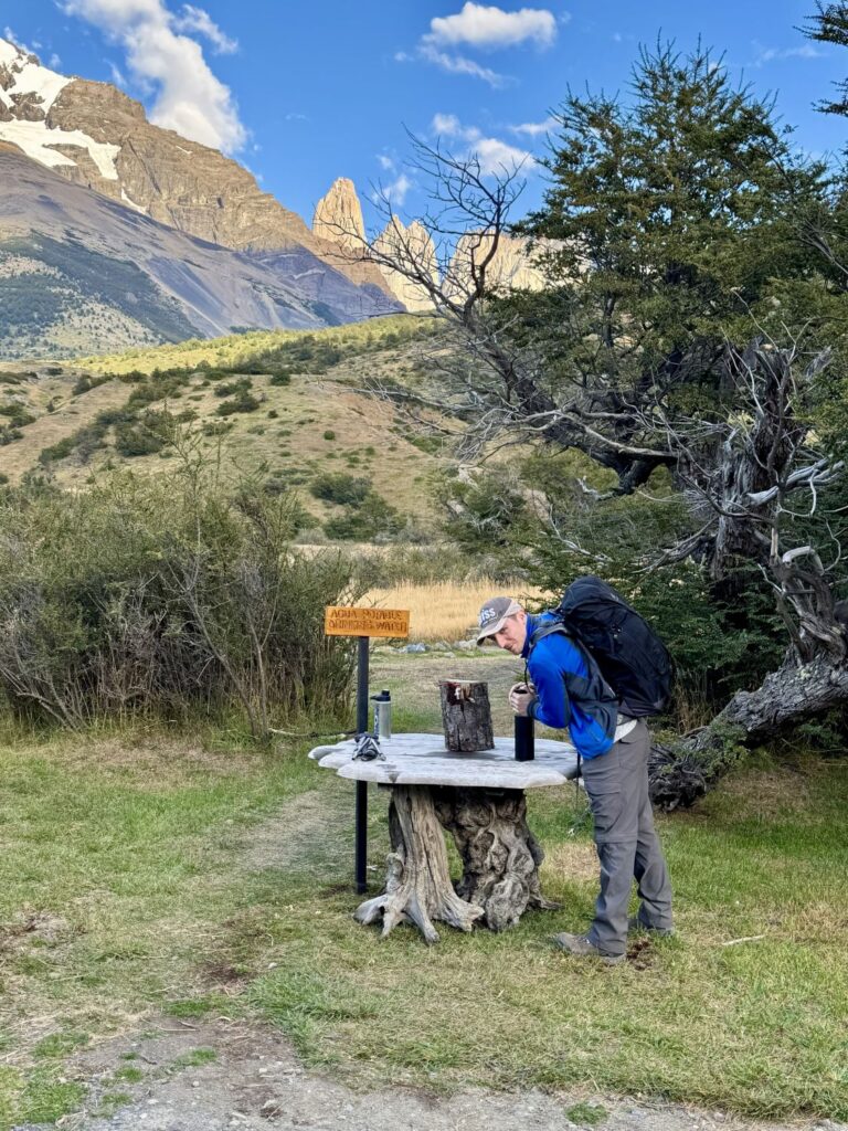
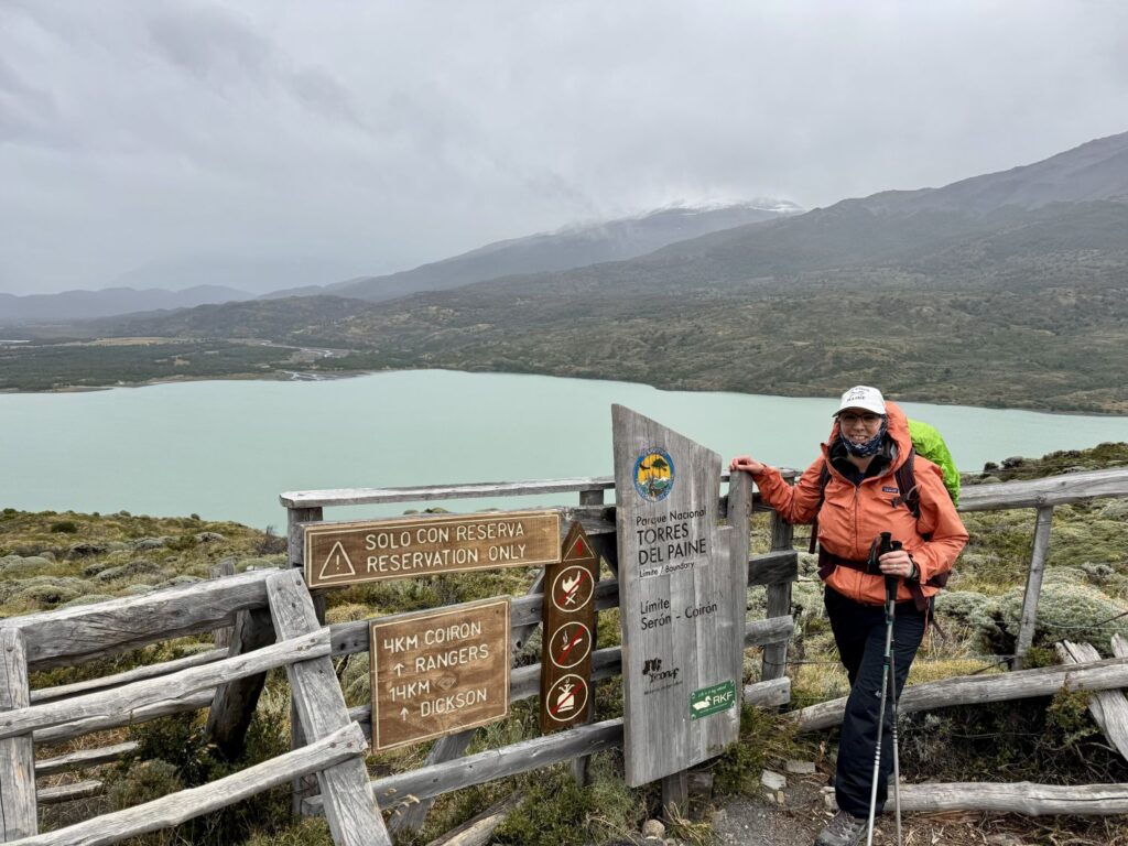
Laguna Amarga serves as a transfer point deeper into the park. Before disembarking, we presented our pre-purchased park entrance tickets (approximately $58 USD for a multi-day pass). After retrieving our backpacks we made our way down a steep hill to catch the shuttle to the Welcome Center. The short but bumpy ride, costing about 5,000 CLP per person (cash only ~$5 USD), took roughly fifteen minutes. Upon arrival, we were greeted by a stunning rainbow arcing over the stone towers—an auspicious welcome.
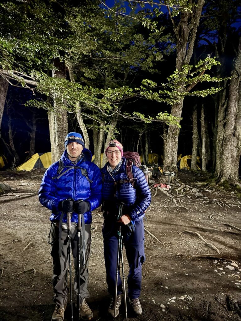
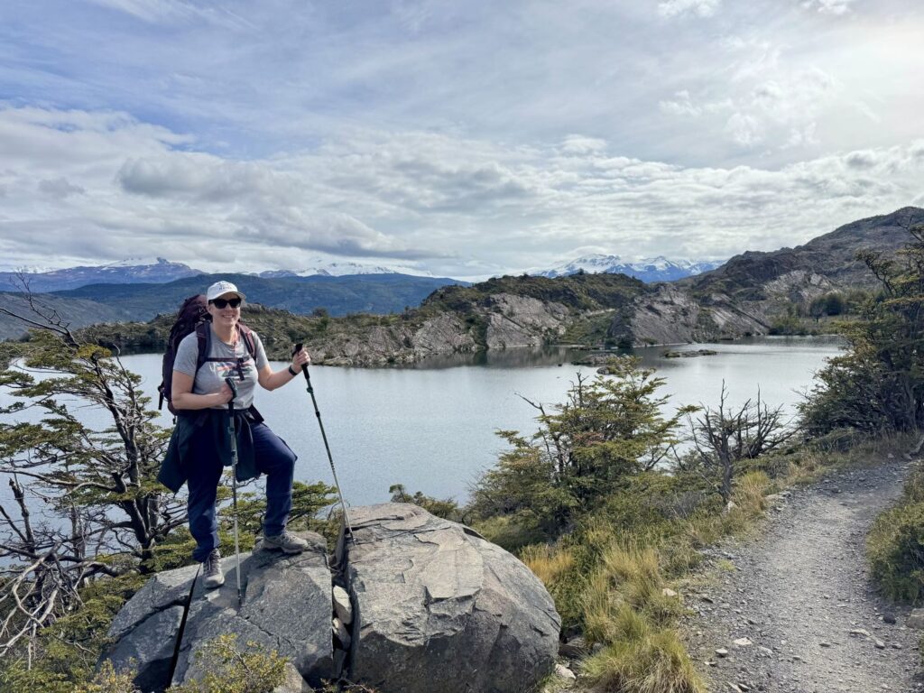
From the Welcome Center, it was a brief walk to Refugio Central, our lodging for the night. After a preliminary check-in, we stored our main packs, grateful to hike unencumbered for the day ahead. The plan was ambitious: an approximately 11-mile trek with nearly 4,000 feet of elevation gain and loss. This route forms the eastern leg of the “W” trek and is typically completed on the final day by those hiking the full “O.” We had deliberately chosen to tackle it first—both as a buffer against potential travel disruptions and to take advantage of fresh legs. In hindsight, it was an excellent decision. Though we appreciated the lighter load, we did miss the support of our hip belts. Our small daypacks carried only the essentials: rain gear, insulating layers, water, and snacks.
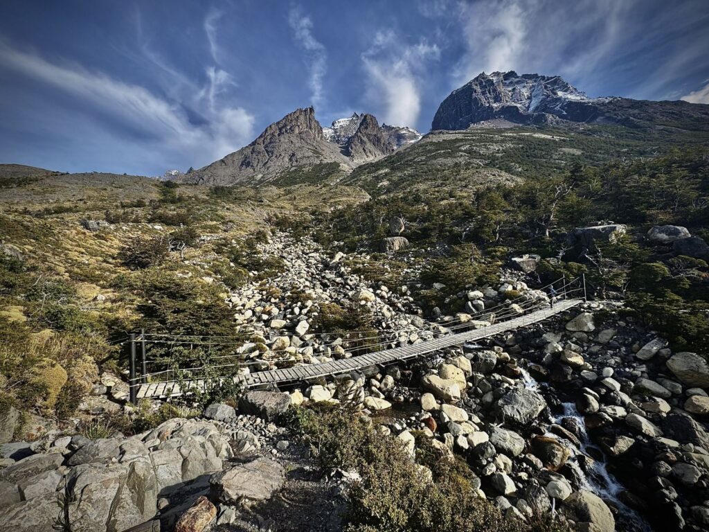
We set off at 9:45 AM. The trail began gently, winding across open fields and past the elegant—and extravagantly priced—Hotel Las Torres. After crossing the Río Ascensio via a suspension bridge—the first of many we would encounter over the coming days—the path turned sharply upward, and the real climb began. The trail followed the river from above, ascending steadily toward “Windy Pass,” which, contrary to its name, was remarkably calm that day.
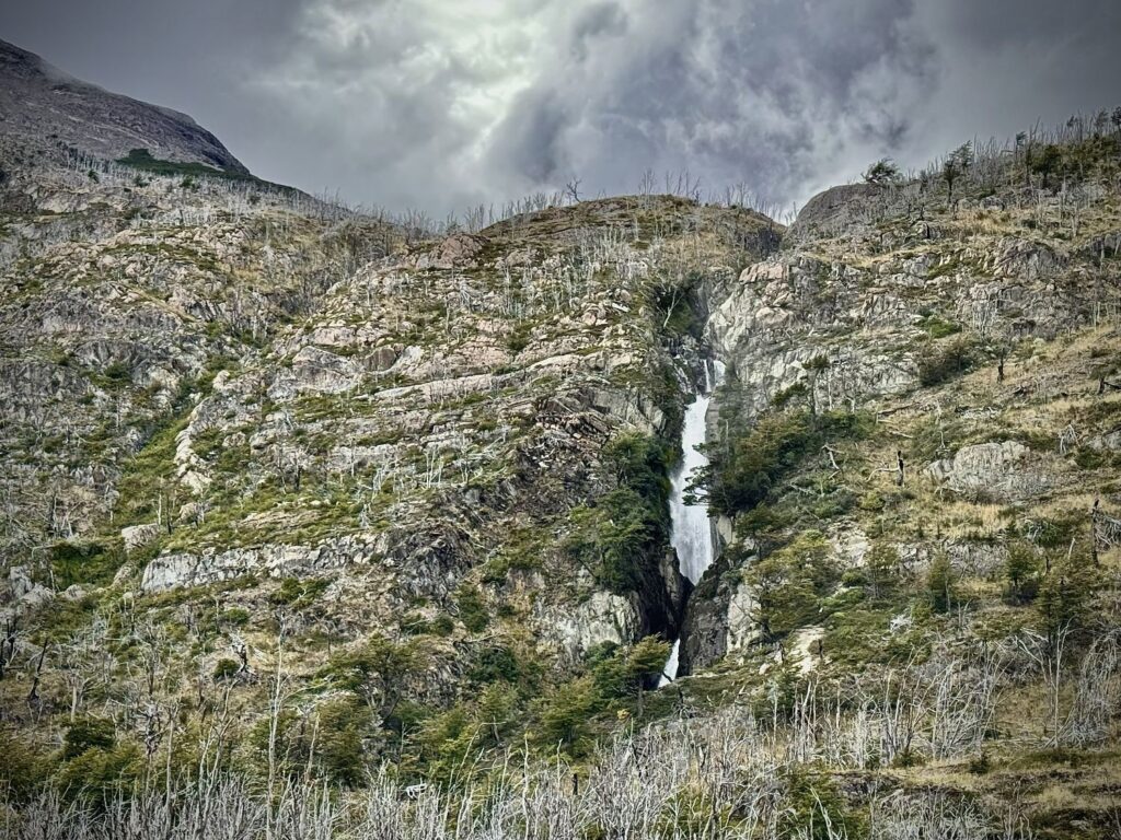
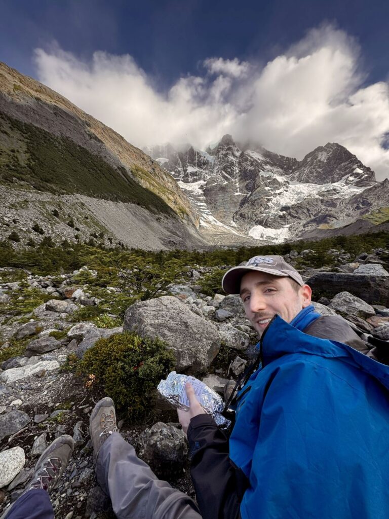
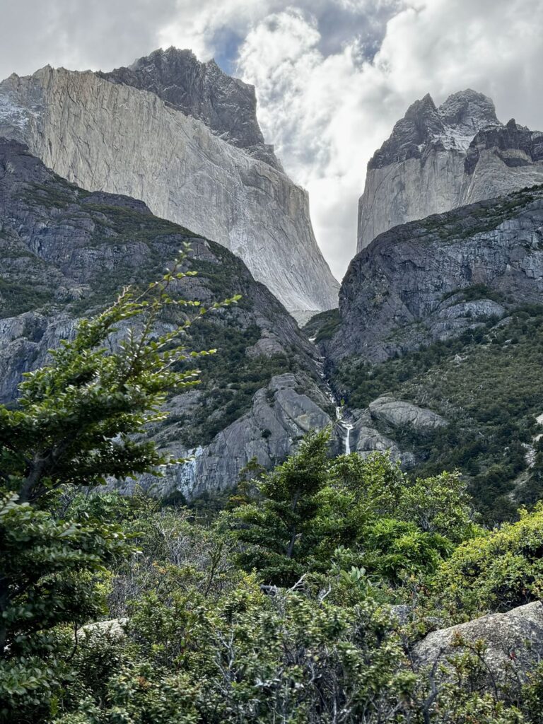
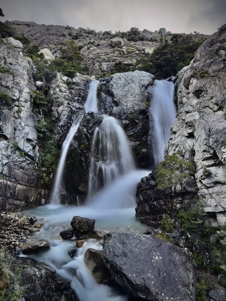
After about 3.5 miles, we reached Refugio Chileno, a popular campsite for those aiming to catch sunrise at the towers. We paused here for lunch beside the rushing river before continuing on. The trail dipped briefly back into forest, passing several powerful waterfalls, before emerging at a final rest area with bathrooms—the last stop before the ascent to Base Torres.
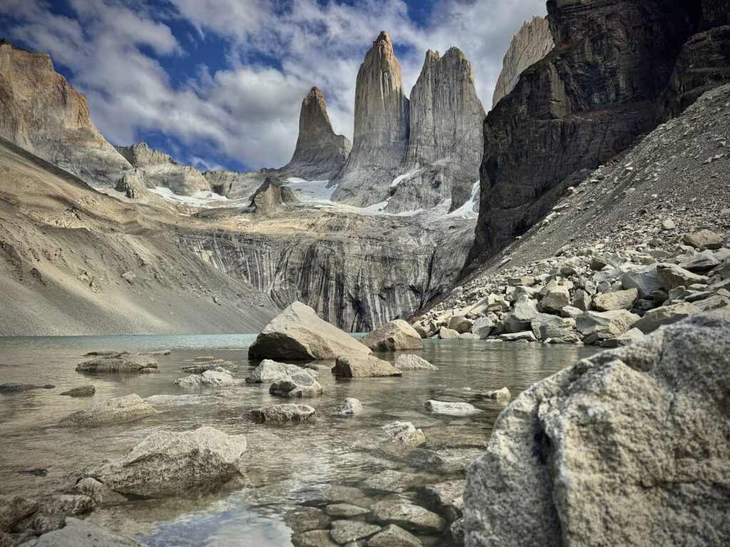
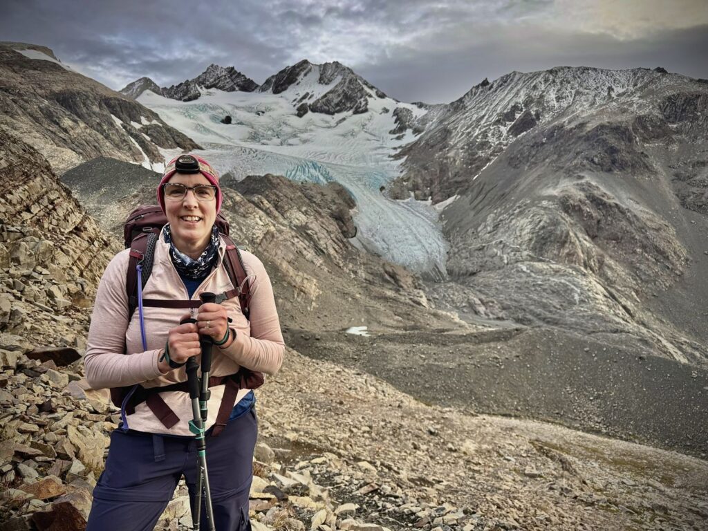
The final 0.6 miles proved the most challenging of the day: a relentless climb of over 1,000 feet of ascent across a rugged field of boulders, requiring careful scrambling at times. At last, around 2:00 PM, we reached the viewpoint—and the reward was nothing short of breathtaking. The granite spires rose sheer above a glacial lake whose color was hard to believe, especially when the Sun was shining on it. The park enforces strict cutoff times along this route; hikers must reach Refugio Chileno by 2:00 PM and the upper rest area by 3:00 PM in order to proceed. We had made it comfortably within the limits.
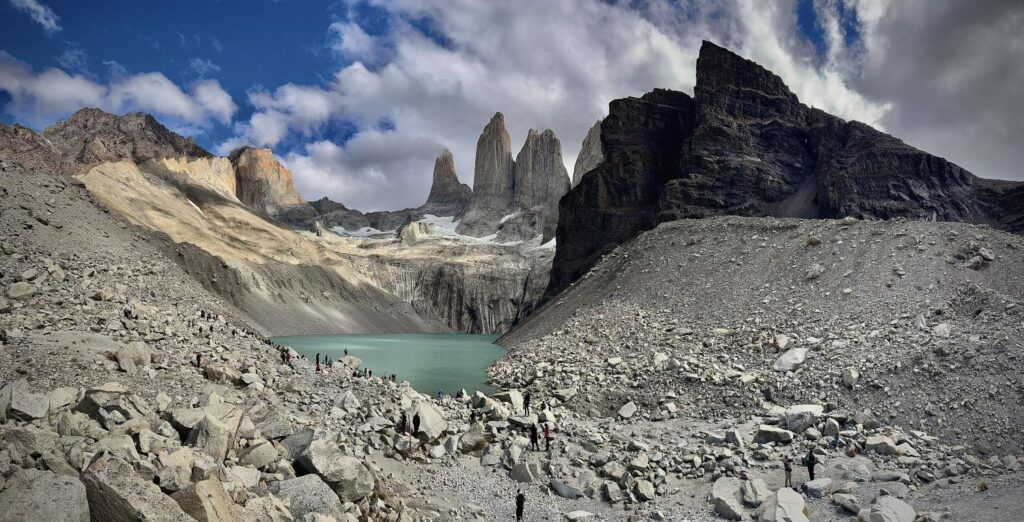
We found a sheltered rock, layered up against the chill, and enjoyed a well-earned snack before wandering down to the edge of Lago Torres. After about forty minutes soaking in the view, we began our descent, retracing our steps to Refugio Central. We arrived around 6:15 PM, completing an 8.5-hour day on the trail.
That evening, we were assigned to a six-bed dormitory—three sets of bunk beds—shared with an eclectic mix of fellow travelers: two young women whose origins we never quite determined, Pedro (originally from Peru, now living in the San Francisco Bay Area after several years in Boston), and Isabel, a marathon runner from California. After quick showers, we gathered for the 7:00 PM dinner seating, joining Isabel and her companions, Joan and Neil—a married couple, with Neil hailing from Manchester, England. They were all trekking the “W.”
Colin and I toasted our first day with pisco sours. Dinner, served plated rather than buffet-style, featured three courses and thoughtful accommodations for various dietary needs (vegetarian, lactose free, glucose free). We began with a light potato and leek soup, followed by salmon with black bean hummus, and finished with a strawberry and coffee panna cotta. Afterward, we played a few rounds of cribbage while charging our devices, then turned in early, settling into bed by 9:15 PM. Sometime during the night, Colin ventured outside in hopes of catching a glimpse of the stars, but clouds had settled in, obscuring the sky.
Day 4 Refugio Centrale to Camp Seron
- Distance: 8.8 miles
- Elevation gain: 1,234 ft
- Elevation loss: 1,076 ft
- Highest elevation on the trail: 1,276 ft
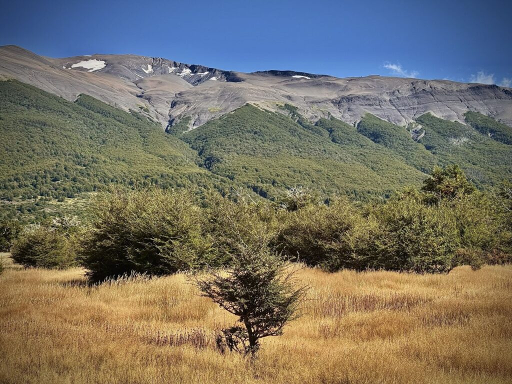
This morning marked our first steps along the “O” circuit of the trek. Unlike the more flexible “W” route, which can be hiked in either direction, the “O” must be completed counterclockwise, beginning either at Sector Centrale or Sector Paine Grande. Our destination for the day was Camp Seron, a manageable 8.8 miles away. Compared to the previous day’s exertions, the terrain promised to be gentler, allowing for a more relaxed start.
We opted for the later breakfast seating at 8:00 a.m., taking our time to repack our backpacks since checkout was not until 9:30. Breakfasts at the refugios and campsites followed a familiar pattern: an assortment of cereals—Colin and I quickly developed a fondness for the vegan cocoa puffs—along with yogurt on occasion, cheeses, cured meats, toast, and scrambled eggs. Our favorite indulgence, however, was manjar, a rich, velvety caramel spread ubiquitous in Chilean cuisine, which we generously slathered on toast each morning. I later discovered that it can be made simply by boiling sweetened condensed milk—something I am now tempted to attempt at home.
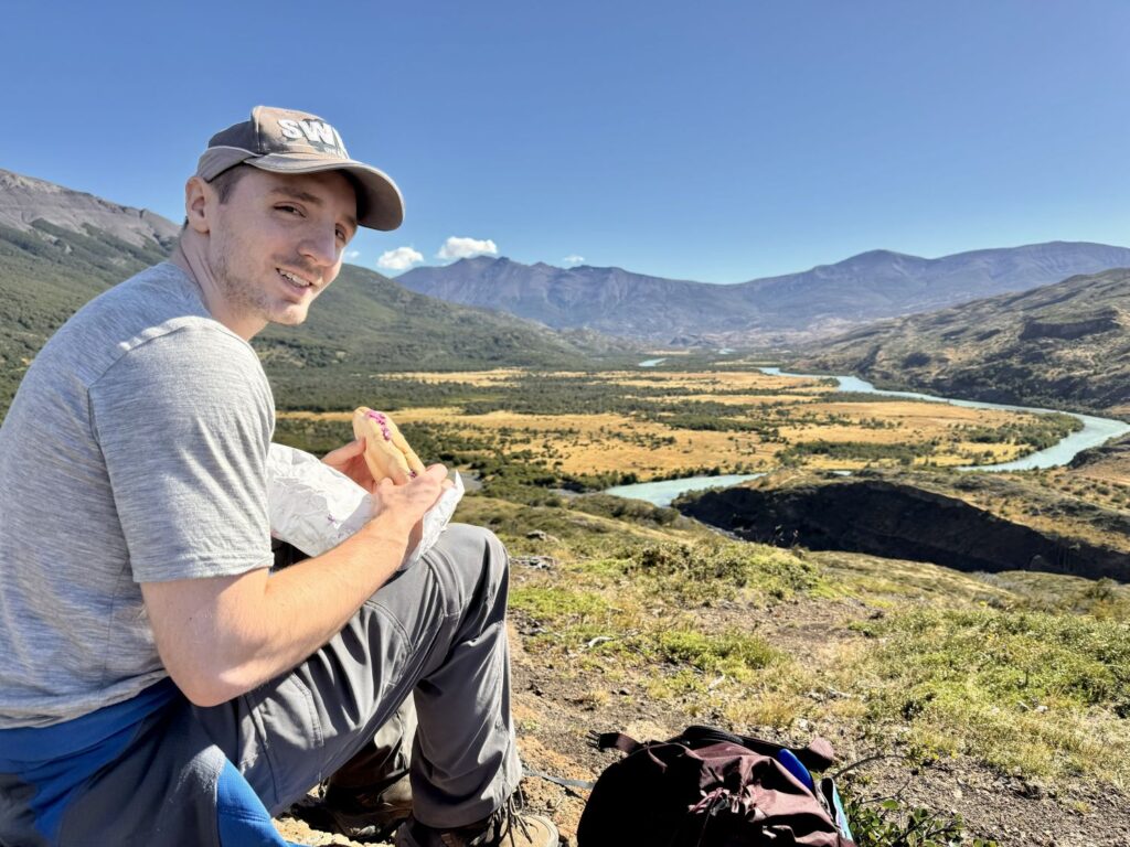
Before setting out, we filled our water bottles and collected our boxed lunches, which remained fairly consistent throughout the trek: a sandwich, chocolate, trail mix, protein bars, electrolyte mix, and energy gels. Although we were repeatedly assured that the water—both at the refugios and from nearby streams—was safe to drink, we chose to err on the side of caution, filtering it whenever possible with Colin’s Grayl bottle.
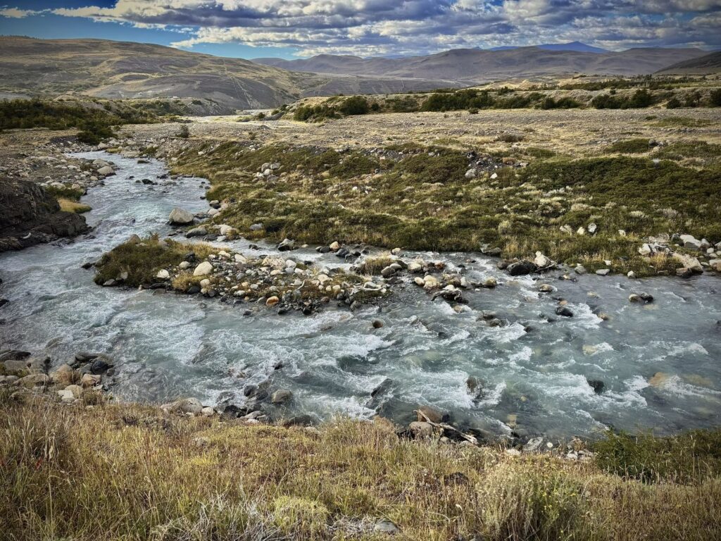
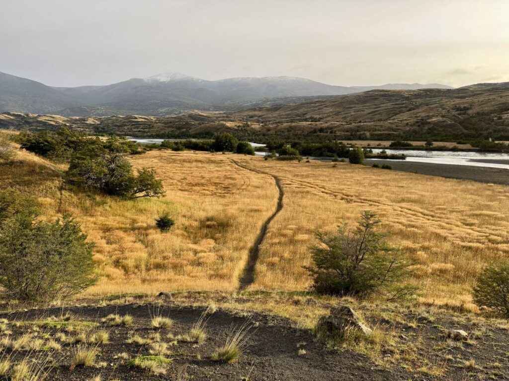
At 9:30 a.m., beneath clear blue skies and bright sunshine, we began our hike. The trail climbed steadily for the first four miles before descending sharply and eventually leveling into a long, tranquil stretch leading to camp. Though we had been warned of muddy sections due to occasional ATV use, the path was, for the most part, dry and easy to navigate. At intervals, the trail opened to reveal sweeping views of the winding Río Paine below. At the highest point, we paused atop a large rock to enjoy our lunch, overlooking the river’s graceful bends.
The final stretch meandered through open meadowland, where tall, golden grasses swayed gently in the breeze. Along the way, we encountered a river crossing; after briefly scouting alternatives, we resigned ourselves to removing our boots and wading across the cold water.
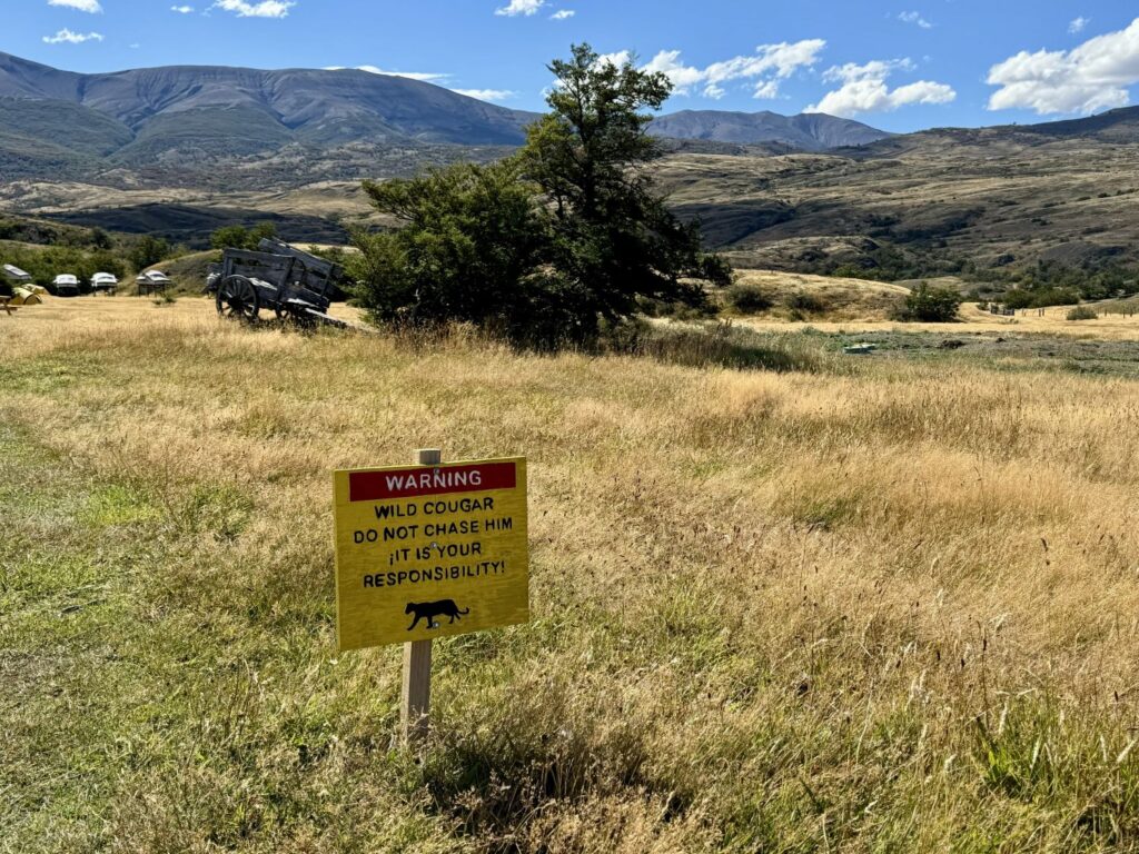
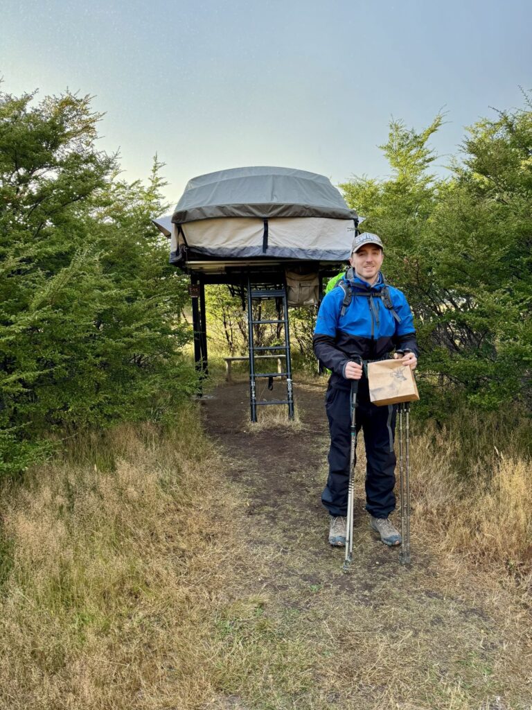
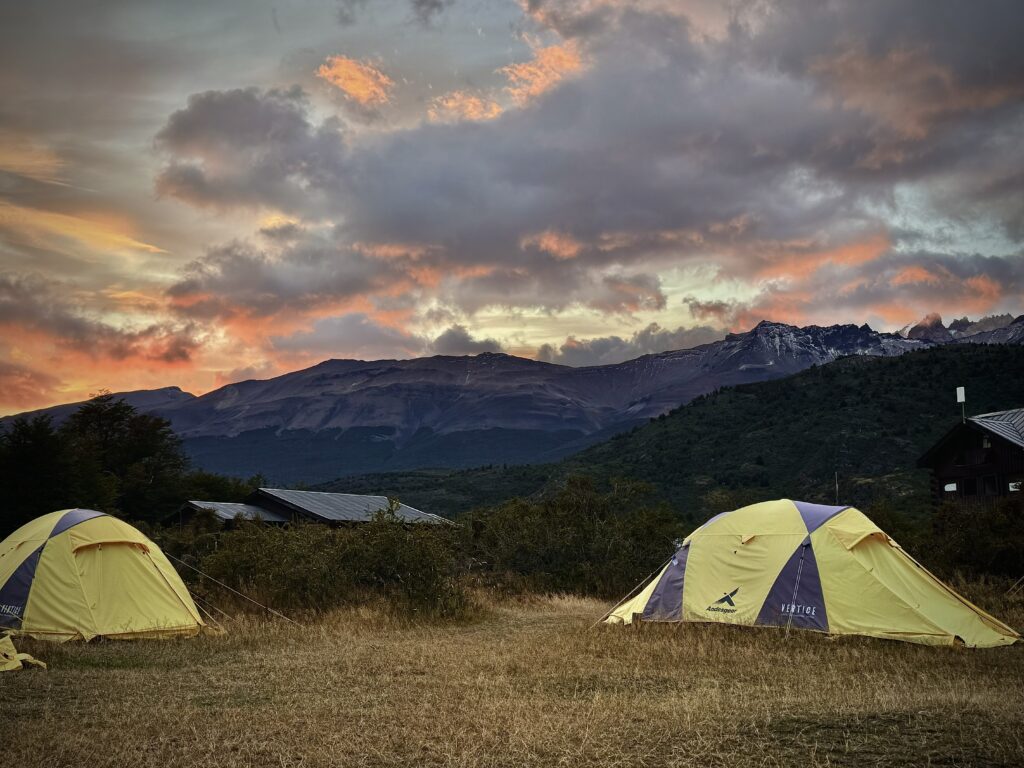
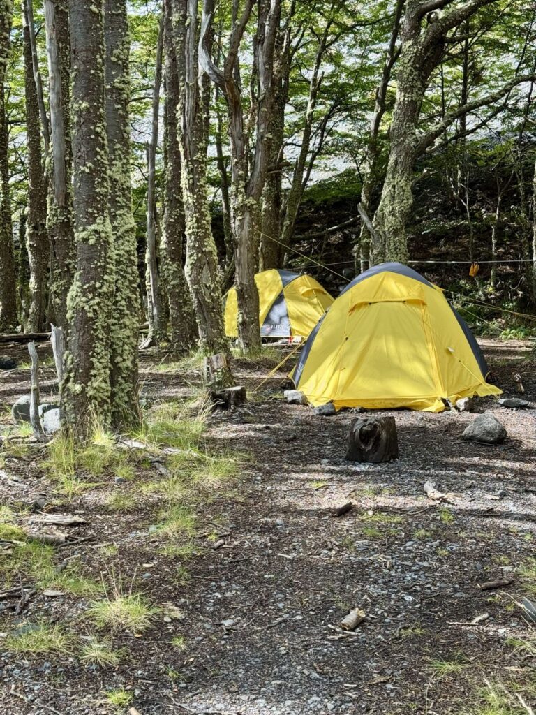
We arrived at Camp Seron just before check-in at 2:15 p.m., where we were greeted by a sign cautioning hikers about a local puma—Nelly, as she was known. Fortunately, she did not make an appearance. Camp Seron offers only camping accommodations, either self-supported or fully equipped. For the entirety of our trek, we had chosen the latter option, which provided either refugio lodging when available or pre-pitched tents complete with sleeping bags and mats, as well as all meals.
Our tent at Seron was notably elevated—accessible by a small ladder—and was the most spacious we had encountered. After settling in, we both took showersand then a nap before dinner.
We chose the early dinner seating and shared our table with a diverse group: Enna, from above the Arctic Circle in Norway; Geraldo, from northern Chile, accompanied by his friend from Bolivia; and two other Chilean men. Enna and Geraldo both spoke English, making conversation easy and enjoyable. Dinner began with a tomato and carrot soup, followed by a hearty Salisbury steak accompanied by a baked mash and vegetables. Dessert was a chocolate mousse infused with merkén, a smoky, mildly spicy Chilean seasoning that gave the dish the character of a subtly spiced dark chocolate.
It was another early night, but shortly after we settled into our tent, the weather shifted dramatically. Rain began to fall, and the wind soon intensified into powerful gusts. We had left some belongings hanging beneath the tent platform, and I lay awake, anxious they might be swept away. Sleep eluded me entirely. Colin managed a few hours’ rest, though he admitted he was more concerned that the tent itself might be lifted off its platform. The rain seemed to come from every direction, and the wind roared like a passing freight train. What struck me most, however, was that despite the storm’s ferocity—and my own sleepless vigilance—I could distinctly hear the steady snoring of our neighbor throughout the night, entirely undisturbed by the chaos outside.
Day 5 Camp Seron to Camp Dickson
- Distance: 11.5 miles
- Elevation gain: 1,827 ft
- Elevation loss: 1,703 ft
- Highest elevation on the trail: 1.171 ft
After a restless night, we cautiously unzipped the tent at 6:40 a.m., half-expecting the worst. To our relief, everything remained exactly as we had left it—our tent secure, our belongings undisturbed. The storm had passed; the rain had ceased and the wind had quieted. All that worry, it seemed, had been for nothing. We made our way to breakfast at 7:00, where we were rewarded with a luminous sunrise arcing across the sky, accompanied by a delicate rainbow. Though the forecast called for rain throughout the morning, we set off nonetheless—clad in our rain gear—under a curious blend of sunshine and drizzle, a rainbow lingering behind us like a parting gift.
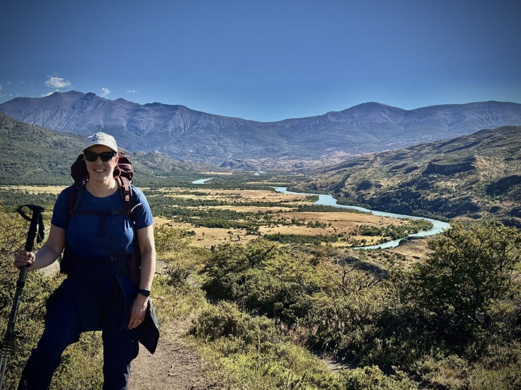
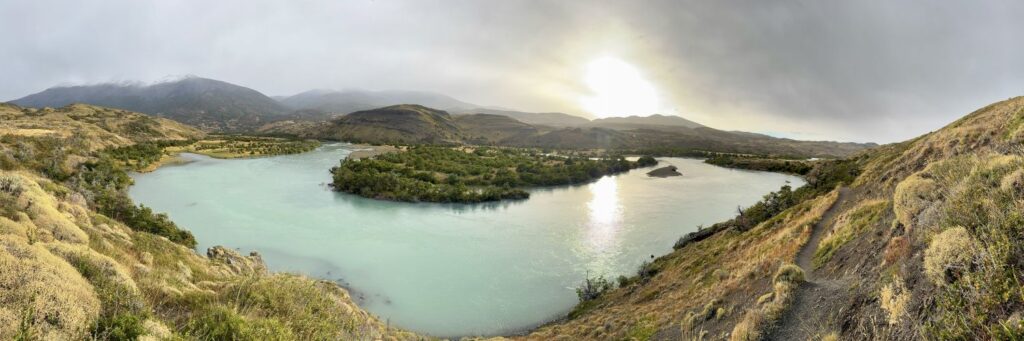
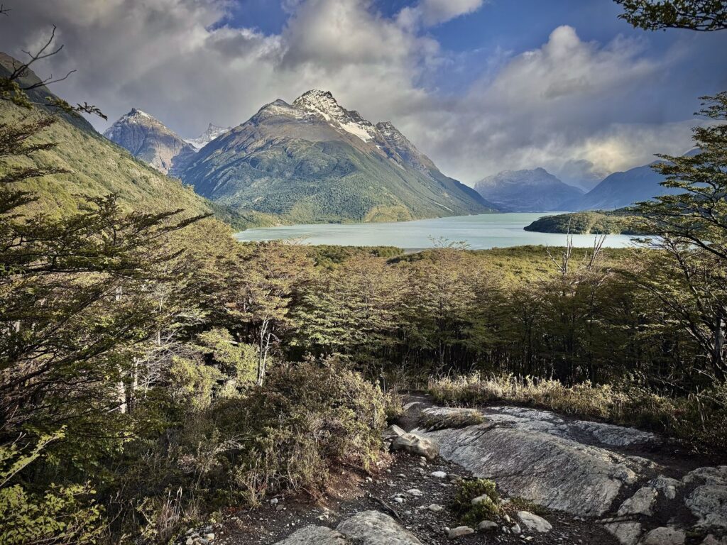
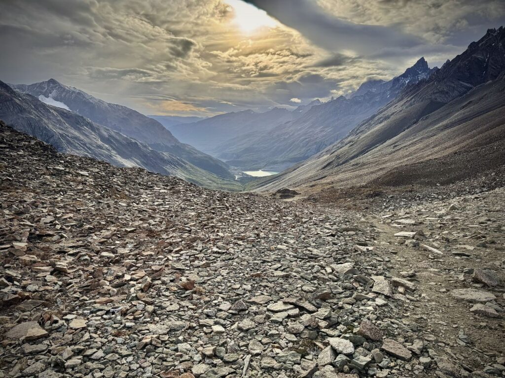
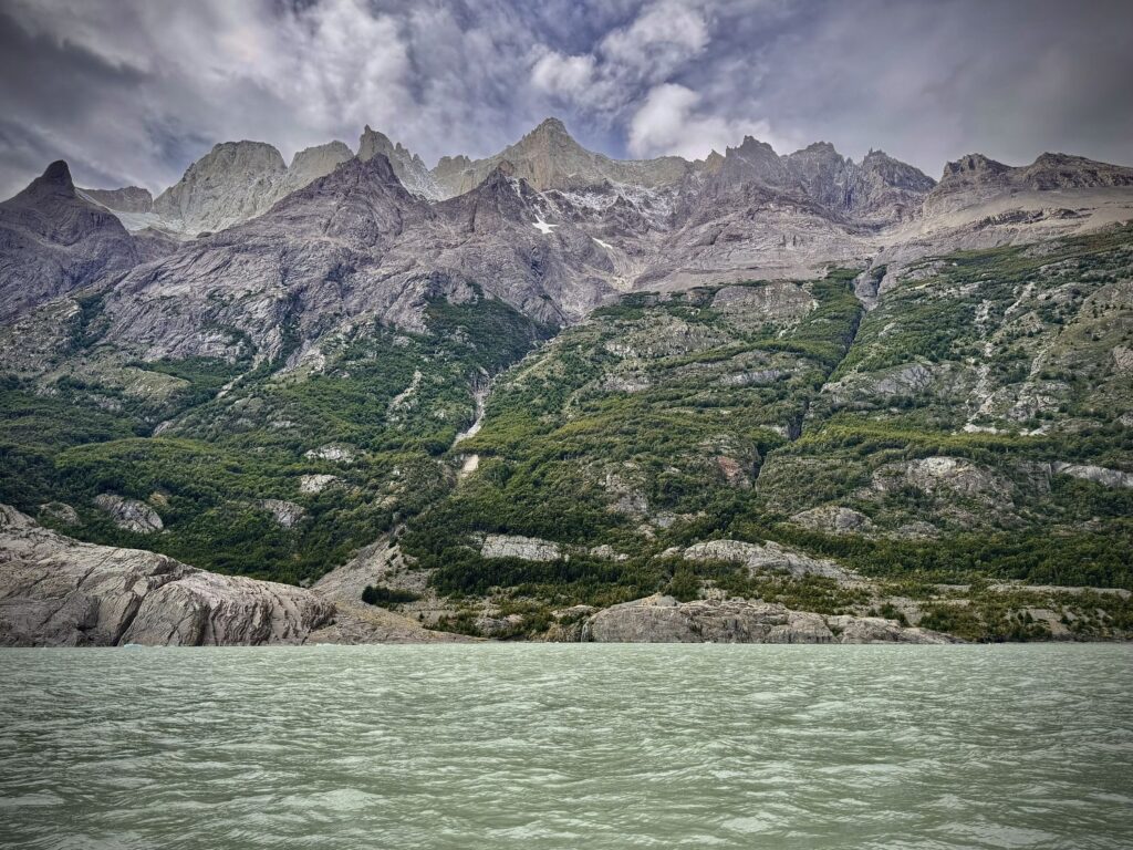
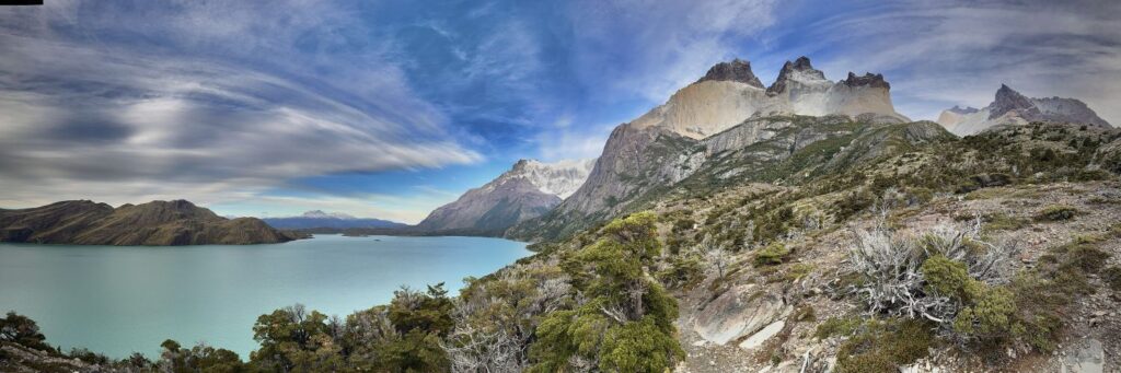
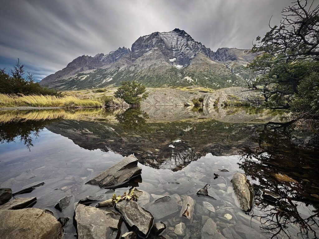
Today’s stage, at 11.5 miles, was among the longer stretches of the O-Trek, yet also one of the more forgiving. The trail began gently, winding through an open meadow alongside the Río Paine for roughly a mile and a half. This was followed by a steep, demanding ascent to the top of the pass. Upon reaching the summit, we were greeted by an entirely new landscape: the expansive Lago Paine stretched out to our right, while mountain ranges framed the horizon on either side. The weather, however, remained subdued—muting the grandeur of the views and lending the scene a quiet, almost contemplative mood.
About halfway to Sector Dickson, we stopped at the Coirón Ranger Station to sign in—the first of four such checkpoints along the O-Trek. Here, as at each station, rangers carefully recorded our progress and reiterated the park’s regulations, ensuring that all trekkers remained accounted for on the remote backside of the Paine Massif. By afternoon, the skies had cleared, and the day warmed considerably. Layers were shed, T-shirts replaced jackets, and sunscreen became essential. The terrain eased as well, transitioning into mostly flat or gently descending paths that carried us across open grasslands and over stretches of wooden boardwalk.
As we approached Refugio Dickson, the glacier slowly revealed itself in the distance, its icy mass emerging between the peaks. A final climb stood between us and our destination, but the effort was richly rewarded. At the summit, a sweeping panorama unfolded before us: the glacier, the lake, and the refugio nestled harmoniously within the landscape.
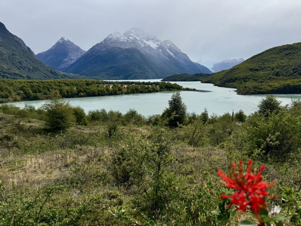
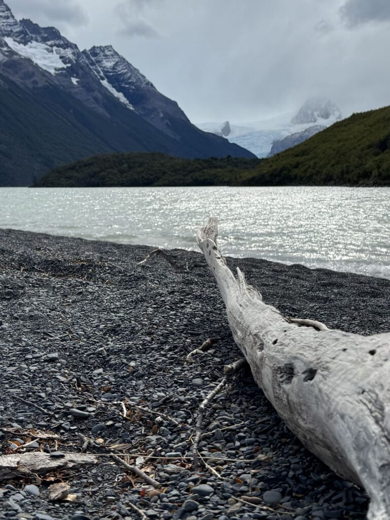
We signed in at the CONAF Dickson Ranger Station and proceeded to our campsite. Although we had originally reserved space in the refugio, we had been notified several weeks earlier that it would be closed for renovations, and all guests had been reassigned to tents. These accommodations proved more modest than those at Camp Serón—smaller and set directly on the ground rather than elevated—but comfortable nonetheless. After dropping our packs, we wandered down to the pebble beach for a closer look at Dickson Glacier, taking in its quiet majesty. Later, we took quick showers before dinner at 6:00 p.m. The meal was both hearty and satisfying: chicken soup to begin, followed by roast pork with polenta, and finished with a fruit cobbler for dessert. We shared a table with a couple from Spain, though conversation between us remained minimal.
By evening, fatigue began to set in, I think more because of the lack of sleep than the actual physical hike of the day. I turned in early at 8:30 p.m. A light rain had begun to fall, and I drifted off almost immediately. What followed was nearly eleven uninterrupted hours of sleep—the most restorative rest I can recall in years. By morning, I awoke feeling entirely renewed, as though the previous day’s exhaustion had been washed away.
Day 6 Refugio Dickson to Camp Los Perros
- Distance: 7.1 miles
- Elevation gain: 1,690 ft
- Elevation loss: 541 ft
- Highest elevation on the trail: 1,844 ft
Morning arrived later than intended; we slept through our alarm and woke at 7:09 a.m., nine minutes past our 7:00 breakfast seating—an indulgence that, in retrospect, felt entirely justified. In a flurry, we pulled clothes over our sleepwear and hurried to the dining hall. With the shortest mileage of the trek ahead, time was on our side; it was the meal we were determined not to miss. The rain that had fallen overnight had ceased, and under calmer skies we packed our belongings at an unhurried pace.
The day’s route covered just over seven miles, tracing the Río de los Perros. For the first half, however, the river remained hidden as the trail wound through dense forest. Early in the hike, we were captivated by two male Magellanic woodpeckers darting between the trees. Striking in appearance, with vivid red heads, they resembled the pileated woodpeckers we often see in Lincoln Woods—though larger and even more commanding. In the final mile and a half, the forest gave way to breathtaking views of the Los Perros Glacier. Though the trail climbed steadily—preparing us for the highest point of the circuit the following day—the ascent was gentle overall, save for one steeper stretch near the beginning.
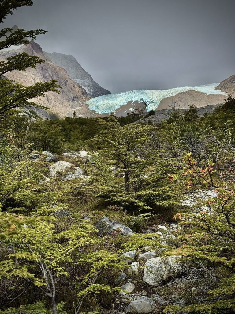
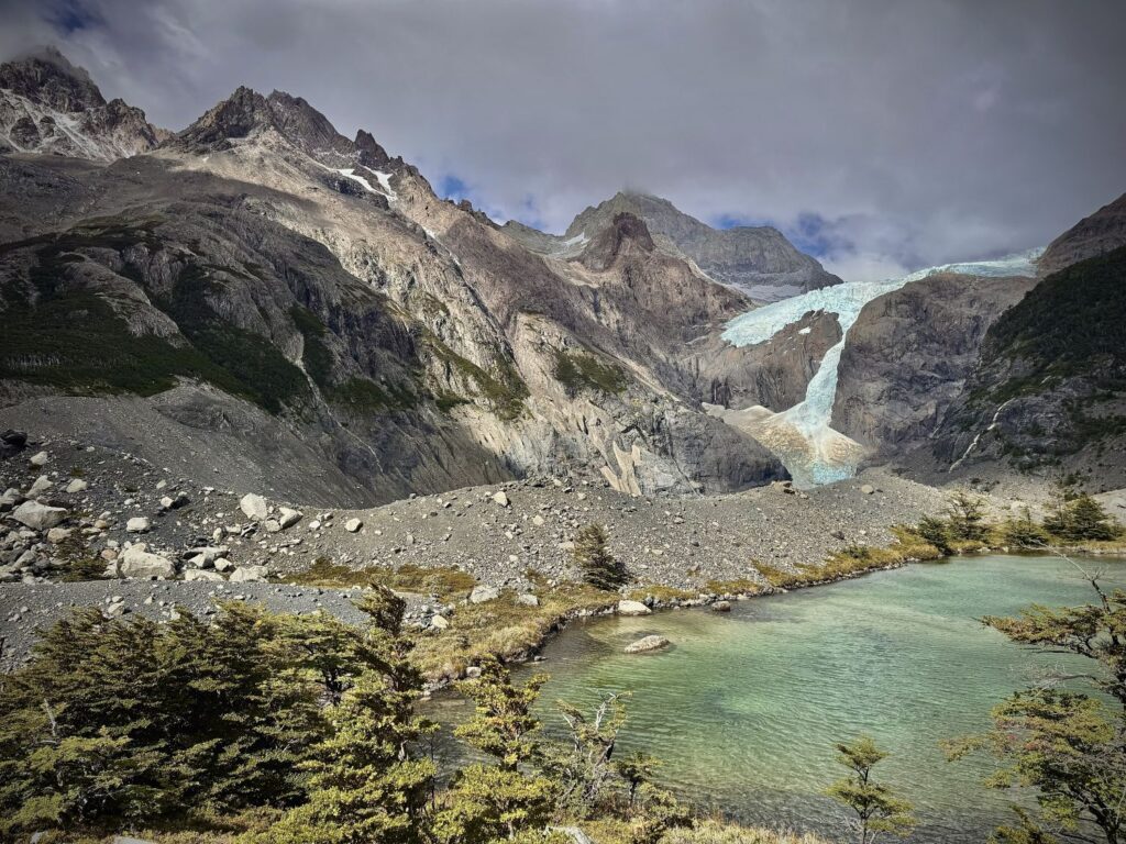
We reached Campamento Los Perros around 2:00 p.m., first registering with CONAF before checking in at the campsite. A brief misunderstanding arose when it was assumed we had brought our own tent, but the error was quickly resolved and a tent was promptly set up for us while we enjoyed lunch at a nearby picnic table. Of all the campsites along the route, Los Perros felt the most rudimentary. The tents were nestled within the forest, sheltered from the wind, and there was no hot water for showers—making this the only evening we went without one.
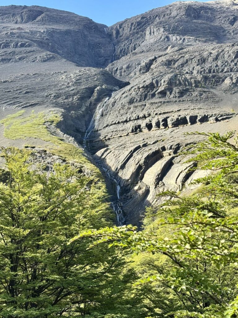
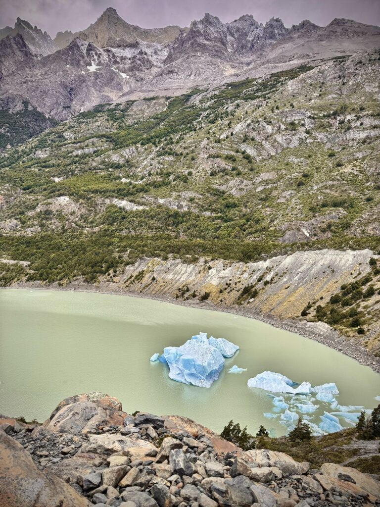
After dropping our packs, we set out on a short, twenty-minute walk to the Los Perros Glacier viewpoint. We found ourselves entirely alone, and the scene before us was nothing short of mesmerizing. At one point, we witnessed—and heard—a small avalanche, followed by the sharp crack of ice calving into the lake. Returning to camp, we passed the makeshift helipad where supplies are delivered, then retreated to our tent for a brief, restorative nap before dinner.
The evening meal proved to be our least favorite of the journey, a reflection of the campsite’s limited facilities. The three-course offering consisted largely of boil-in-a-bag fare: lentil soup to start (surprisingly flavorful), followed by a quinoa dish with peas and carrots that only faintly evoked chicken, and finished with mangoes in juice. Afterward, we played a quiet game of cribbage in our tent before doing a little star gazing and then turning in early. The following day promised to be the most demanding of the trek, with breakfast scheduled for 5:30 a.m. and an early departure encouraged to meet the challenges ahead.
Day 7 Camp Los Perros to Refugio Grey via the John Garner Pass
- Distance: 8.8 miles
- Elevation gain: 3,284 ft
- Elevation loss: 4,879 ft
- Highest elevation on the trail: 3,881 ft
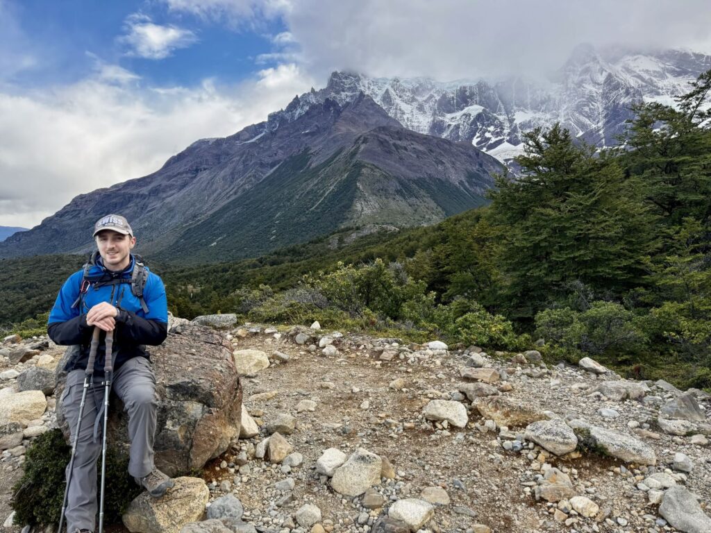
Today was the day I had both long anticipated and quietly dreaded—the crossing of the John Garner Pass, the highest point along the route at 3,881 feet. Compared to other hikes we have undertaken, the elevation itself was not the true challenge; rather, it was the volatile and often unforgiving weather systems that sweep through the pass. Earlier in the hiking season, in November 2025, five hikers tragically lost their lives while attempting this crossing. A convergence of rare and unfortunate circumstances had unfolded: a forecasted storm intensified with alarming speed and with park rangers absent—having temporarily left their posts to participate in mandatory Chilean elections—there was no one to officially close the trail. Many hikers, bound by prearranged lodging reservations, felt compelled to press onward. Though thirty set out that day, all were ultimately forced to turn back high above the tree line, where hurricane-force winds, whiteout conditions, and treacherous ice rendered the ascent impassable. Five individuals never made it back, succumbing to hypothermia. In the aftermath, the “O” Circuit was closed for nearly a month. When it reopened, hikers were required to be accompanied by a certified guide until January 1, 2026, when that restriction was lifted.
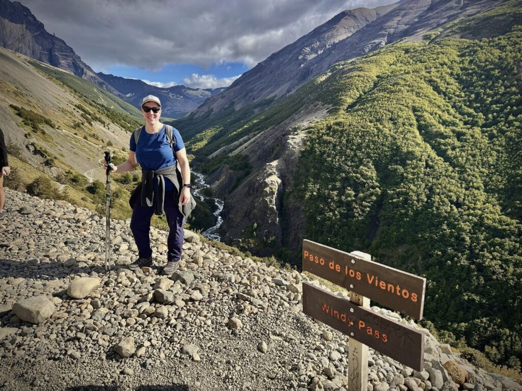
With this sobering history in mind, we had been diligently monitoring the weather each evening at the refugio and campsite offices. For our planned crossing, the forecast appeared favorable—no precipitation and relatively mild winds at the pass. Our tour operator, Pygmy Elephant, had emphasized that if at any point we felt unsafe, we should not proceed and should notify them accordingly. We rose at 5:10 a.m. for an early breakfast at 5:30. It is strongly recommended to depart camp by 8:00 a.m.—earlier, if possible—to avoid the strengthening winds that typically build throughout the day. The nearly nine-mile trek is estimated to take between seven and a half and eleven hours, depending on conditions and pace. We set out at 7:00 a.m. beneath the cover of darkness, headlamps illuminating the trail ahead, as sunrise would not arrive until 7:45. The first 2.5 miles proved to be a steep and demanding ascent, beginning in dense forest before climbing above the tree line toward the pass. The forest section was especially treacherous in the dark, with slick mud and sprawling, exposed roots demanding careful footing. We emerged above the tree line just as the first light of day broke across the landscape.
Beyond this point, the trail became less defined, marked only by a succession of orange posts guiding the way. We followed the course of a stream, passing cascading waterfalls, surrounded on all sides by dramatic mountain and glacier vistas. Overhead, an Andean condor rode the rising thermals with effortless grace as we approached the pass. Named after British mountaineer John Garner, who pioneered the first circuit around the Paine Massif in 1976, the pass felt both historic and formidable. Until this point, I had been comfortable in just two layers, but about a quarter mile from the summit I added two more—an instinct that proved wise. As we crested the pass, the temperature dropped sharply, and the wind intensified.
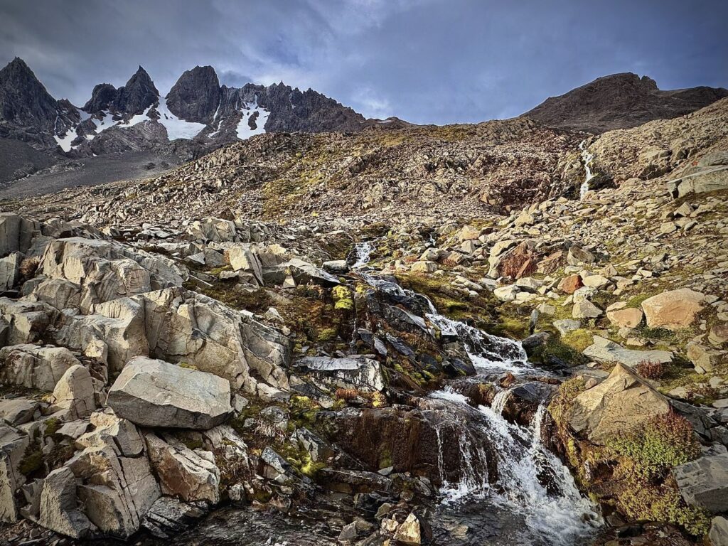
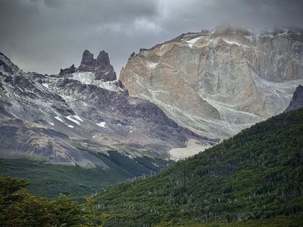
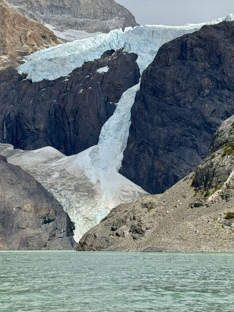
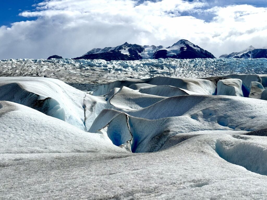
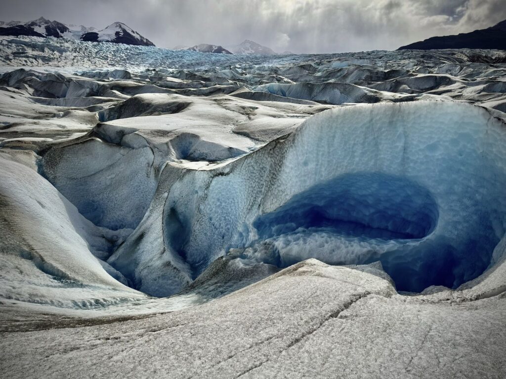
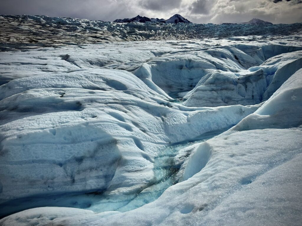
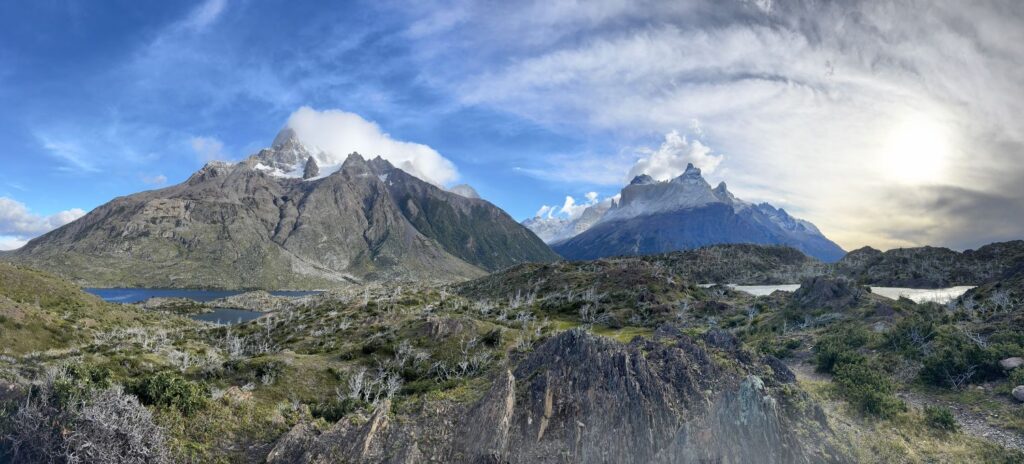
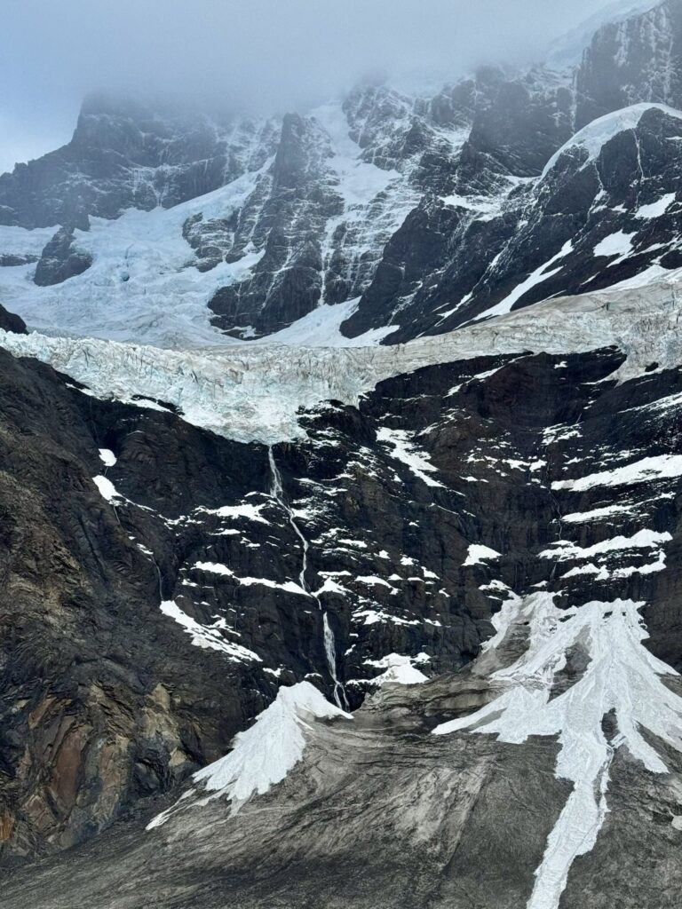
At the summit, the landscape transformed entirely. Before us stretched the immense Grey Glacier, a staggering expanse roughly 3.75 miles wide and nearly 100 feet deep before splitting into two arms that flow into Lago Grey below. From this vantage point, we began the next phase of the journey: a relentless six-mile descent, losing approximately 4,800 feet of elevation while tracing the glacier’s edge.
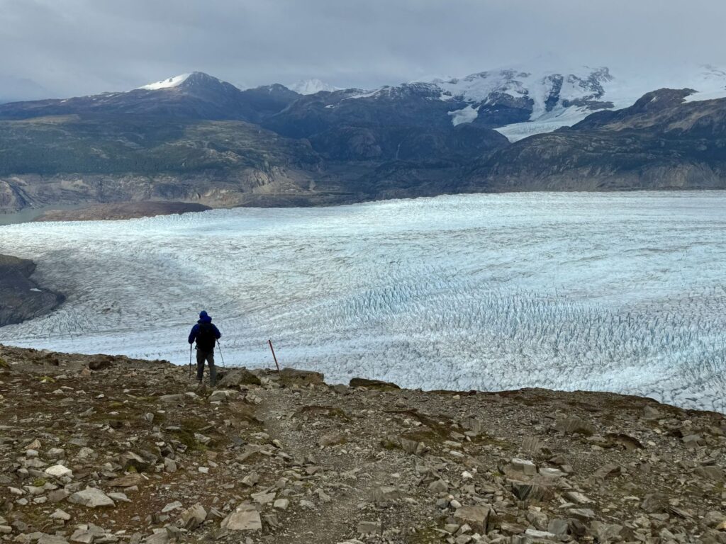
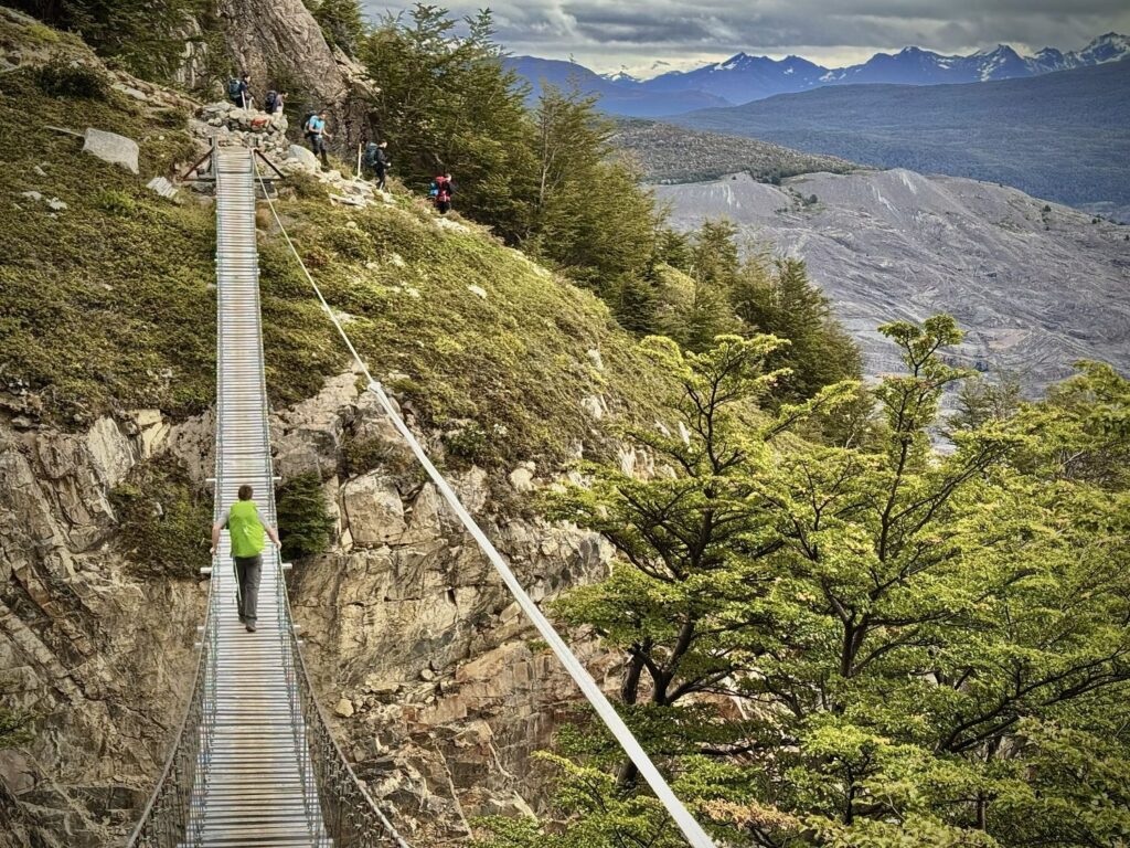
After descending below the tree line once more, we arrived at Campamento Paso, where we signed in for the final time along the “O” Circuit. Following a brief rest and snack, we continued downward along the unyielding trail. The descent was punishing, particularly on the knees, and was punctuated by three suspension bridge crossings—each both exhilarating and unnerving. With strict limits of one to two people at a time, we crossed carefully, rewarded with sweeping views of the glacier below. After the second bridge, we paused to watch a condor glide in and land upon the cliffs above.
At last, we arrived at Refugio Grey at 3:45 p.m., weary and sore after an eight-hour and forty-five-minute day. We were especially grateful to be staying inside the refugio, as the adjacent campsite appeared densely packed, with tents clustered tightly together.
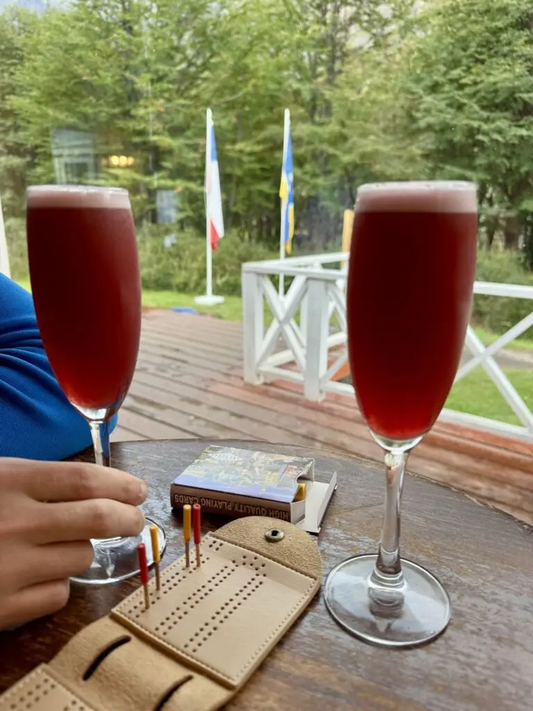
We checked in and were assigned a six-bed dormitory, shared with a married couple from Mexico and a young woman from Atlanta. It was, without question, the cleanest and most comfortable accommodation we had experienced on the trek so far. H The central hallway was warmed by a wood-burning stove, though the sleeping quarters themselves remained unheated. The facility also offered a bar, restaurant, and hot showers, along with separate amenities for self-supported campers. After showering, we attended the 6:00 p.m. dinner seating. The meal was served buffet-style, with unlimited servings of soup, vegetables, and sides, though guests were limited to a single portion of protein and dessert. Both Colin and I opted for the beef, accompanied by rice and pasta. Dessert was a delightful custard of strawberry, lemon, and blueberry, finished with a layer of toasted marshmallow. Later, we retrieved our cribbage board and made our way to the bar to celebrate the day’s accomplishment with a Calafate sour. Unfortunately, they had run out of pisco—fresh supplies were due to arrive the following day. Undeterred, we lingered a while longer, savoring the quiet satisfaction of the day. With a rest day ahead and a late breakfast scheduled for 8:30 a.m., we allowed ourselves the rare luxury of staying up just a bit later that evening.
Day 8 Glacier Hiking on Grey Glacier
We allowed ourselves the rare luxury of sleeping in, waking at 8:15 a.m. in time for the late breakfast seating at 8:30. On this trek, a “rest day” was a relative concept—one defined simply by hiking fewer than five miles and, perhaps more importantly, by leaving behind our fully loaded packs. Our only commitment for the day was a 2:30 p.m. glacier hike on Grey Glacier. While we were permitted to leave our belongings in the dorm room, access was strictly prohibited between 9:30 a.m. and 1:00 p.m. during the scheduled cleaning period—a rule that was firmly enforced.
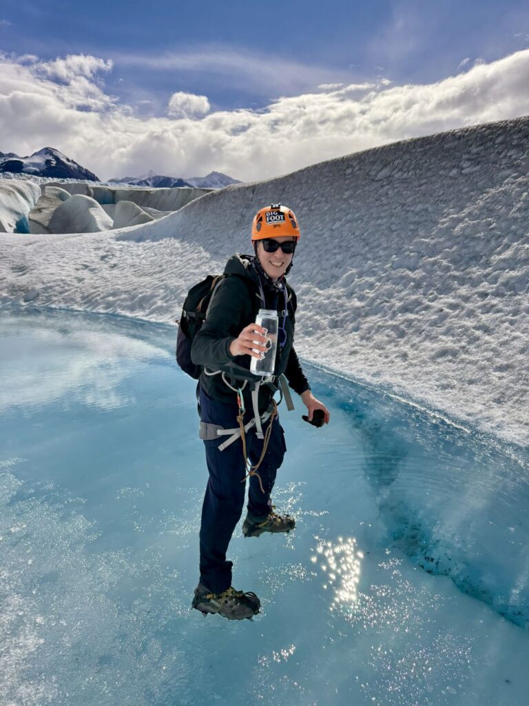
After breakfast, we strolled down to Big Foot Adventures, situated along the shores of Lago Grey. This was the outfitter coordinating both our glacier hike and the following morning’s kayaking excursion, and we had a few lingering questions. The staff greeted us warmly and provided clear, helpful answers. From there, we continued on a short hike to Mirador Grey, where we were rewarded with a direct, sweeping view of the glacier and the scattered icebergs drifting silently in the lagoon below. On our return, we meandered along a brief interpretive nature trail to pass the time. Rather than a packed lunch, we opted to enjoy the refugio’s buffet at 1:00 p.m. At 2:10 p.m., we made our way back to Big Foot Adventures for a pre-departure briefing. Our group consisted of nine participants and two guides, Maky and Alan. Among our companions were five American men on an annual adventure trip—last year’s destination had been Everest Base Camp—as well as a British couple from Oxford, the woman quietly revealing later that she held a master’s degree in glaciology.
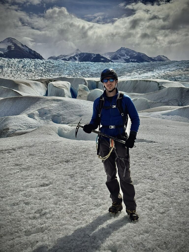
Each of us was issued a small backpack containing essential gear: helmet, harness, and crampons, with room to add personal items. Colin and I packed an extra layer, water bottles, hats, gloves, and secured our phones with harnesses. After a thorough application of sunscreen and donning sunglasses, we set off once more. Our previous glacier experience—in Iceland—had been memorable, though marred by relentless cold and rain that made even simple photography a challenge. Today, however, the weather could not have been more perfect.
A brief ten-minute boat ride carried us across the lake to the glacier’s edge. From there, we traversed the moraine for fifteen to twenty minutes before reaching a staging area, where we donned our gear and received instruction on glacier travel and ice axe technique. For the next two hours, we moved steadily across the ice, navigating its undulating surface. In several sections, we clipped into fixed lines set by Alan for added security.
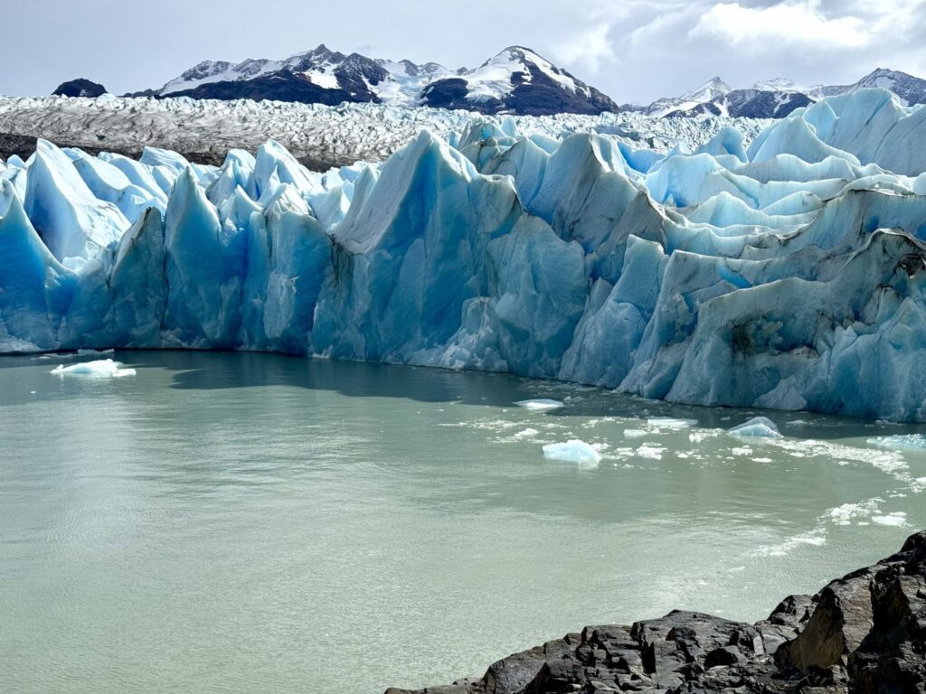
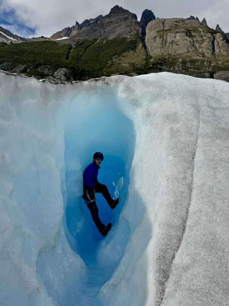
Along the way, the guides led us to a small, enchanting ice cave, just large enough to climb into one at a time. As we took turns exploring the crystalline hollow, Alan produced a thermos and poured steaming cups of black tea infused with honey, ginger, and cinnamon—a simple yet deeply comforting treat in such an extraordinary setting. Continuing onward, we crossed terrain that felt almost otherworldly, reminiscent of scenes from Frozen. Our final stop brought us to a broad expanse etched with a glacial stream, its vivid blue tones shimmering brilliantly in the sunlight.
On the return journey, our boat drew close—though not too close—to the glacier’s towering face where it met the lake, mindful of the ever-present risk of calving ice. It was, without question, one of the most memorable experiences of the entire trip.
We arrived back at the refugio earlier than anticipated and were able to move our dinner reservation to the 7:00 p.m. seating. Fresh supplies had been delivered that day, and at last we were able to enjoy the long-awaited Calafate sours as we settled into our nightly game of cribbage. With an early breakfast scheduled for 6:30 a.m. ahead of our 8:00 a.m. kayaking excursion, we retired for the evening feeling both content and quietly exhilarated by the day’s adventures.
Day 9 Refugio Grey to Refugio Paine Grande Hike
- Distance: 6.5 miles
- Elevation gain: 1,339 ft
- Elevation loss: 1,444 ft
- Highest elevation on the trail: 906 ft
It was back to an early start, with our first breakfast seating scheduled for 6:30 AM. Afterward, we packed our backpacks and made our way to the luggage storage closet. When we had inquired about storage the previous day, the space had been crammed with gear; this morning, however, our bags were among the first to arrive. We clipped them together to avoid any confusion—my burgundy Osprey Kyte pack, in particular, was a popular model among many of the female hikers on the trail.
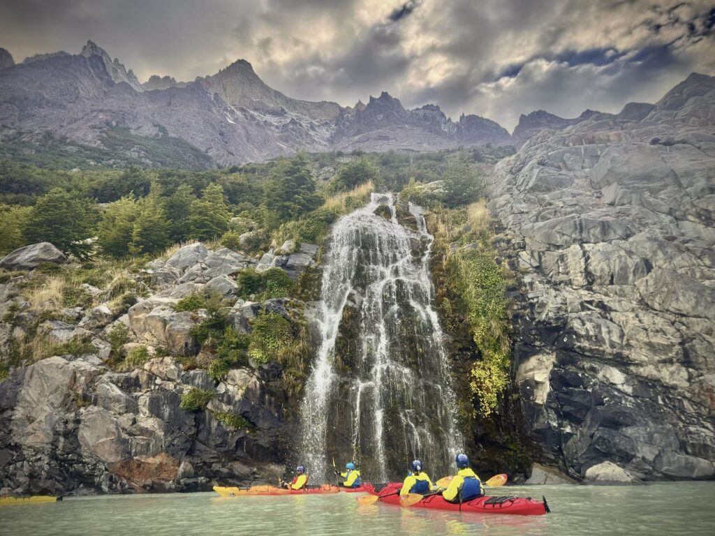
We arrived at the Bigfoot Adventure area around 7:45 AM, as instructed, for our 8:00 AM kayak tour. Seventeen kayakers were scheduled, including three of the men we had met on our glacier hike. The group also included four older Australians, a younger Australian couple who had gotten engaged just the day before, and an Indian family who arrived late, shortly after 8:10 AM. Once everyone had gathered, we were directed to the beach to collect our equipment: neoprene wetsuits and booties, waterproof jackets, helmets, life vests, and spray skirts. The paddles even had built-in gloves Colin and I wore our base layers beneath the wetsuits and found them perfectly comfortable for the conditions. Before launching, our four guides—Juan, Davy, Diana, and Elliot—reviewed paddling techniques, steering, and safety procedures, including how to exit the kayak in the event of a capsize.
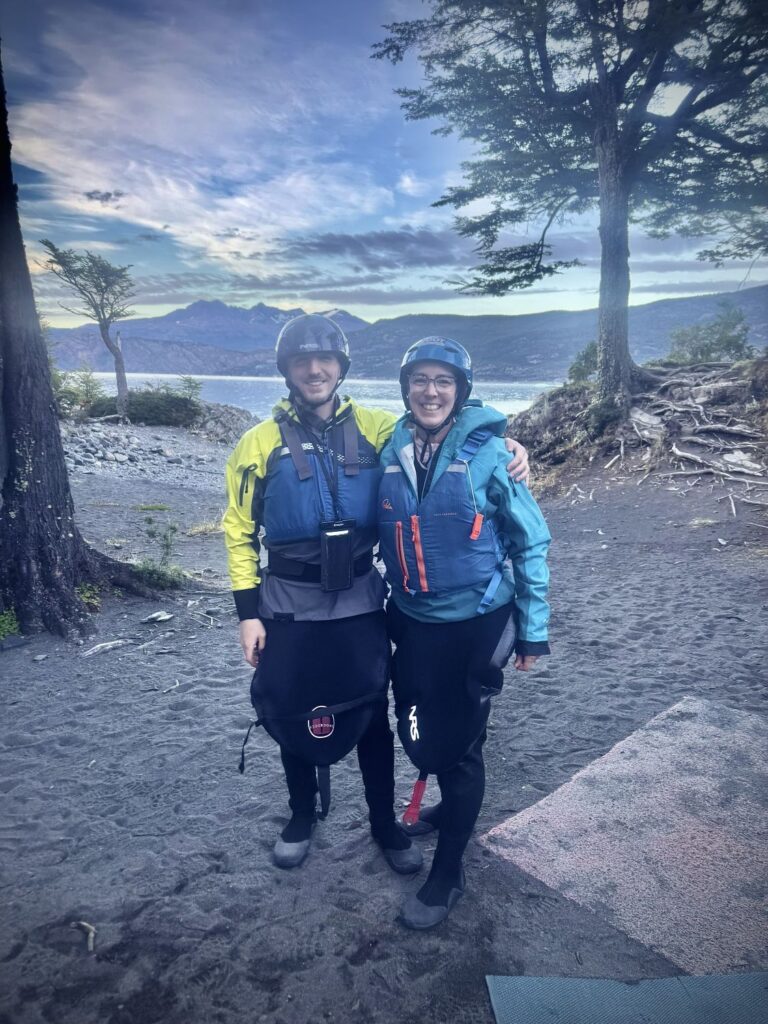
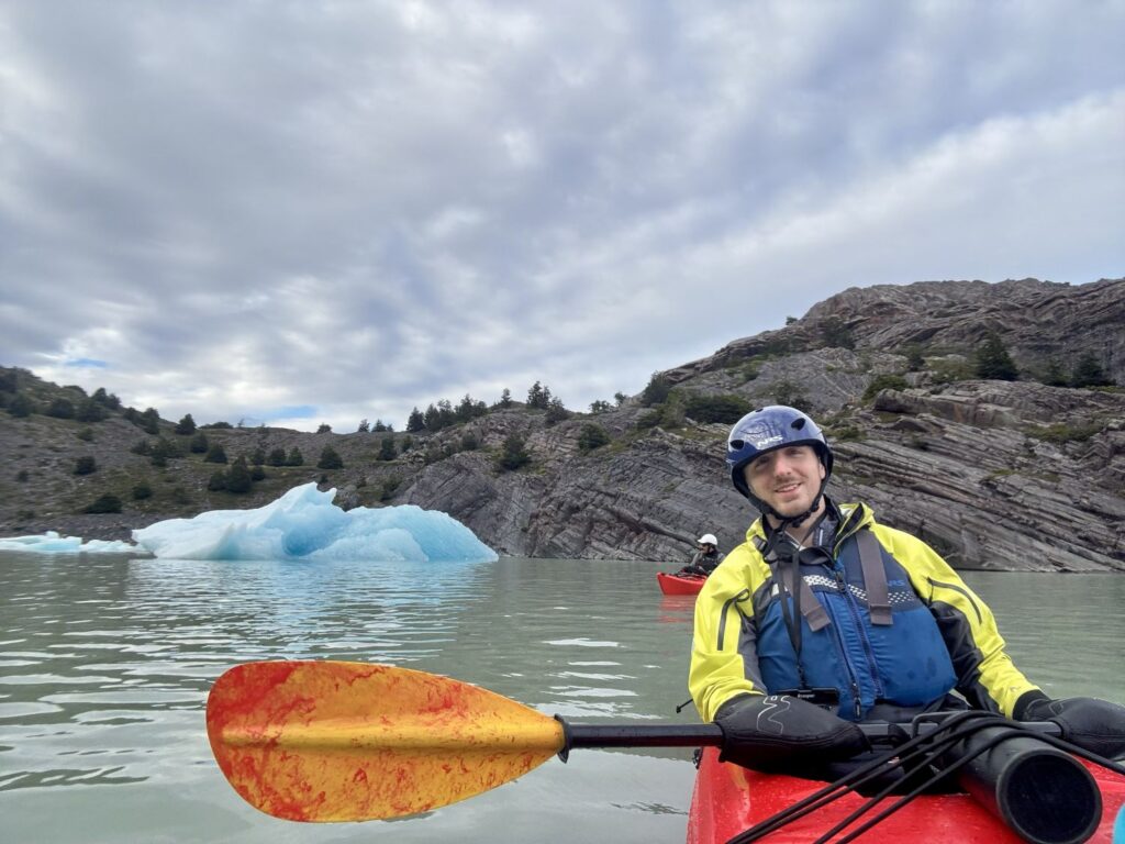
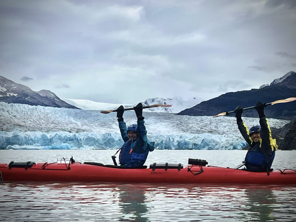
All of the kayaks were tandem. I took the front seat while Colin steered from the rear. With a gentle push from the guides, we set off along the shoreline toward the lagoon dotted with icebergs we had admired the day before from Mirador Grey. The conditions were ideal: no wind, and water so still it resembled glass, making for effortless paddling. After weaving among the icebergs, we continued along the coast to a beautiful waterfall before making our final stop in front of Grey Glacier. We were kept at a safe distance, mindful of the possibility of calving, which could send a powerful, wave-like surge across the lake. We returned to shore around 11:10 AM, where we were once again greeted with snacks and that delicious honey, ginger, and cinnamon-infused black tea. It was an exceptionally peaceful way to spend the morning.
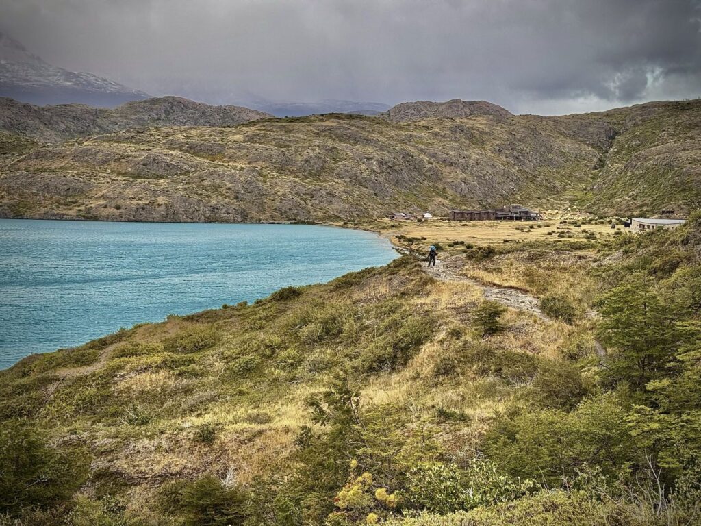
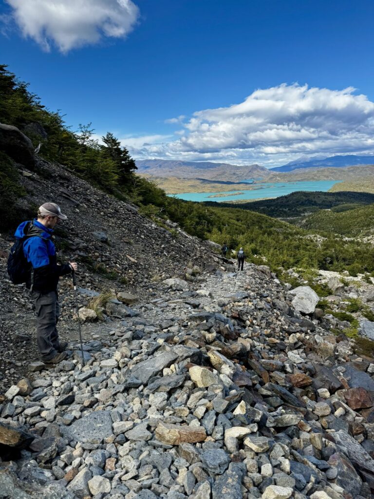
We made our way back to Refugio Grey around 11:30 AM, retrieved our backpacks, and picked up our boxed lunches. Settling into Adirondack chairs on the refugio’s deck, we enjoyed a leisurely meal before beginning our afternoon hike. At approximately 6.5 miles, this section was one of the easier stretches of the circuit. The trail followed the southeast coast of Lago Grey for most of the day. For quite a while we still had a view of Glacier Grey when looking back. The trail began with three moderately steep ascents before reaching Mirador Lago Grey. The landscape here bore the scars of a devastating, human-caused wildfire in 2011, its aftermath visible in the charred, silvery remains of trees. Beyond the viewpoint, the trail gradually descended toward Laguna Los Patos at the 4.6-mile mark. The final two miles dropped another 650 feet in elevation, leading us to Refugio Paine Grande—our home for the night.
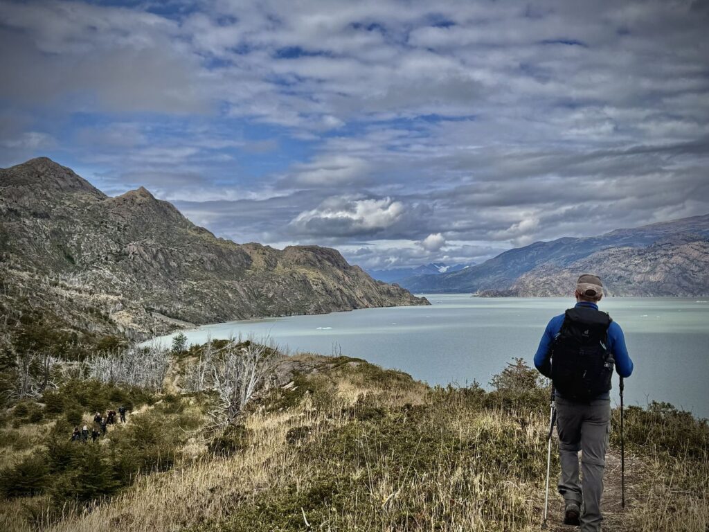
Situated on the shores of Lago Pehoé, Refugio Paine Grande was the largest refugio we encountered during the trek and serves as a primary hub for those hiking the “W” circuit. Access typically involves a 30-minute catamaran ride across the lake from Pudeto. The refugio accommodates up to 100 hikers across 22 dormitory rooms and offers extensive amenities, including a large restaurant, bar, café, lounge area, and a small market. There is also ample space for both supported and unsupported camping. Each room is equipped with electrical outlets, though power is shut off after 11:00 PM.
We were fortunate to be assigned a four-bed dormitory. Until 7:30 PM, it seemed we might have the room to ourselves. However, at 7:45 PM, two young women were assigned as our roommates. Though we were unsure where they were from, English was clearly not their first language. With a long day ahead of us, we turned in early, grateful for a comfortable place to rest before the next stage of the journey.
Day 10 Refugio Paine Grande to Refugio Los Cuernos via the French Valley
- Distance: 11.7 miles
- Elevation gain: 3,540 ft
- Elevation loss: 3,398 ft
- Highest elevation on the trail: 1,640 ft
Today’s hike was listed in our guidebook at 14.7 miles, with an estimated duration of eight to eleven hours. After some discussion the previous evening, we agreed we would likely shorten the route by foregoing the final stretch to Mirador Británico in the French Valley. When we set out at approximately 8:30 AM—later than we had hoped—it effectively confirmed that decision. The forecast called for dry conditions, though winds were expected to gust up to 45 mph. We found ourselves quietly eager for this, having yet to fully experience Patagonia’s famed winds beyond our crossing of John Garner Pass.
Just half a mile in, the trail split. The main route veered left, while an alternate path branched off to the right. After consulting our map and speaking with fellow hikers, we learned that the right-hand trail added roughly 0.6 miles but offered more scenic views. Since we had already planned to shorten the day overall, we opted for the longer, more picturesque route. It proved an excellent choice. The trail was uncrowded—we encountered only four other hikers—and offered sweeping lake views on both sides. It also exposed us fully to the Patagonian winds, which were largely shielded by the forest along the main trail.
This route also passed through terrain scarred by the 2011 Olguín fire, which burned from December 27, 2011, to March 8, 2012, after being ignited by a negligent tourist who was burning toilet paper. The incident underscores the park’s strict regulations regarding cooking and smoking. Portions of the trail now feature elevated boardwalks, part of ongoing conservation efforts to restore the fragile landscape. Some of my favorite photographs were taken along this hauntingly beautiful stretch.

Eventually, the trail rejoined the main route near a suspension bridge just before Camp Italiano, where we arrived around 11:15 AM. Camp Italiano serves as the gateway to the French Valley, and access to the valley closes at 2 PM. Like many hikers, we left our heavier packs at the camp and continued onward with a single daypack carrying lunch and water. About half a mile in, we paused to eat, enjoying sandwiches with Glacier Francés spread out before us.
Given the time, we decided to continue ascending the valley for another hour and a half before turning back. The scenery grew increasingly dramatic, though clouds gathered ominously at the far end of the valley. At one particularly striking viewpoint, with mountains rising on both sides, we encountered a fellow hiker from the UK whom we had previously met at Refugio Grey. He was also headed to Refugio Cuernos and was debating whether to continue all the way to Mirador Británico. Ultimately, he pressed on, while we chose to turn back, mindful of the additional three miles and our growing fatigue. Later that evening, when he arrived at Refugio Cuernos at 7 PM, it affirmed that we had made the right decision for our pace.
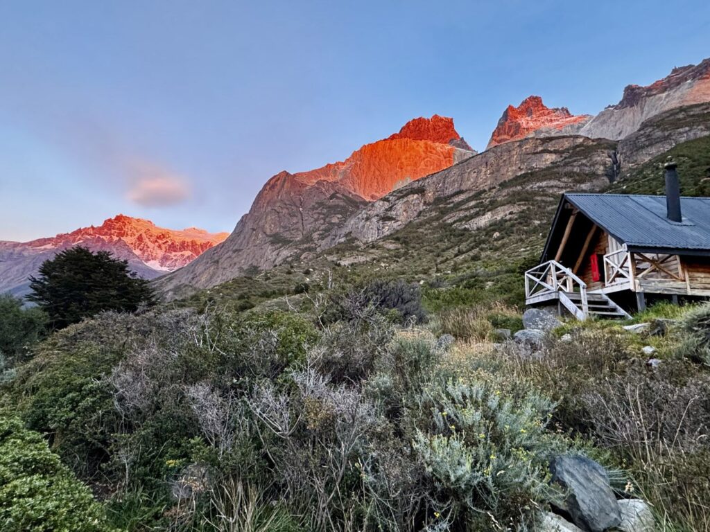
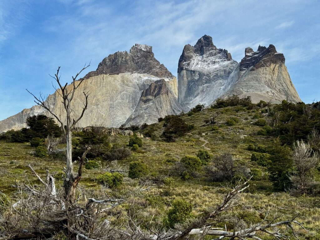
We retraced our steps to Camp Italiano, retrieved our packs, and set out for the final 3.5 miles to Refugio Cuernos. The trail climbed steadily at first, leveling off near Refugio Francés before descending. While the stretch from Camp Italiano to Refugio Francés was largely forested and unremarkable, the scenery opened dramatically beyond, revealing stunning views over Lago Nordenskjöld. Eventually, we descended to the lake’s shoreline, where a beautiful pebble beach stretched before us. Walking along the water’s edge, we were treated to striking views of Los Cuernos—the iconic “horns” of the massif. From there, the trail reentered the forest and climbed gently to Refugio Cuernos, where we arrived at 4:15 PM.
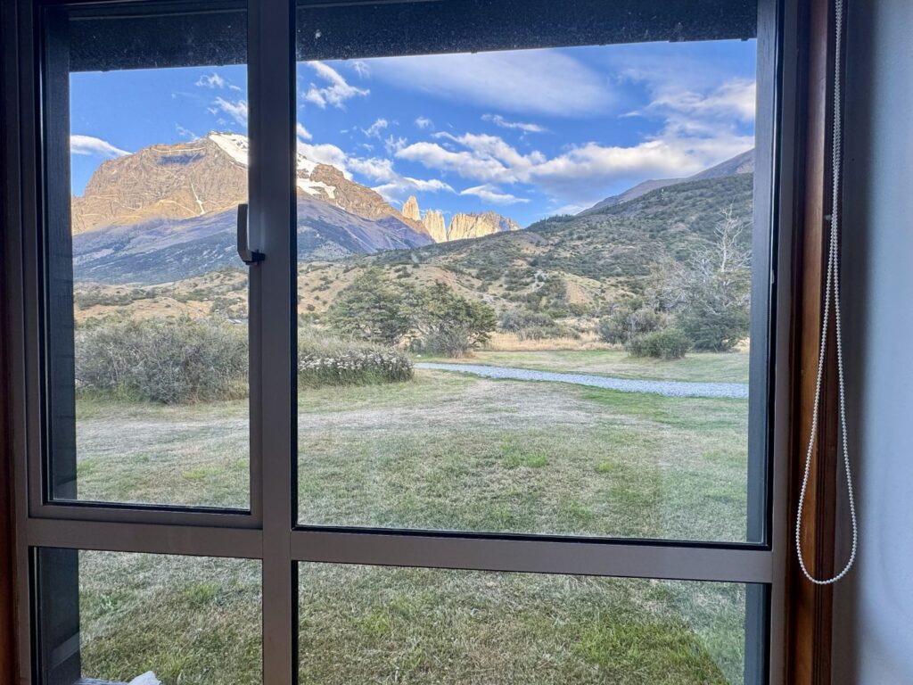
Refugio Cuernos offers both dormitory accommodations and premium campsites tucked into the forest. For this stay, I decided to splurge and reserved a private cabana. Perched above the main lodging area, the cabanas offered breathtaking views of Lago Nordenskjöld and Los Cuernos. Ours featured two twin beds, electrical outlets with 24-hour power (a rarity on the trek), charging ports, and two luxuriously fluffy towels. A wood-burning stove was available for heat, though we opted not to have it lit, anticipating we would be warm enough overnight. In wetter conditions, however, it would have been a welcome comfort. The stay also included a complimentary drink, and a separate nearby building provided exclusive shower and bathroom facilities for cabana guests.
After quick showers, we made our way to the bar for our welcome drinks. At dinner, we were seated beside an Indian couple living in California who were hiking the “W” trek. Well-traveled and engaging, they shared stories of their journeys, and we discovered we had been in the Dolomites at the same time in 2024 and reminisced about the freak snowstorm we encountered . Dinner was served as a plated meal rather than a buffet. It began with a delicious cochayuyo soup—a dish made from edible brown seaweed found in the cold waters of Chile, New Zealand, and the South Atlantic—and easily our favorite soup of the trip. This was followed by salmon with couscous, and finished with an apple tart for dessert.
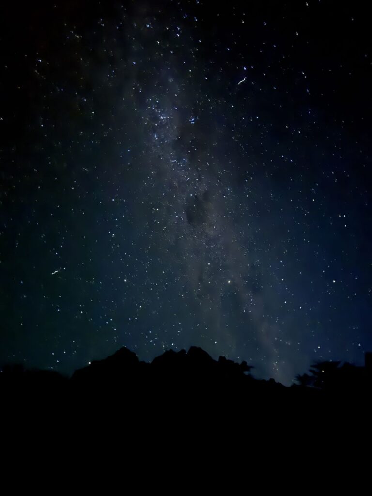
After dinner, we visited a nearby waterfall before returning to our cabana for a few games of cribbage. Later, while brushing our teeth, we noticed the sky had cleared, revealing a brilliant canopy of stars. With headlamps on, we wandered in the darkness searching for the perfect vantage points for night photography. We finally turned in around 10:15 PM, savoring our final night on the circuit. It was, without question, one of the most memorable days of the entire journey.
Day 11 Refugio Los Cuernos to Welcome Center and back to Puerto Natales
- Distance: 7.0 miles
- Elevation gain: 1,519 ft
- Elevation loss: 1,368 ft
- Highest elevation on the trail: 863 ft
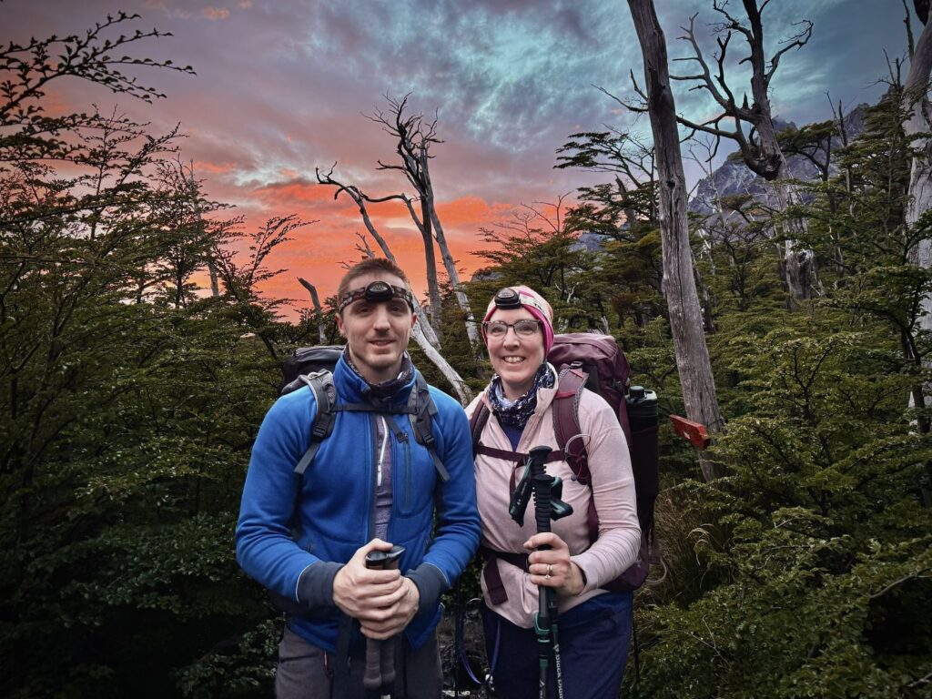
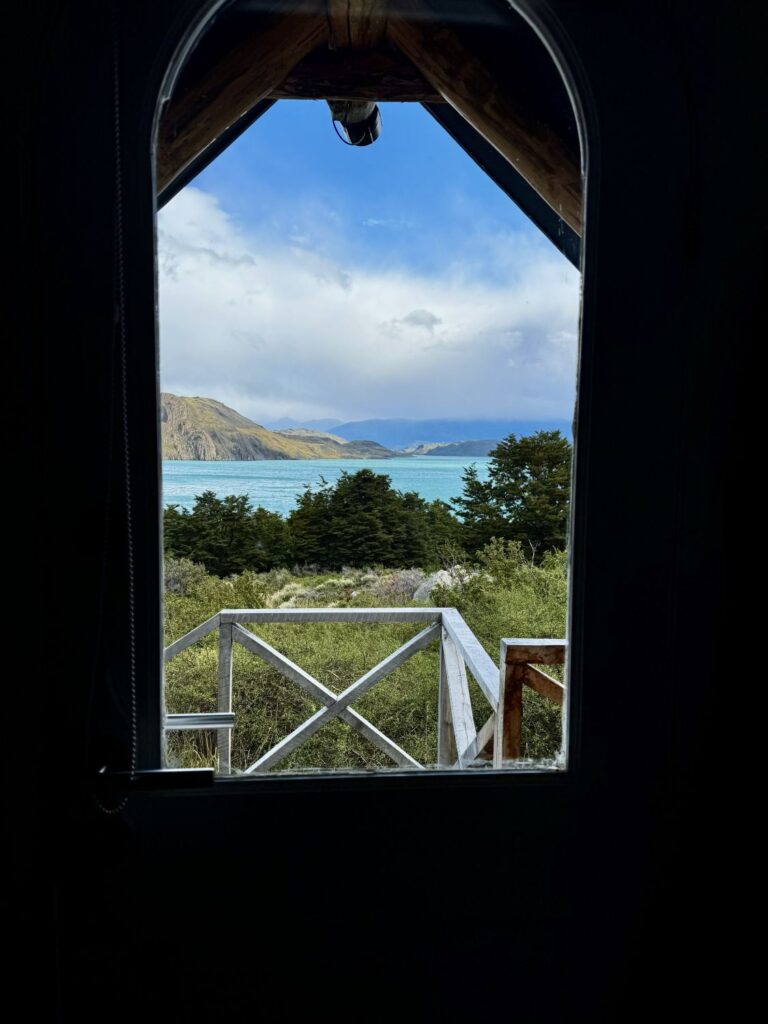
After a restorative night’s sleep, we awoke to our final day on the circuit. Following a 7:00 a.m. breakfast, we stepped outside to witness a remarkable sunrise. Though the sun itself remained hidden, its rays illuminated the sheer granite faces of the Cuernos in delicate hues of pink and orange, while the snow-draped peaks of the distant French Valley glowed softly in the early light.
The day’s hike covered seven miles and was estimated at approximately four and a half hours to the Welcome Center. Compared to previous days, it felt refreshingly gentle, tracing the northern shoreline of Lago Nordenskjöld. We departed the cabana around 8:00 a.m., setting off at an unhurried pace, unburdened by time with our 2:00 p.m. shuttle awaiting us. The trail offered sweeping views across the lake, and, when we paused to look back, striking vistas of Los Cuernos rising behind us. The final mile retraced familiar ground—the same path we had followed days earlier en route to the base of Los Torres.
We arrived at the Welcome Center around 12:30 p.m. and settled at a nearby picnic table for lunch. Soon after, we boarded the first shuttle to Laguna Amarga, where we faced a wait of an hour and a half before our Big Sur bus departed for Puerto Natales. Upon arrival in Puerto Natales, we struggled briefly to secure a taxi but eventually made our way back to Hotel Aquaterra. Retrieving our duffel, we settled into our new accommodations—a spacious two-room setup with three twin beds.
Over nine days, we had traversed more than 85 miles, blessed with extraordinary weather and unforgettable landscapes. It was, in every sense, an adventure to be proud of—another remarkable journey added to the collection.
Day 12 Flights Puerto Natales to Boston
Colin and I enjoyed the hotel’s included breakfast before checking out at 11:00 a.m. We left our luggage in storage and spent a leisurely hour wandering through Puerto Natales while awaiting our 12:30 taxi. Though souvenir shops were somewhat sparse, we discovered two charming stores where I picked up postcards and souvenirs.
Our taxi arrived slightly ahead of schedule at 12:20 p.m. and delivered us on a short ride to the airport. Our flight departed promptly at 2:20 p.m., and three hours later we landed in Santiago. From there, we exited the domestic Terminal 1 and walked outside to Terminal 2 for our international connection. As our bags were checked through to New York, we were spared the need to retrieve them, and we passed through immigration and security with ease. With a 5.5-hour layover ahead, we had ample time to relax.
Our flight departed Santiago on time at 10:25 p.m. Although all carry-on bags were inspected at boarding, mine was selected for additional screening. Colin slept for nearly the entirety of the ten-hour flight, while sleep eluded me entirely. We arrived at JFK Airport at 8:00 a.m., facing a two-hour layover that had initially caused us some concern. We had heard stories of long delays at immigration and security due to the partial government shutdown, but the reality could not have been smoother—barely a minute at immigration, ten minutes through security, and then a relaxed hour and a half at the gate.
Our final flight departed on schedule, and once again we were among the last to board before gate-checking began. We landed in Boston at 11:20 a.m., where our bag was among the first to appear on the carousel. Back home by 1pm carrying with us a wealth of unforgettable memories.