Summits, Sand, & the Subterranean – Exploring 4 National Parks in Texas & New Mexico

Day 1 Arrival in Terlingua, Texas

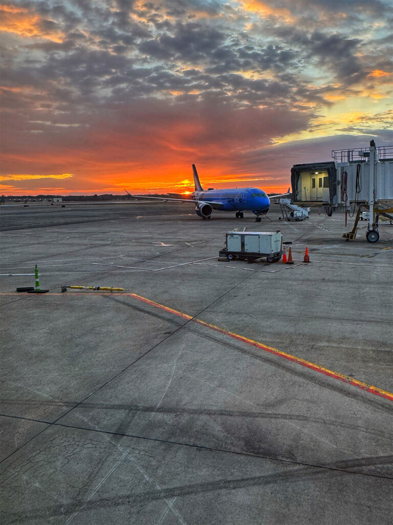
Our Southwest flight #892 departed Providence on time, with the cabin pleasantly sparse at just 55% capacity. We touched down in Chicago Midway a full 35 minutes ahead of schedule. With a generous four-hour layover ahead, we enjoyed a leisurely breakfast at Gene’s Bistro in Terminal B, followed by a mile-long stroll through the adjoining terminals to stretch our legs and get some steps in. I took the opportunity to write and send off a few postcards before we boarded our connecting flight.

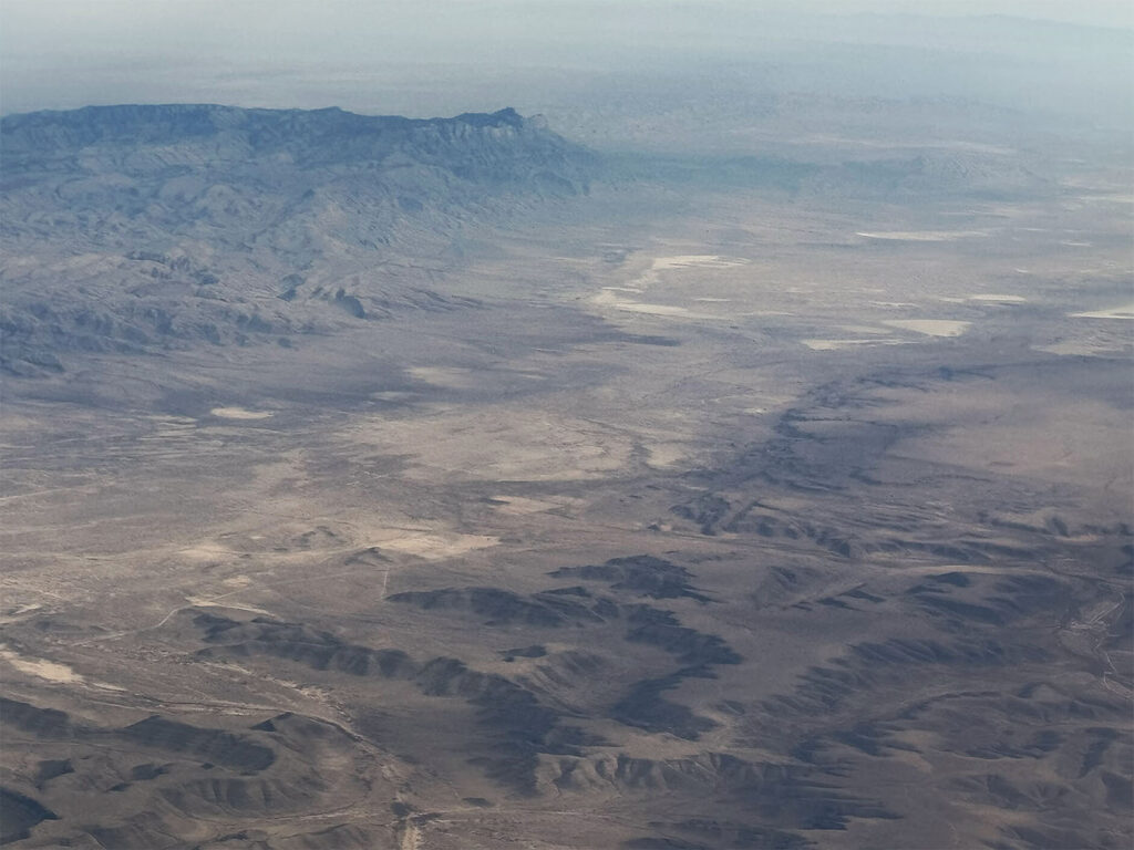
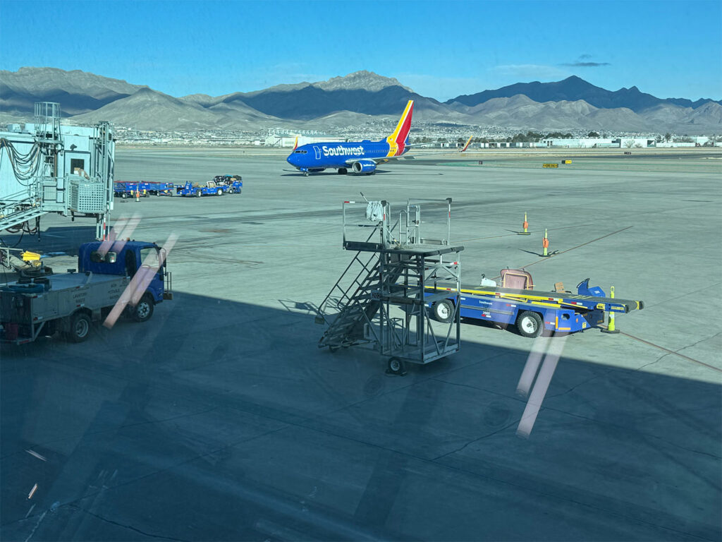
Southwest flight #1441 to El Paso departed promptly at 12:50 PM. We landed 20 minutes early, at 2:50 PM MST, greeted by a stunning panoramic view of the Franklin Mountains. Our good fortune continued: our checked bag was the third to appear on the carousel, and there was only a single person ahead of us at the Thrifty car rental counter. Everything was falling into place effortlessly.

We walked next door to the garage and collected our sleek black Nissan Rogue, which had just 684 miles on the odometer. Before leaving El Paso, we stopped at Walmart for groceries and road-trip snacks, and grabbed a quick dinner at Raising Cane’s. The area surrounding Interstate 10 was heavily congested, packed with an almost dizzying array of chain restaurants, hotels, and shopping centers. But once we exited the city and headed southeast on I-10, the bustle faded behind us.

As the highway opened up, we were rewarded with a beautiful desert sunset. We continued on to Van Horn, Texas, where we turned south onto Route 90, passing through the tiny town of Valentine (population 73) and the artsy enclave of Marfa. Along the way, we caught a fleeting glimpse of the famous Prada Marfa installation—a whimsical, life-sized replica of a Prada boutique constructed in 2005. It’s not a functioning store, but a thought-provoking piece of art. Unfortunately, it appeared so suddenly that I missed the chance to photograph it.

We paralleled a seemingly endless freight train for miles—rail traffic being a more common sight here than the long-haul trucks that dominate highways elsewhere. In Alpine, we veered south again onto Route 118. Though night had fallen, this stretch of the journey was marked by abundant wildlife: coyotes and rabbits lined the roadside, their eyes gleaming in our headlights. I couldn’t say whether they were Eastern Cottontails, Desert Cottontails, or Black-tailed Jackrabbits, but they were plentiful. We even spotted a javelina—a wild, pig-like creature native to the region.

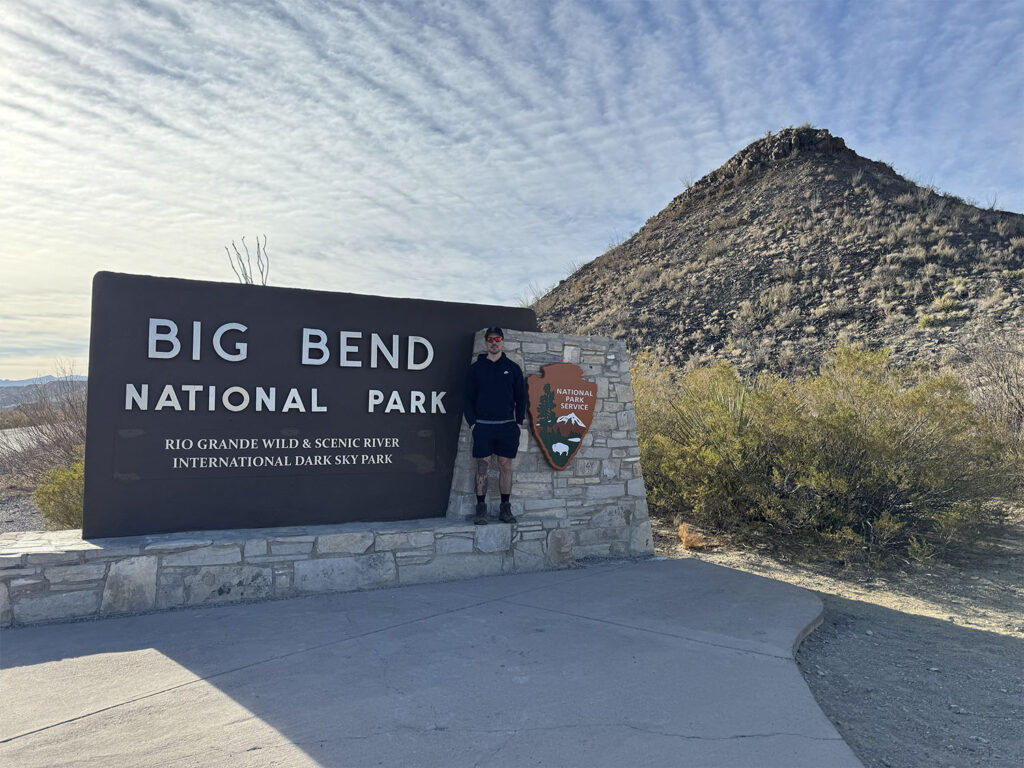
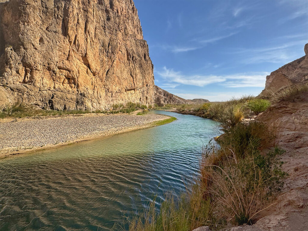
Upon reaching the town of Study Butte, we took a final turn west onto Route 170, a Farm to Market Road. Around 10 PM, after crossing back into the Central Time Zone and losing an hour, we arrived at our Airbnb. The drive from El Paso to our lodging had taken approximately four hours and forty-five minutes. Coincidentally, this was the same Airbnb I had stayed in back in 2003 during a visit with my sister-in-law and her friend. We unpacked quickly and turned in for the night, eager to get an early start the next morning.

 
Sunrise at TF Green Airport, Rhode Island
Aerial view over southern New Mexico

Day 2 Big Bend National Park

We woke at 7:45 AM and enjoyed a leisurely breakfast of fruit and yogurt on the front patio, basking in the warm morning sun. With a hot day in the forecast, I packed the cooler with fluffernutters and assorted snacks, filled both CamelBaks, and added four extra water bottles. By 8:50 AM, we were out the door. We had no firm agenda, other than to spend the morning exploring the Ross Maxwell Scenic Highway—one of the three main routes through Big Bend National Park—and, of course, to stop for the obligatory photo at the park entrance sign.

 
Ryan at the Big Bend National Park entrance

We decided to drive straight through to the end of the highway—Santa Elena Canyon—before the parking lot filled up, planning to meander and make scenic stops on the way back. The Ross Maxwell Scenic Highway, named after Big Bend’s first superintendent, winds through some of the most dramatic landscapes in the park. We arrived at Santa Elena Canyon around 10:00 AM, just as the last available parking space was taken by the car ahead of us. I had promised myself before the trip not to sweat the small stuff, and I kept my cool. Fortunately, we only circled the lot once before a space opened up—crisis averted.

I had hiked this trail during a previous visit. It’s a relatively short and easy 2-mile round trip, though it begins with a series of steep steps and switchbacks. The trail starts by crossing Terlingua Creek, which in 2023 had been waist-deep, forcing us to make an improvised, off-trail crossing. This time, both the Rio Grande and Terlingua Creek were running extremely low, and a makeshift log bridge allowed for an easy crossing. On my last visit, the river had been dotted with kayaks and canoes; today, the water level was so low that paddling was clearly not an option, and the boats were nowhere to be seen. We were able to walk much farther into the canyon this time, right down onto the exposed riverbed, taking in the sheer, majestic cliffs in near silence.

 
Ryan at the top of the switchbacks before dropping into Santa Elena Canyon
Stephanie posing on a rock in Santa Elena Canyon

Around 12:30 PM, we pulled into the trailhead for the Upper Burro Mesa Pouroff Trail, a 3.5-mile round-trip hike with 492 feet of elevation gain—most of it, unfortunately, on the return. The trail follows sandy washes and rocky canyons, making the trek especially tiring in the midday heat. Just before the turnaround point, the trail descends two slickrock drops—one about 8 feet, the other closer to 20—leading into a grotto-like cavern. A narrow “V” in the rocks marks the final pour-off: a dramatic 100-foot drop that ends the trail. There is a separate, shorter route—the Lower Burro Mesa Pouroff Trail—that leads to the base of the pour-off, but the two trails do not connect. We took a break in the grotto, one of the only shaded spots along the route, and had lunch there. The hike back, under the full force of the sun and uphill through loose sand, wasn’t exactly fun—but we both agreed it was well worth the effort.

 
Ryan at the start of the Upper Burro Pour-off Mesa Trail
Endpoint of the Upper Burro Pour-off Mesa Trail
Lunch at The Grotto on the Upper Burro Pour-off Mesa Trail

With the temperature climbing into the 90s, we decided any further strenuous hiking could wait. We headed east to the Rio Grande Village area and saved the mountainous Chisos Basin region for the following day. We stopped at the Boquillas Canyon trailhead for a short 1.5-mile hike. Much like in 2023, the same Mexican vendor was there on horseback, selling homemade tamales and trinkets. Boquillas Canyon is wider than Santa Elena and less dramatic, but still beautiful. Nearby is the official border crossing at Boquillas, where many visitors spend a half-day exploring the small Mexican village across the river. That side trip didn’t appeal to us.

Looking into Boquillas Canyon
Looking out of Boquillas Canyon

On the way back, we made a spontaneous stop at the Hot Springs Historic Area. The dip in the thermal waters wasn’t quite what Ryan had envisioned, and he ended up stepping across into Mexican soil—a literal crossing of borders.

 
Stephanie in the Historic Hot Springs area
Ryan crossing over into Mexico

We returned to the Airbnb late in the day, showered quickly, and made our way to the Terlingua Ghost Town in hopes of dining at the iconic Starlight Theatre. Alas, there was a 45-minute wait. The hostess suggested we try The Old Cantina next door for quicker service. Starving, we took her advice. Both of us ordered the beef brisket sandwich and fries, paired with a prickly pear margarita. It hit the spot. Ryan even made friends with a lonely dog that wandered onto the patio. We turned in early, already looking forward to tomorrow’s adventures.


Day 3 Big Bend National Park

After our usual morning breakfast, we managed to get an earlier start to the day. Our plan was to drive to the Chisos Basin and hike the Lost Mine Trail—a popular mountain hike in Big Bend National Park. I had done it on a previous visit and found it well worth repeating. As a backup, we considered the Windows Trail, a desert hike that follows a wash in the same area.

Parking at the Lost Mine Trailhead is extremely limited, and just as we arrived, a car pulling up from the basin claimed the final available spot. Disappointed but undeterred, we continued down into the basin before deciding to circle back and try our luck again. We idled at the far end of the lot, temporarily blocking a few cars, and waited for someone to return from the trail. Fortunately, after just ten minutes, a couple emerged and Ryan quickly secured their vacated space.

We hit the trail around 10 AM. The Lost Mine Trail is a 4.8-mile out-and-back route with numerous switchbacks, winding through juniper, oak, and pine woodlands. The views along the trail are breathtaking—Casa Grande and Juniper Canyon unfold to the east, while closer to the turnaround point, sweeping vistas of Pine Canyon and the Sierra del Carmen mountains in Mexico come into view. There are a number of exposed sections, especially near the top, but Ryan handled them admirably despite his fear of heights. He always seems more confident on the descent than the ascent.

 
Stephanie near the summit on the Lost Mine Trail
Panoramic view from the Lost Mine Trail summit
Ryan on the descent along the Lost Mine Trail

Although the temperature climbed to a sweltering 93°F, a steady breeze and ample shade along the trail helped keep us comfortable. After completing the hike, we made our way to the Chisos Basin Visitor Center to inquire about other trails. The park ranger strongly advised against hiking the Windows Trail in the heat, noting it has the highest rescue rate in the park and is not particularly scenic. For desert wash hikes, she recommended the Upper Burro Mesa Trail—which, as it happened, we had tackled the day before—as a far superior option.

Instead, she suggested we try the Chisos Basin Nature Trail, a gentler two-mile loop. We ate lunch in the car, then set out on the shorter hike. It would likely be more picturesque when the cacti are in bloom, but in the afternoon heat, even this modest walk proved taxing. With temperatures continuing to soar, we decided to return to the Airbnb, take showers, and enjoy an early dinner before potentially heading back into the park for sunset.

 
View of The Window from The Chisos Basin Nature Trail

We arrived at the Starlight Theatre at 4:40 PM—twenty minutes before it opened—only to find a crowd already gathering. The wind had picked up and visibility of the mountains was starting to decline. We were seated by 5:20 PM and enjoyed a delicious meal. Both of us ordered the brisket tacos; I opted for a frozen prickly pear margarita, while Ryan chose the Pecos Piña-Rita. For dessert, we split churros with chocolate sauce and a scoop of Mexican vanilla ice cream.

By the time we finished dinner around 6:15 PM, we still had enough time to catch the sunset. But as we stepped outside, we were met with a sky completely obscured by dust—no sun in sight. So we shifted to Plan B: a quick browse through the adjacent country store followed by a relaxed evening back at the Airbnb, playing cribbage and beginning to reorganize and pack for our departure the following morning.


Day 4 Guadalupe Mountain National Park

We checked out of our Airbnb around 9 AM and began the journey north. A high wind advisory had been issued, so we weren’t entirely sure what conditions to expect. Though the gusts had roared through the night, by morning they had momentarily quieted. Of course, the reprieve was short-lived. As we retraced our route back to Van Horn, Texas, we drove through multiple brownout conditions—sweeping waves of dust so thick it felt like navigating a snowstorm, only the snow was ochre-toned sand. The landscape took on an eerie, apocalyptic atmosphere.

 
Dust storm outside Van Horn, Texas

Once in Van Horn, we continued north on Route 54, which eventually merged into Route 62, carrying us toward the Pine Springs entrance of Guadalupe Mountains National Park. En route, we passed Blue Origin’s Launch Site One—the suborbital launch facility owned by Jeff Bezos’s aerospace company. Though visibility was poor in stretches, as we approached the park, the dramatic silhouette of El Capitan came into view—an unmistakable landmark and the tenth highest peak in Texas.

Approaching Guadalupe Mountain National Park, El Capitan on the left

We paused at the park entrance to take our customary photo and then stopped at the visitor center to consult with a ranger about trail conditions. Given the current weather, we decided to hike the Devil’s Hall Trail that afternoon. If the forecast for the following day held true—with calmer winds and plenty of sunshine—we’d attempt the Guadalupe Peak summit. Plan B would be the Permian Reef Trail.

Having crossed back into Mountain Standard Time, we gained an extra hour in our day. The Devil’s Hall Trail begins at the Pine Springs Campground, not far from the trailhead for Guadalupe Peak. This 4.2-mile out-and-back route gains 548 feet in elevation. The first mile winds through a forested area with some moderate ascent before dropping into a rugged, boulder-strewn wash. From there, the trail leads to a striking natural rock staircase that ascends into a narrow “hallway” flanked by steep canyon walls. It reminded me of The Narrows in Zion—dry, less extensive, but just as dramatic.

 
Ryan & Stephanie at Pine Springs Entrance to Guadalupe Mountain National Park
Ryan in Devil’s Hall

The wash section required scrambling over large boulders and loose rock, which made for a fun and engaging hike. Less than a quarter mile in, we encountered a charming family of mule deer, calmly picking their way through the underbrush. As we progressed, the trail revealed stunning geological formations, sheer canyon walls, towering trees, and expansive views of the surrounding peaks. Ryan kept scanning the skyline, trying to trace the path that would eventually lead us to Guadalupe Peak the following day.

The turnaround point was clearly marked with a sign indicating restricted access beyond a certain time of year—likely due to wildlife protection, perhaps for nesting raptors or other sensitive species.

 
Mule deer at the start of the trail
Stephanie in the rockyy wash section of the Devil’s Hall Trail

After completing the trail, we continued north on Route 62, crossing into New Mexico and arriving at our hotel in Carlsbad. We settled into our room at the Quality Inn, showered, and then made our way to Guadalupe Mountain Brewing Company for dinner. Although we didn’t partake in any of their brews, we shared a Caesar salad and a hearty meat lover’s pizza. Back at the hotel, we played a game of cribbage—my winning streak continued. We called it an early night, knowing the winds were expected to pick up again around 2 PM the next day, and we hoped to be off the mountain well before then.


Day 5 Guadalupe Mountain National Park

We awoke to a flawless blue sky and blissful calm—no trace of the winds that had dominated the previous days. Despite the perfect weather, Ryan had slept poorly, his nerves tightly wound in anticipation of the day’s hike. I reassured him that simply attempting the trail would be enough—I wouldn’t be disappointed if he chose to turn back. I knew I was asking a lot, and all I wanted was for him to give it a try.

We drove 50 minutes south along Route 62, returning to Guadalupe Mountains National Park under ideal hiking conditions: clear skies, minimal wind, and temperatures in the upper 50s to low 60s. With the strong sun, it felt much warmer. We slathered on sunscreen, pulled on our hats, and, poles in hand, set out on the trail.

The Guadalupe Peak Trail—often called “The Top of Texas”—leads to the state’s highest point at 8,751 feet. It’s an 8.4-mile out-and-back route with 3,000 feet of elevation gain. From the outset, the trail climbs steeply via a series of switchbacks. A park ranger had warned us that the first 1.5 miles would be the most strenuous, and she wasn’t exaggerating. The path was exposed, with precipitous drop-offs along one side—daunting even for seasoned hikers.

Ryan was a trooper. Though we hiked at different paces—me slow and steady, him powering through exposed stretches at near-sprint speed—we reunited every few minutes at spots he deemed “safe,” often behind large rocks where the trail curved.

 
Stephanie along the switchbacks of the Guadalupe Peak Trail
Looking back down at the switchbacks along the Guadalupe Peak Trail

After the grueling first stretch, the trail leveled out slightly as it entered a peaceful forest of piñon pine and fir. Ryan was able to relax here, and the path began to curve toward the backside of the mountain. Around the three-mile mark, we reached a false summit and entered a stand of towering Ponderosa pines. A side trail led to a backcountry campsite, but we stayed on the main path, which briefly descended before crossing a wooden bridge.

Shortly after the bridge came what I considered the sketchiest part of the hike—a blind curve around a large rock, with no clear view of the trail beyond. I thought for sure Ryan might call it quits here, but to my surprise and admiration, he pressed on.

One final series of switchbacks brought us to a breathtaking panorama. El Capitan’s dramatic summit loomed to the south, and the salt flats shimmered in the distance. The true summit took me by surprise, appearing suddenly after the last bend. A six-foot metal pyramid marks the peak, erected in 1958 by American Airlines to honor the transcontinental overland and airmail carriers. The three sides of the monument bear emblems of American Airlines, the Boy Scouts, and the U.S. Postal Service’s tribute to the Pony Express riders of the Butterfield Overland Mail route.

 
Along the final push to the summit of Guadalupe Peak
Looking down on El Capitan and the salt flats from the summit of Guadalupe Peak

After snapping a few photos and allowing Ryan’s heart rate to return to normal, we sat down at the summit to enjoy our well-earned lunch. The return hike, though less taxing on the lungs, was punishing on the knees with its relentless downhill steps. My trekking poles proved invaluable. About three-quarters of the way down, the wind began to pick up again, but we made it back to the car five hours and eight minutes after setting out. Given the trail guide’s estimate of six to eight hours for the average hiker, we felt pretty accomplished. Ryan drank every drop of the three liters in his CamelBak.

 
Stephanie & Ryan at the Guadalupe Peak summit
Panoramic view from the Guadalupe Peak Trail

We returned to the visitor center to browse the gift shop and inquire about a shorter hike to round out the day. The ranger recommended the McKittrick Canyon Nature Trail, a one-mile loop in a different section of the park. We drove north to the McKittrick Canyon entrance—also the starting point for our backup hike, the Permian Reef Trail—and walked the loop. While the trail wasn’t especially scenic at this time of year, the informational placards provided interesting context. I imagine it’s far more striking once the cacti are in bloom.

 
McKittrick Canyon

Back at the hotel, we took quick showers and headed to the Lucky Bull Grill, a local pub in Carlsbad. We shared a plate of chicken nachos, followed by a buffalo chicken sandwich for Ryan and a pulled pork sandwich with fries for me. That evening, we played another round of cribbage—this time Ryan emerged victorious.


Day 6 Carlsbad Caverns National Park & Roswell, NM

The wind was forecasted to return in full force today—and it certainly delivered. Fortunately, our plans to explore Carlsbad Caverns National Park meant that the weather would have little impact on our day, as we would be spending most of it underground.

Carlsbad Caverns operates on a timed-entry reservation system, with tickets becoming available online 30 days in advance. We had secured a reservation for the earliest time slot, requiring us to enter the cave between 8:30 and 9:30 AM. This guaranteed us access to a self-guided tour of the famed Big Room. I had also attempted to book the King’s Palace Tour, a ranger-guided experience through an unlit section of the caverns where visitors carry lanterns, but unfortunately, I wasn’t successful—only 24 spots are available each day. A few weeks after making our initial reservation, the park was hit with sweeping federal staffing cuts. Carlsbad lost 14 of its 28 rangers, and all guided tours were abruptly canceled. Additionally, the early morning self-guided entries (8:30–9:30 AM) were eliminated starting March 23. We were lucky to have gotten in just before those changes took effect.

After checking out of the Quality Inn in Carlsbad, we drove about 15 minutes south along Route 62/180—the National Parks Highway. At White City, we turned right onto the Carlsbad Caverns Highway and ascended through a series of switchbacks to the visitor center, which sits at 4,406 feet. There are two ways to enter the cave: by elevator from the visitor center, or via the natural entrance, a 1.5-mile steep trail descending into the earth. We opted for the natural route.

Before entering, we attended a brief but mandatory ranger orientation outlining cave etiquette and preservation guidelines. Then we were off.

Carlsbad Caverns was first designated a national monument by President Calvin Coolidge in 1923, and in 1930, Congress elevated it to a national park. The park contains four main cave systems:

  • Lechuguilla Cave, over 140 miles long and 1,604 feet deep, is accessible only for scientific research.
  • Carlsbad Cavern, with 30 miles of developed trails, is open to the public.
  • Spider Cave, at 3.5 miles, remains undeveloped.
  • Slaughter Canyon Cave, at 2.3 miles, has minimal development.


These caves were formed when sulfuric acid dissolved ancient limestone reefs, carving out the chambers over millennia.

The trail into the cave begins at a stone amphitheater built in 1963. From May through October, this spot becomes a viewing area for the evening bat flight, when an estimated 400,000 Brazilian free-tailed bats emerge from the cave in a spectacular swarm.

 
Ryan and Stephanie at the Carlsbad Caverns National Park entrance

Beyond the amphitheater, the trail descends via a series of switchbacks into the heart of the mountain. Ryan, who had never been inside a cave before, was captivated. We had fun giving names to the alien-like rock formations as we passed them. Among the more scientifically recognized features were stalactites, stalagmites, soda straws, cave pearls, draperies, and lily pads—each looking like a masterwork of nature’s sculpture.

 
Natural entrance to Carlsbad Caverns
Giant stalagmite along the Natural Entrance Trail

After about an hour, the natural entrance trail merged with the elevator trail inside the Big Room. Covering 8.2 acres—roughly the size of six football fields—it’s the largest publicly accessible cave chamber in North America. Measuring approximately 4,000 feet long, 625 feet wide, and 255 feet tall at its highest point, the space is vast and awe-inspiring. The Big Room Trail is a 1.25-mile loop, with a shortcut for those who want a shorter walk. We chose to take the full loop, walking counterclockwise.

 
Cave formation in The Big Room
Stephanie in The Big Room

Photographs simply don’t do the cavern justice. We tried capturing its massive scale by including ourselves in some shots, but even those couldn’t quite convey the wonder of being there. After about 90 minutes exploring the Big Room, we took the elevator 750 feet back up to the visitor center. We browsed the exhibits, watched the park film, and spent some time in the gift shop before heading out.


As we drove back toward the town of Carlsbad, the wind had picked up considerably, reducing visibility and casting a strange haze over the landscape—it was hard to tell whether it was dust or just atmospheric haze. We made a quick stop at McDonald’s, then headed north toward Roswell, New Mexico. Given the worsening weather, we decided to make a detour and visit the International UFO Museum and Research Center.

We were about 20 minutes from Roswell on Route 285 when traffic came to a halt—the highway had been shut down due to a dust storm. All vehicles were diverted onto a nearby farm road. Apparently, the stretch ahead was notorious for poor visibility and had seen a 21-car pileup just the day before. Despite the detour, we eventually made it to the museum around 3 PM.

 
Roswell, New Mexico

The museum was quirky and fascinating—a perfect way to spend a dusty afternoon. I didn’t know much about the Roswell Incident of 1947 beforehand. Conspiracy theorists claim that the government covered up the crash of an extraterrestrial spacecraft, while official reports insist it was merely a weather balloon. The museum presented a range of information: details on the incident itself, accounts of other UFO sightings, and nods to science fiction in popular culture. After spending about 45 minutes there, we continued on toward Alamogordo, our destination for the night.

 
International UFO Museum and Research Center

The drive wasn’t particularly scenic due to the lingering dust, though on a clear day, it likely offers stunning views of the Sacramento Mountains and Lincoln National Forest. We checked into the Holiday Inn Express in Alamogordo and walked across the street to Chili’s for dinner.

Local staff told us that visibility had been poor for the past four days—conditions not ideal for our plans to visit White Sands National Park the following day. Standing in a dune field under high-wind conditions sounded less than appealing. Over dinner, Ryan and I decided to check out of Alamogordo in the morning and make our way to El Paso, positioning ourselves for a smoother departure ahead of our Saturday morning flight. It seemed like the wisest choice given the unpredictable weather.


Day 7 White Sands National Park

I woke at 7:00 AM to complete darkness, which immediately struck me as odd—sunrise was at 6:22 AM. Fearing the worst, I went to the window, only to discover that the room had blackout shades. I peeled one back and was greeted by a blaze of sunlight and a flawless blue sky. Relieved and energized, I woke Ryan so we could seize the favorable weather before the wind picked up later in the morning.

After a quick breakfast at the hotel—simple, but included—we checked out and borrowed a plastic sled (the classic saucer kind) from the front desk. Our destination was just 15 minutes south: White Sands National Park.

As we packed the car, the unmistakable roar of fighter jets cut through the air. Holloman Air Force Base is just a few miles away, and sure enough, we caught sight of another jet taking off as we passed the base. At the national park visitor center, we picked up a trail map and a small block of wax to help our sled slide better on the dunes. Though the park isn’t large and has only a few trails, it makes up for it in sheer visual impact.

 
Stephanie & Ryan at the White Sands National Park entrance

We headed to the end of the scenic drive, where the tallest dunes and the Alkali Flat Trail are located. The gypsum dunes shimmered a blinding white—sunglasses were absolutely essential. White Sands is home to the largest gypsum dune field in the world, and the sunlight reflecting off the soft mineral created a surreal, almost glowing landscape. Though the air temperature was in the upper 50s, we changed into shorts; the dunes radiate heat quickly under the intense sun. Sunscreen was a must.

 
View along scenic drive

We attempted to sled down the dunes, but our plastic saucer was comically ineffective. We laughed at our own lack of speed—and at the fact that others nearby weren’t faring any better. We later learned that the visitor center rents wooden sleds, which apparently work much better.

 
Ryan attempting sledding

From there, we set out along the Alkali Flat Trail, a five-mile loop through the heart of the dune field. The trail is marked only by tall white poles, and navigation relies entirely on moving from one visible pole to the next. The guidance is clear: if you lose sight of the next marker, turn back immediately to the last visible one. The stark beauty of the dunes hides real dangers—people have become lost here, and there have been tragic deaths due to dehydration and heat stroke.

We chose to cut across the loop at the halfway point, as the wind was picking up and several trail markers had been knocked over. We took the time to reset two of them, hoping to help others stay on course. Compared to the Mesquite Dunes in Death Valley, the gypsum here was much softer, and the dunes slightly smaller—but no less photogenic. The landscape was absolutely stunning.

 
Ryan along the Alkali Flats Trail
View along the Alkali Flats Trail
Stark contrast between the white gypsum, dark mountains, and blue sky

After hiking, we returned to the visitor center to watch the park film and pick up a few souvenirs. Just outside, we met a ranger with an educational display of animal pelts. She gave us an engaging talk on the wildlife that has adapted to the unique environment of White Sands—a fascinating glimpse into desert ecology.

We dropped off our borrowed sled at the hotel and made a quick stop for lunch at McDonald’s. For the past several days, we’d been seeing endless roadside signs for McGinn’s PistachioLand in Alamogordo. The barrage of billboards had worn us down—we had to see what it was all about.

Expecting a kitschy tourist trap, we were pleasantly surprised. We signed up for the 20-minute orchard tour and boarded an open-air cart with a group of eight others. Our guide, Tara, was knowledgeable and engaging. She shared the history of the pistachio in the United States and explained the biology of the trees. We learned that 97% of American pistachios are grown in California, with the remaining 3% divided between Arizona and New Mexico. Pistachios, it turns out, aren’t nuts at all—but fruits—related to apricots, peaches, and plums. They grow only on female trees, while male trees serve solely as pollinators. At McGinn’s 12,000-tree orchard, the ratio is nineteen female trees to every one male. We also learned that pistachios cannot grow in the U.S. without being grafted onto the trunk of another species. The tour was brief, informative, and surprisingly delightful.

 
Stephanie at McGinn’s Pistachio Land
Pistachio orchard

After picking up some postcards and a bag of pistachios for my coworkers, we began the drive south to El Paso. The route between Alamogordo and El Paso was unremarkable,l with no notable stops along the way. I had hoped to visit Fort Bliss National Cemetery, just before reaching our hotel, as my great-aunt Mary, along with her husband and son, are buried there. Unfortunately, the weather was not on our side.

We arrived at the Holiday Inn Express near the El Paso Airport around 4:30 PM. At 5:14 PM, our phones buzzed with an emergency alert warning of an incoming dust storm. Ryan had considered going for a swim in the hotel’s outdoor pool—which was directly below our room—but it was still filled with dirt and debris from previous storms.

Instead, we opted for takeout from Whataburger, conveniently located down the road. Back in the room, we played one final game of cribbage. Ryan won, tying our series at 2–2. Neither of us pushed for a tiebreaker; we were content to leave it at a draw.


Day 8 Departure from El Paso

Our Southwest plane with the Franklin Mountains in the background

We were up by 7:00 AM and, after a quick breakfast provided by the hotel, we checked out promptly at 8:00. The El Paso airport was just a short 10-minute drive away, and we returned the rental car without any trouble.

I breezed through TSA PreCheck, while Ryan once again found himself delayed in the standard security line. This time, the hold-up was caused by his ceramic Guadalupe Mountains mug, which contained a pewter ornament—enough to raise suspicion on the x-ray scan.

Our Southwest flight #3470 departed slightly behind schedule at 9:33 AM, but we made up the time in the air and landed in Chicago Midway right on time. With a 1-hour and 15-minute layover, we had a comfortable window before boarding our final leg, Southwest flight #900 to Providence, which departed punctually at 2:55 PM.

Once again, we found ourselves with an empty middle seat—clearly, the travel gods had been smiling on us throughout this trip. During the flight, I watched Don’t Look Up—a sharp, darkly comedic film that, though entertaining, hit uncomfortably close to home given today’s political climate.

We arrived in Providence on time, and our luggage appeared quickly—mine was the eighth bag off the belt.

It had been over a year since I last traveled with Ryan—our previous adventure was to Iceland in September 2023—and this trip felt especially meaningful. The variety of landscapes we explored and the conversations we shared made it a memorable journey. When reflecting on highlights, it’s hard to choose between Carlsbad Caverns National Park and our Guadalupe Peak hike—each was a favorite in its own right, for entirely different reasons.

As Ryan prepares to get married next year, I’m mindful that our shared travel opportunities may become less frequent. Still, I hope that now and then—whether it’s just him or with his future wife—we’ll find time to embark on more adventures together.


Leave a Comment

Your email address will not be published. Required fields are marked *