The Laugavegur Trek – Hiking in the Icelandic Highlands

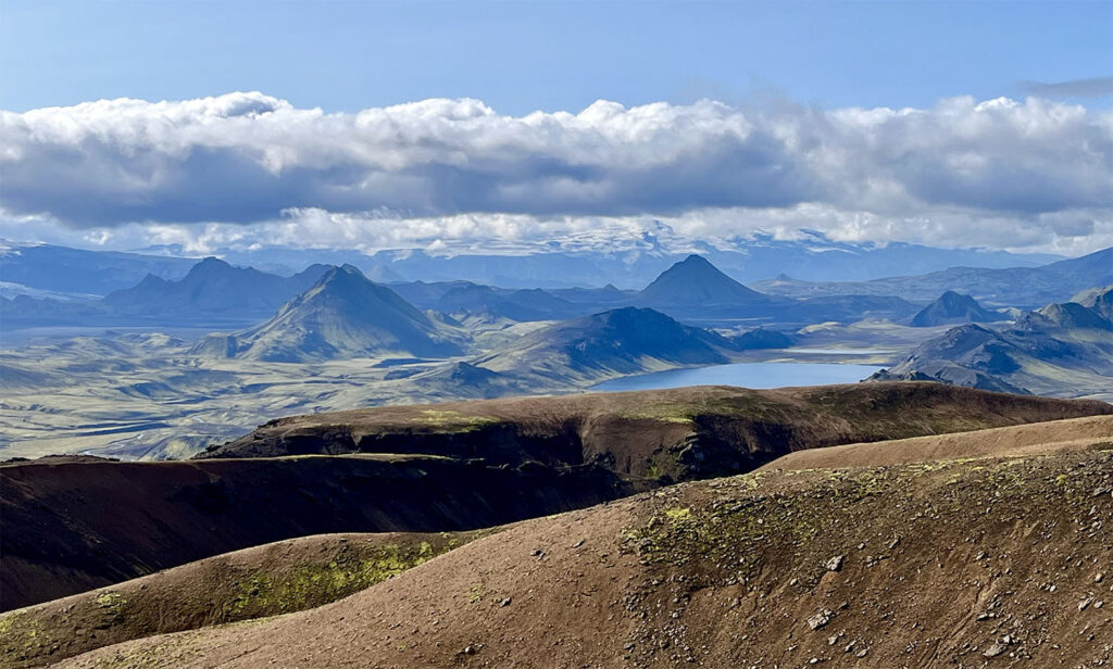
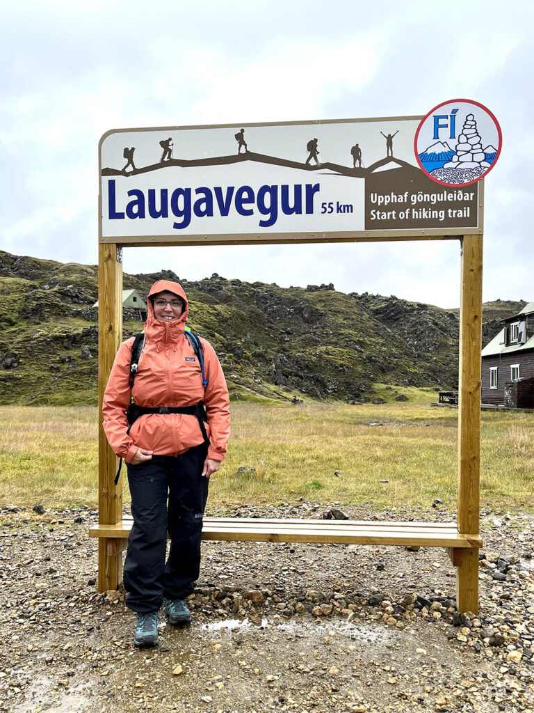
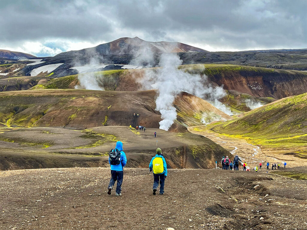
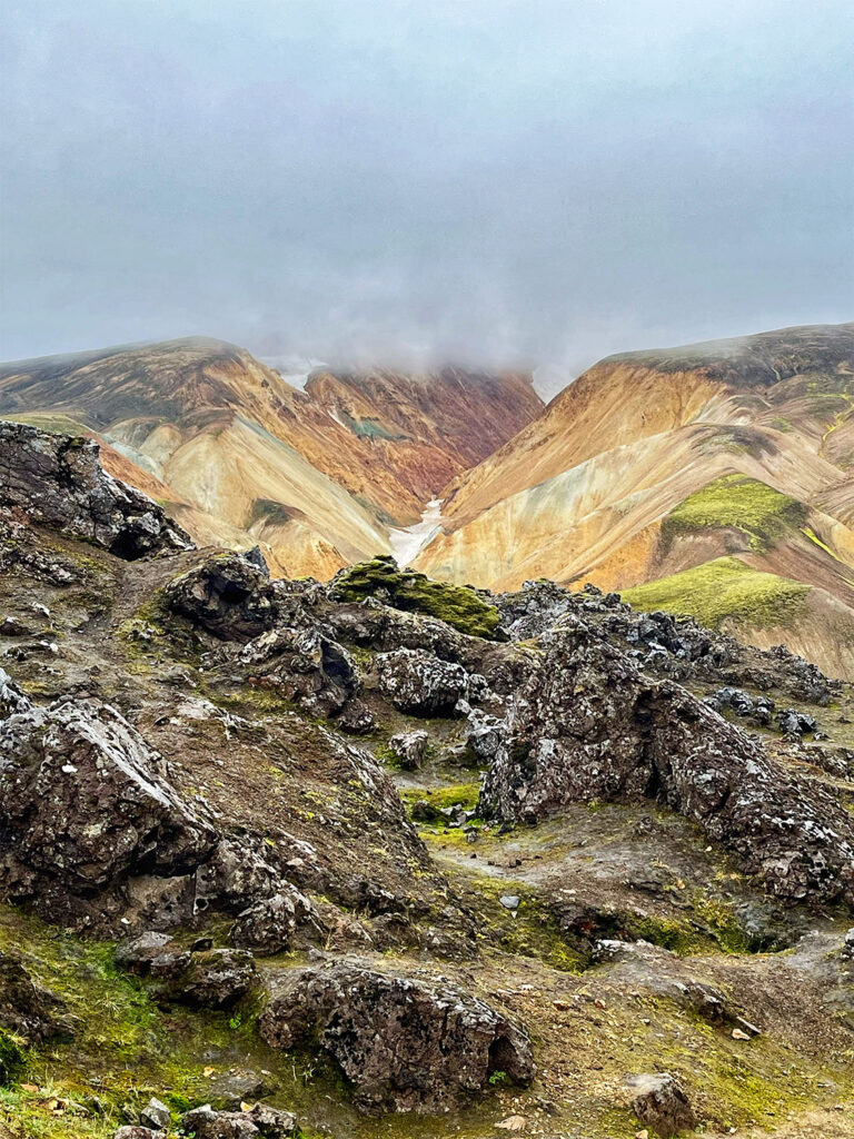
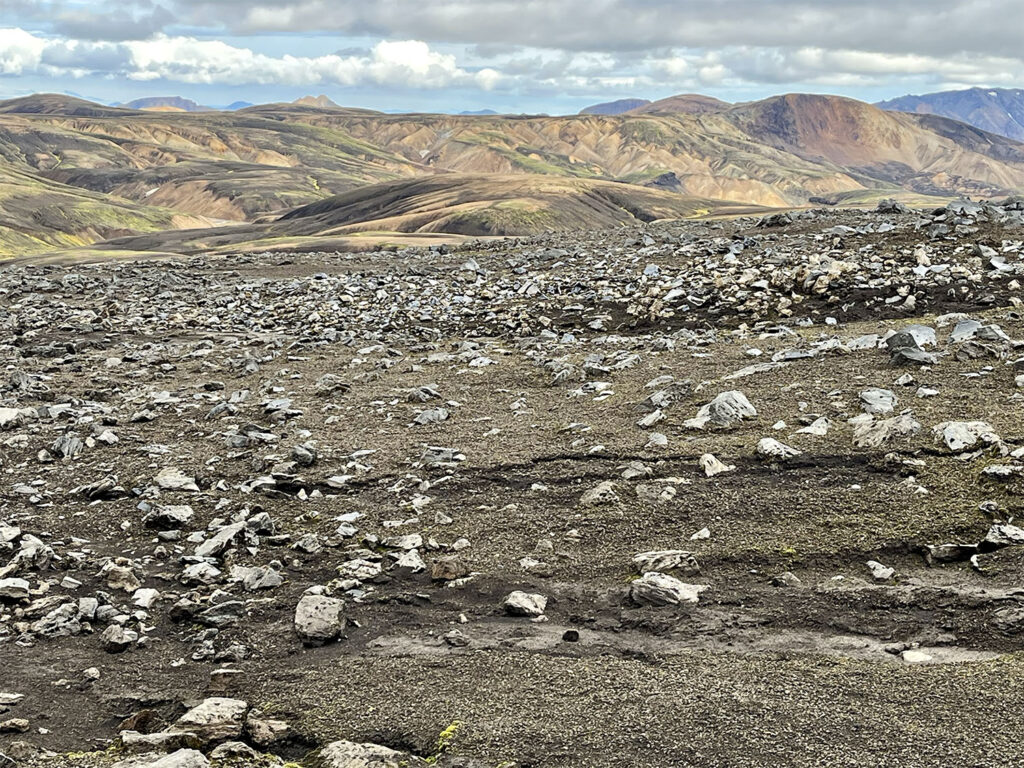
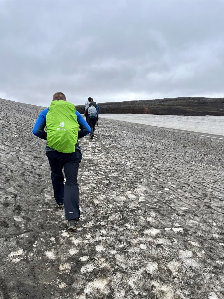
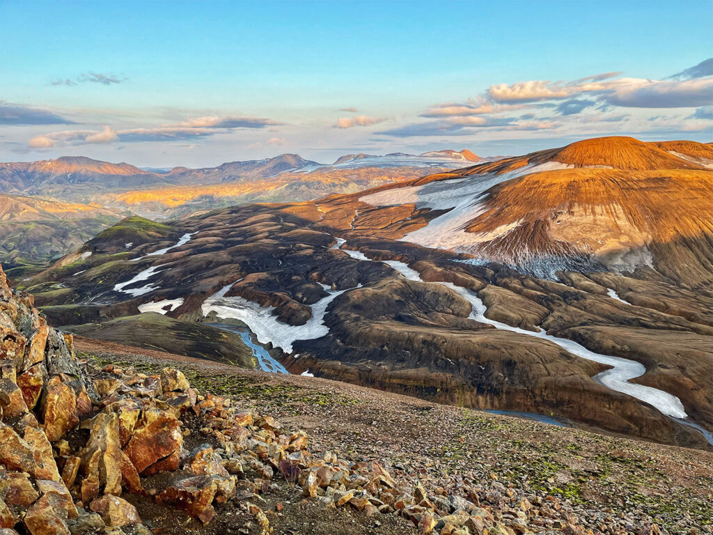
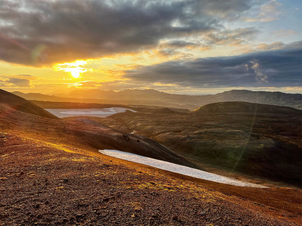
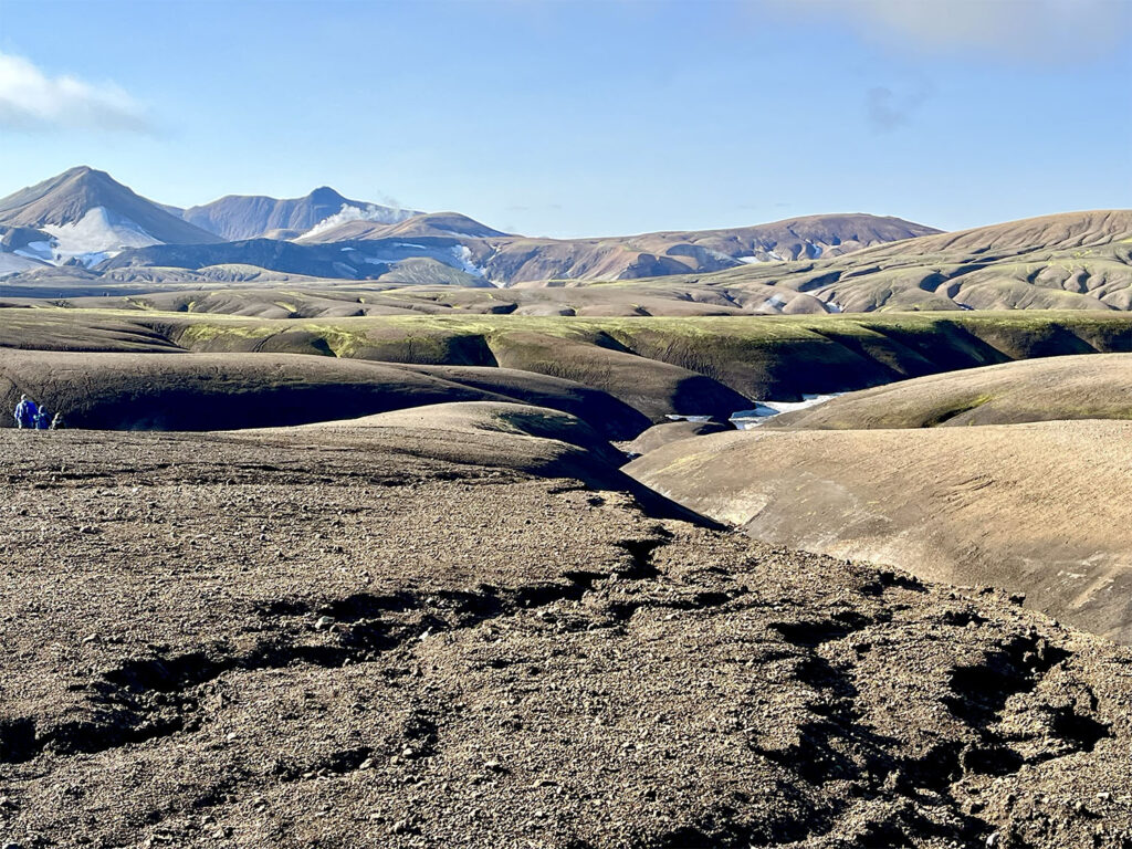
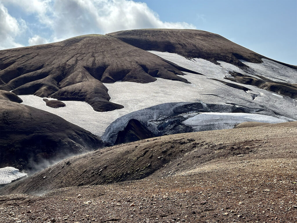
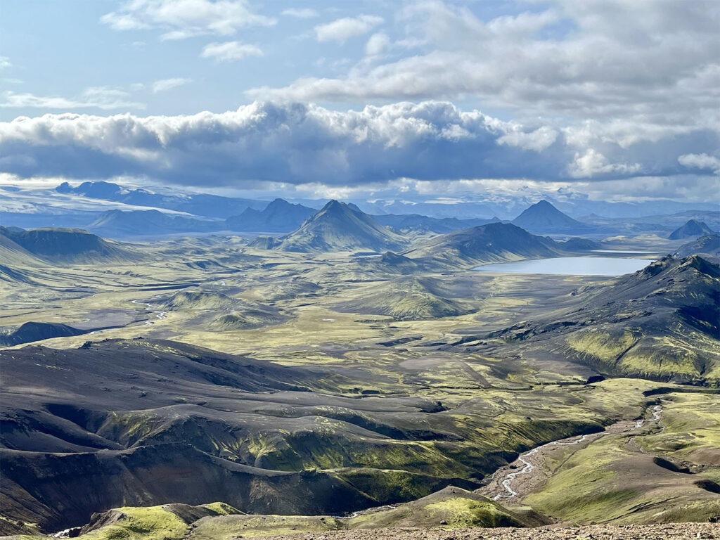
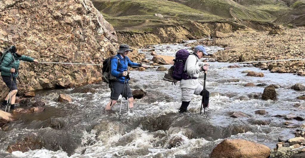
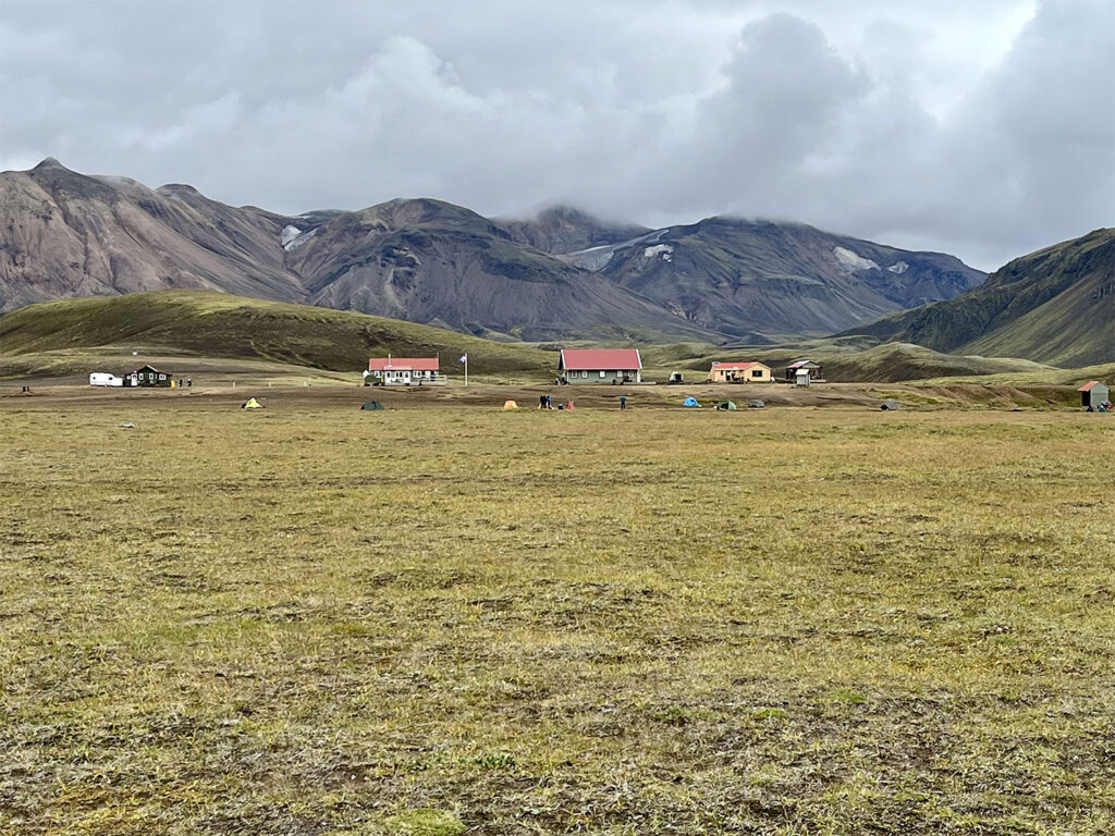
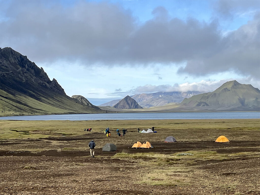
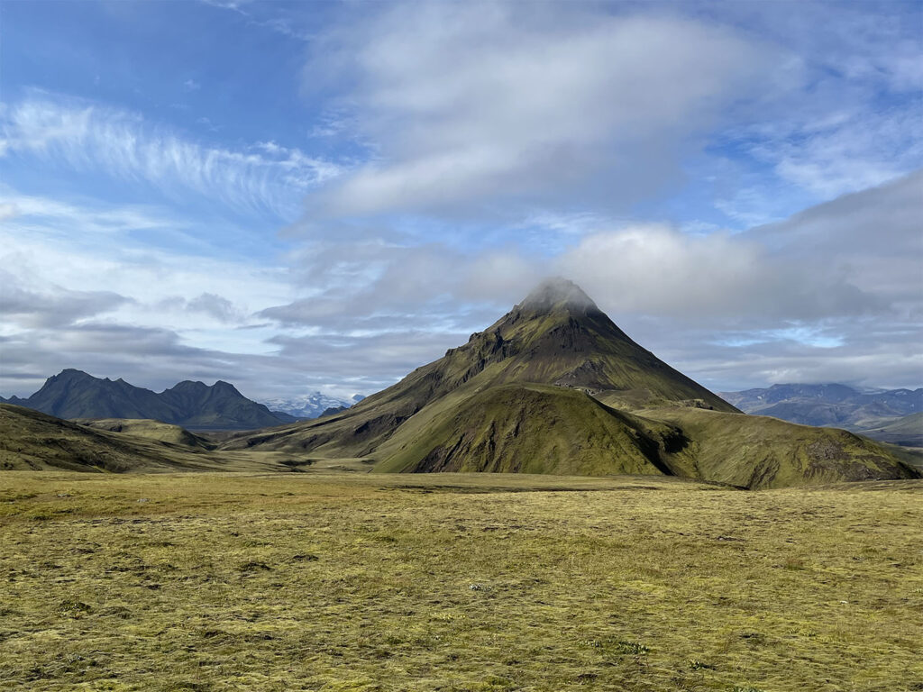
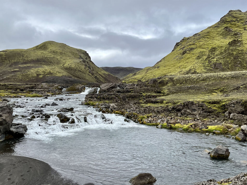
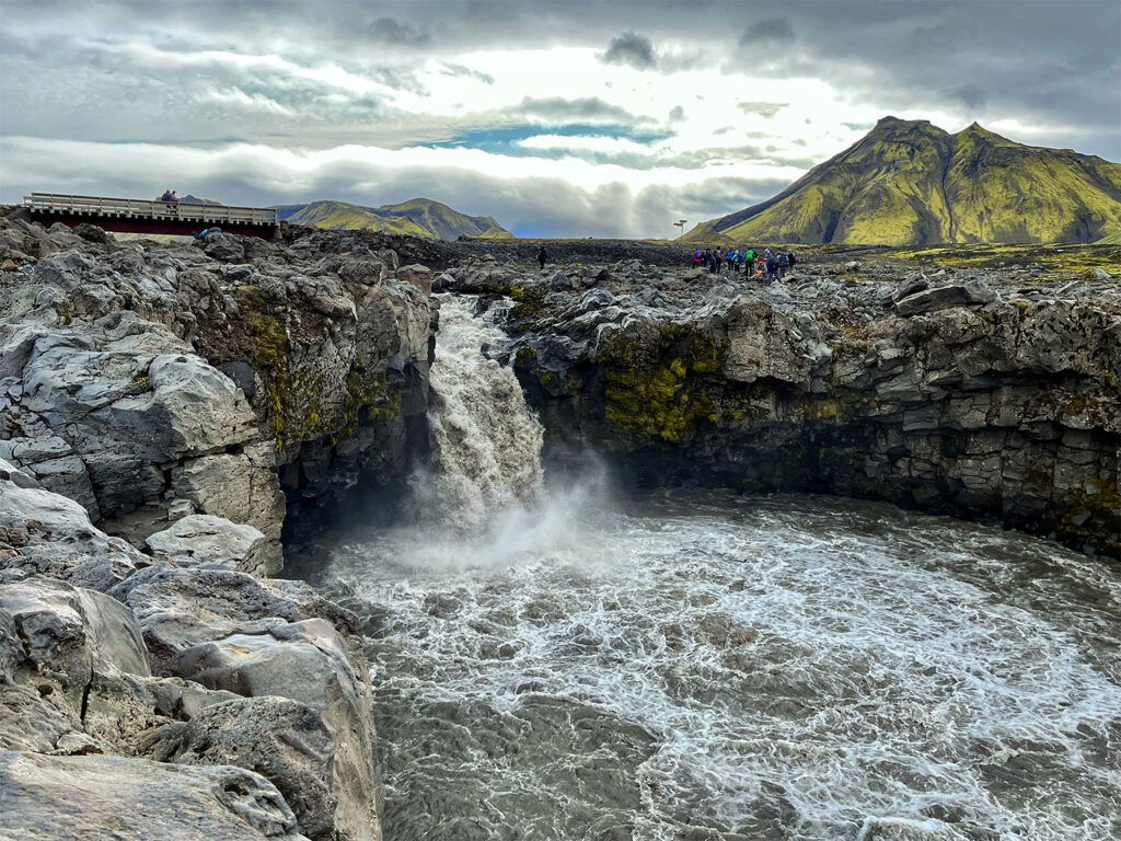
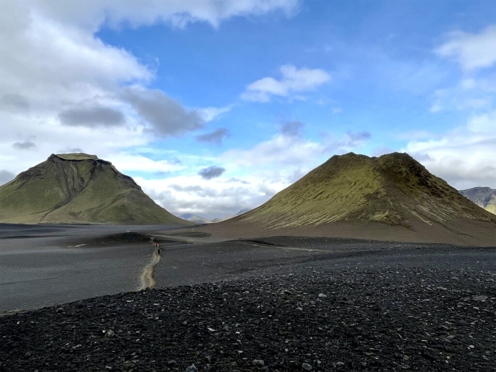
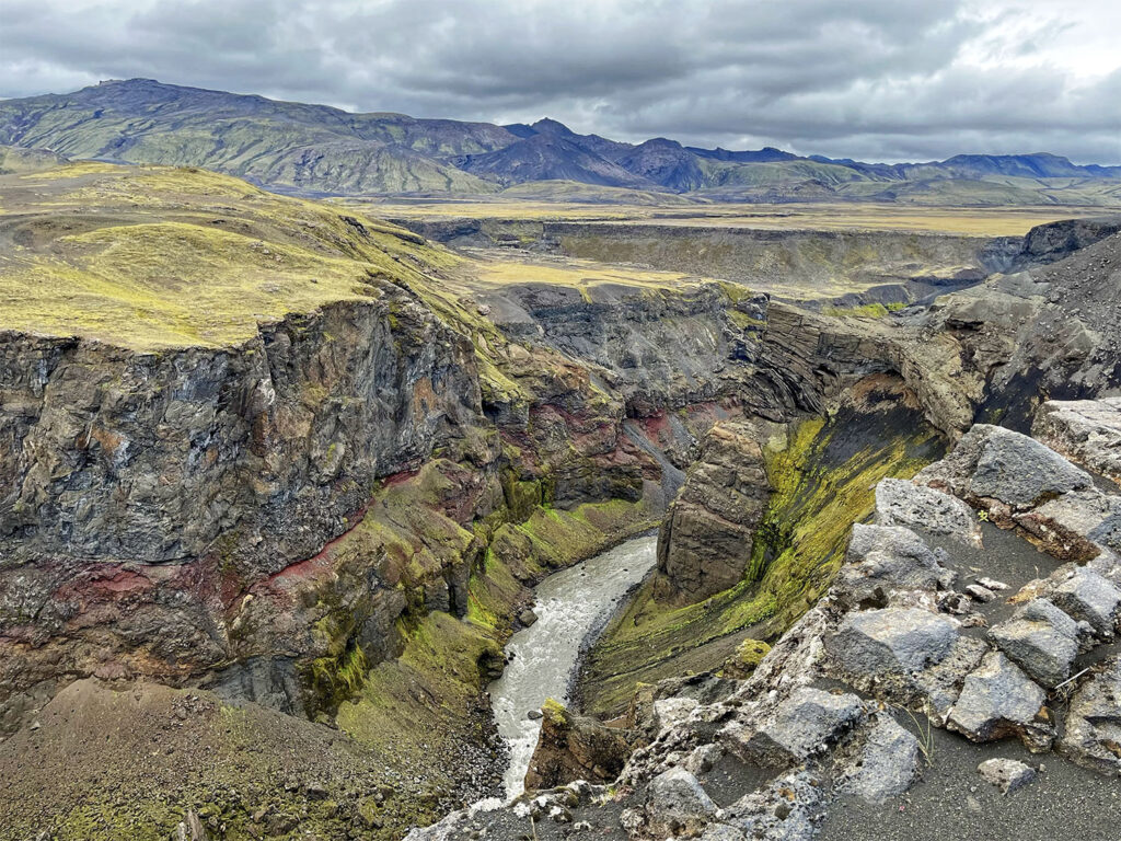
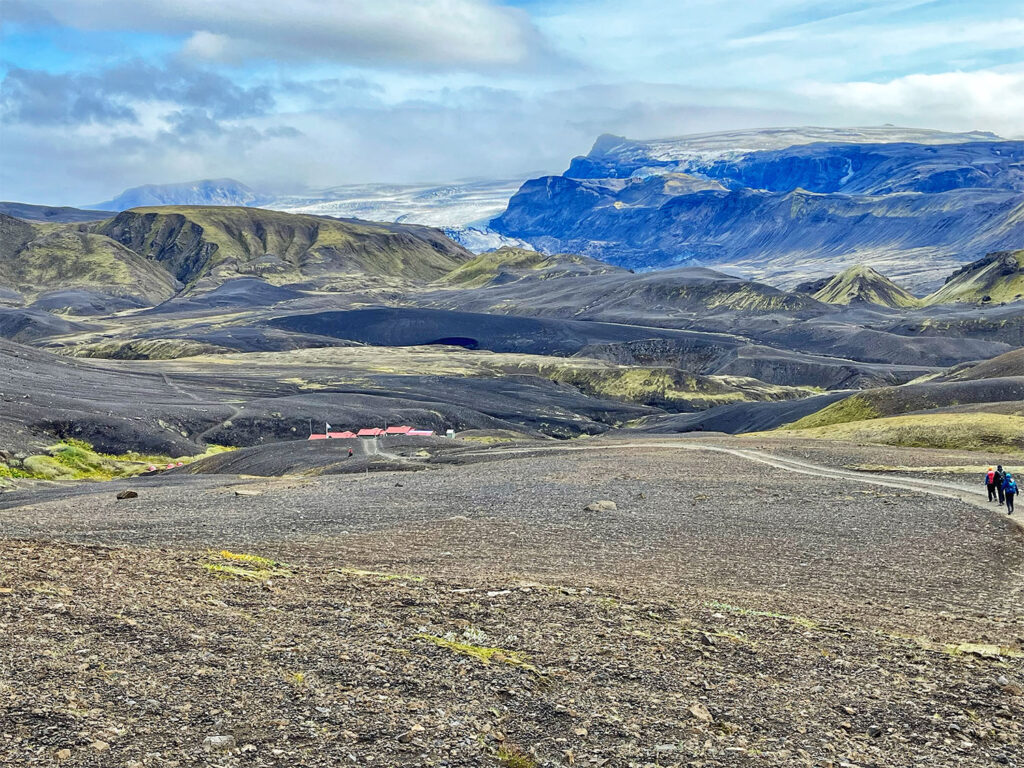
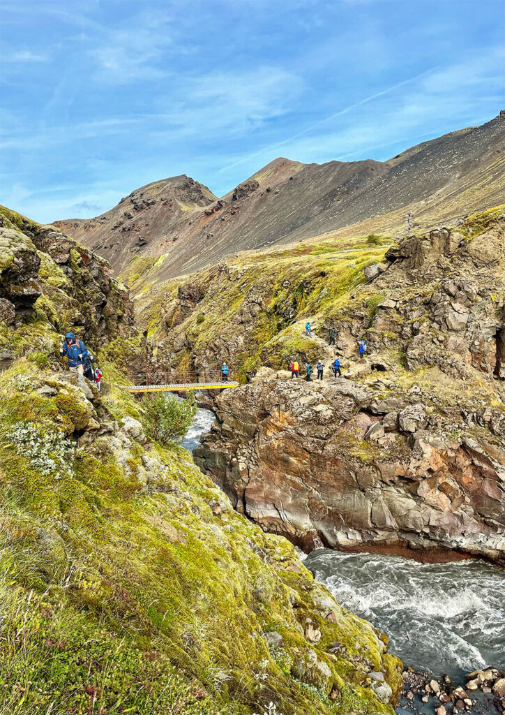
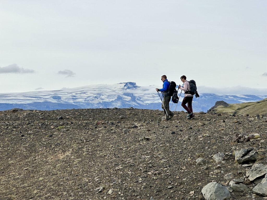
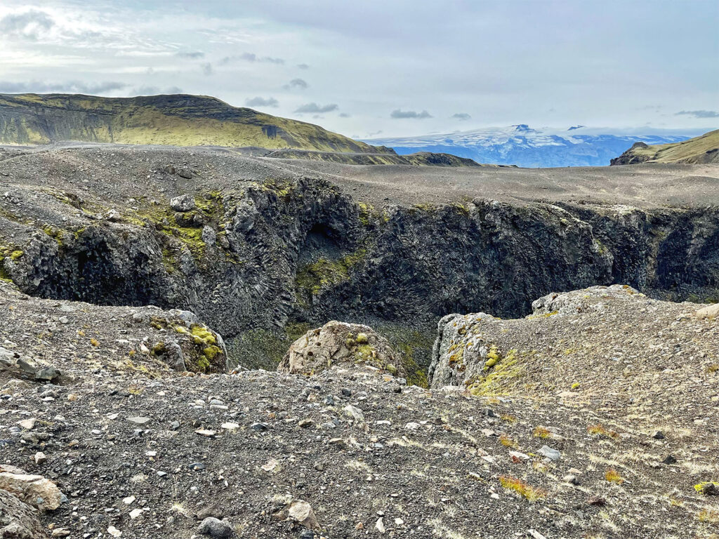
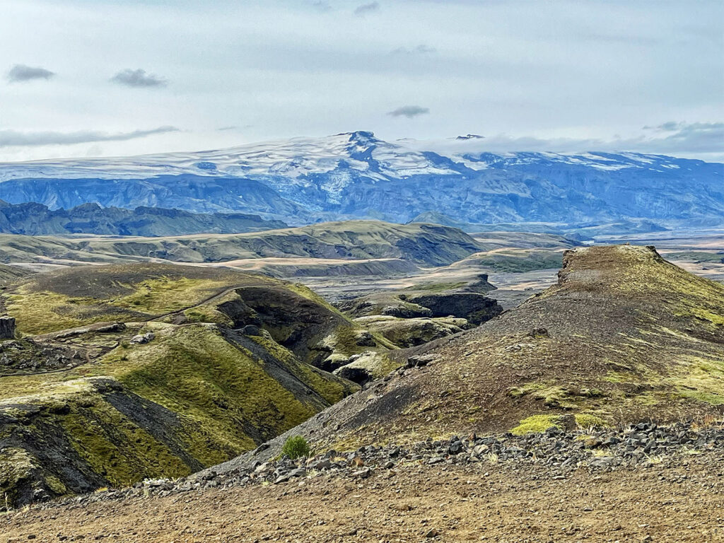
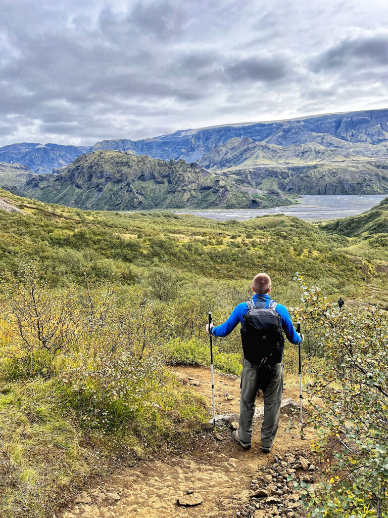
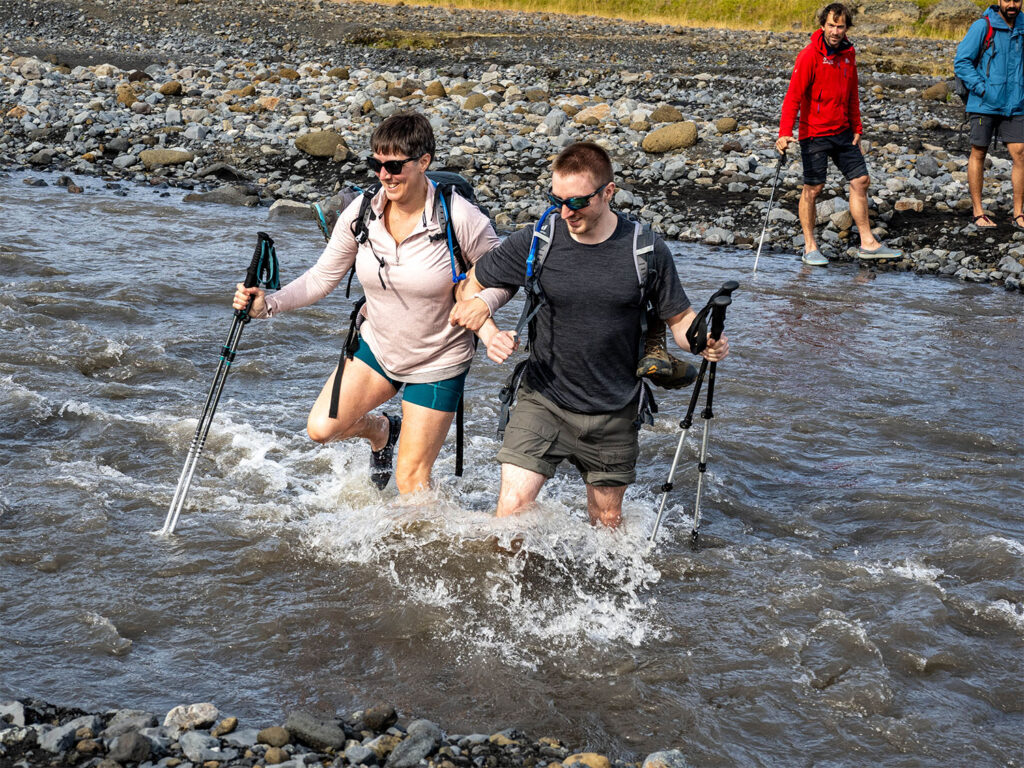
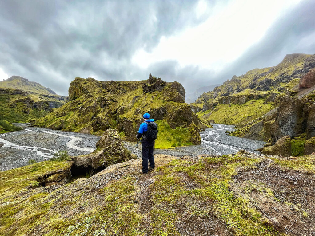
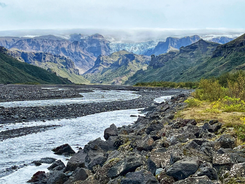
The Laugavegur Trek is a 34-mile (55 km) hut-to-hut journey stretching from Landmannalaugar to Þórsmörk, and is consistently ranked by National Geographic as one of the top 20 hikes in the world. This legendary trail winds through an extraordinary array of Icelandic landscapes—steaming hot springs, vividly colored rhyolite mountains, vast lava fields, geothermal zones, glistening obsidian expanses, lingering snowfields, dramatic canyons, and the stark beauty of a black sand desert. On clear days, the trail affords views of three different glaciers shimmering in the distance, and there are several river crossings that add to the sense of adventure.

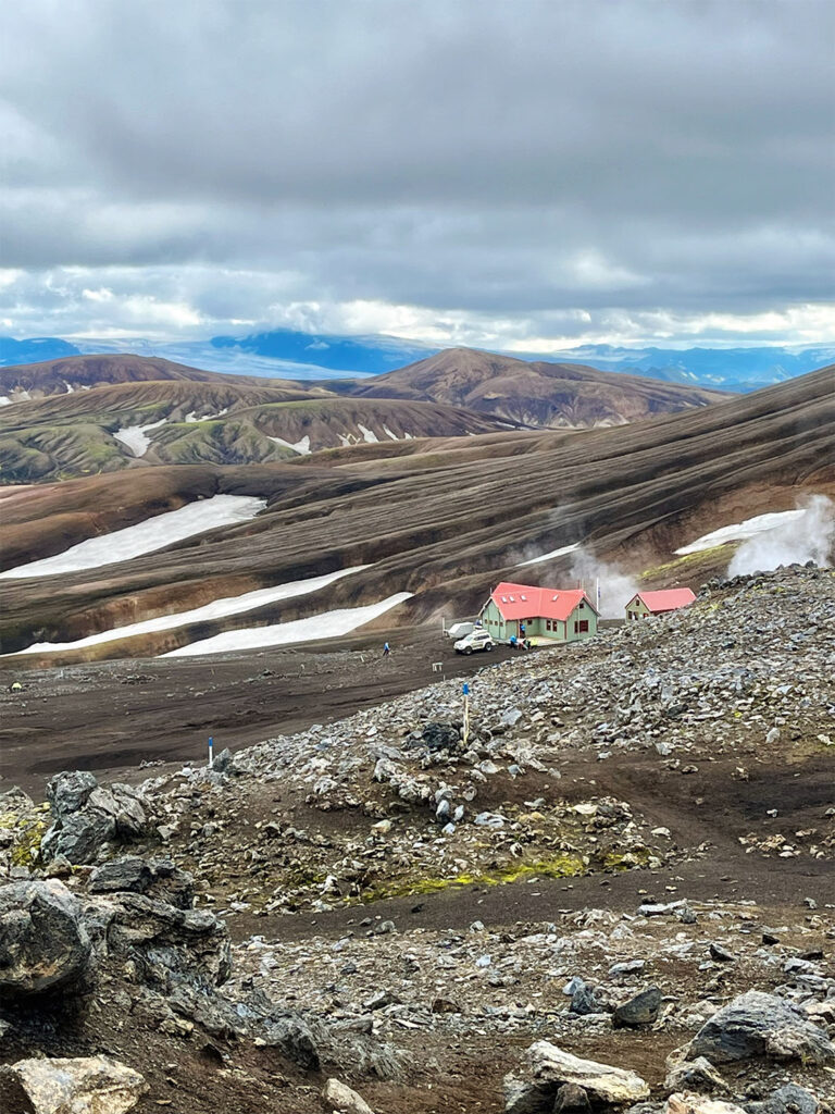
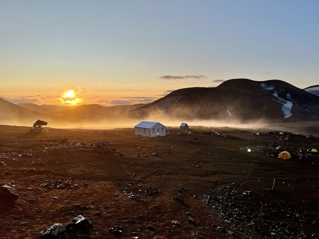
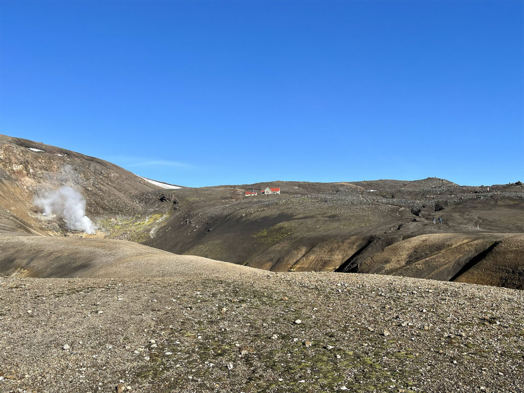
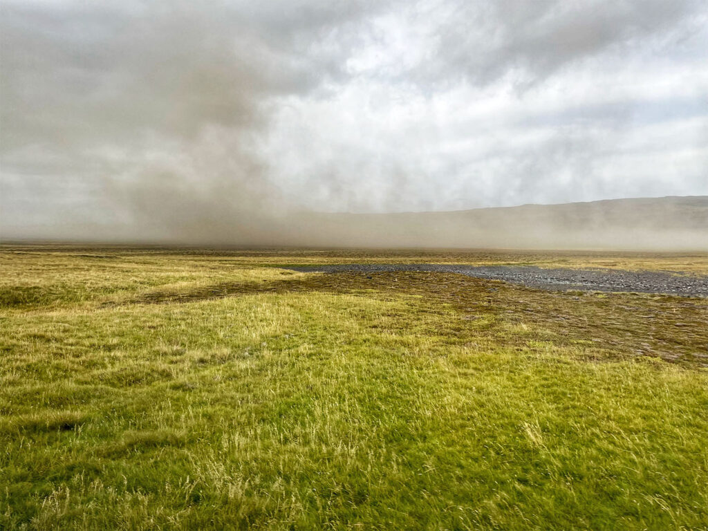
The trek is maintained by Ferðafélag Íslands (FI), the Icelandic Touring Association, which operates a network of huts along the route. While wild camping is not permitted, hikers may pitch tents at the hut sites for a modest fee. Though the trail is well-marked and accessible to independent trekkers, we opted for a guided tour for several compelling reasons: first, Iceland’s notoriously unpredictable weather can render navigation challenging for the inexperienced; second, all hut reservations were handled for us; third, all meals were prepared and provided, sparing us the burden of carrying food; and finally, we only needed to hike with daypacks, as our remaining gear was transported between huts.

We chose to travel with Icelandic Mountain Guides and could not have been more pleased with our decision (we also booked a glacier hike with them later in our trip). Our guides were Víla and Ales, both extraordinary in their own right. Vilborg Arna Gissurardóttir—whom we affectionately knew as Víla—was the first Icelandic woman to ski solo to the South Pole and to summit Mount Everest, becoming the seventh Icelander to do so. Unbeknownst to us at the time, she is something of a national icon. Her partner, Ales, hails from Slovenia and is an accomplished technical climber, alpinist, certified mountain guide, and holder of a PhD in civil engineering. In 2017, he was named Alpinist of the Year by the Alpine Association of Slovenia.

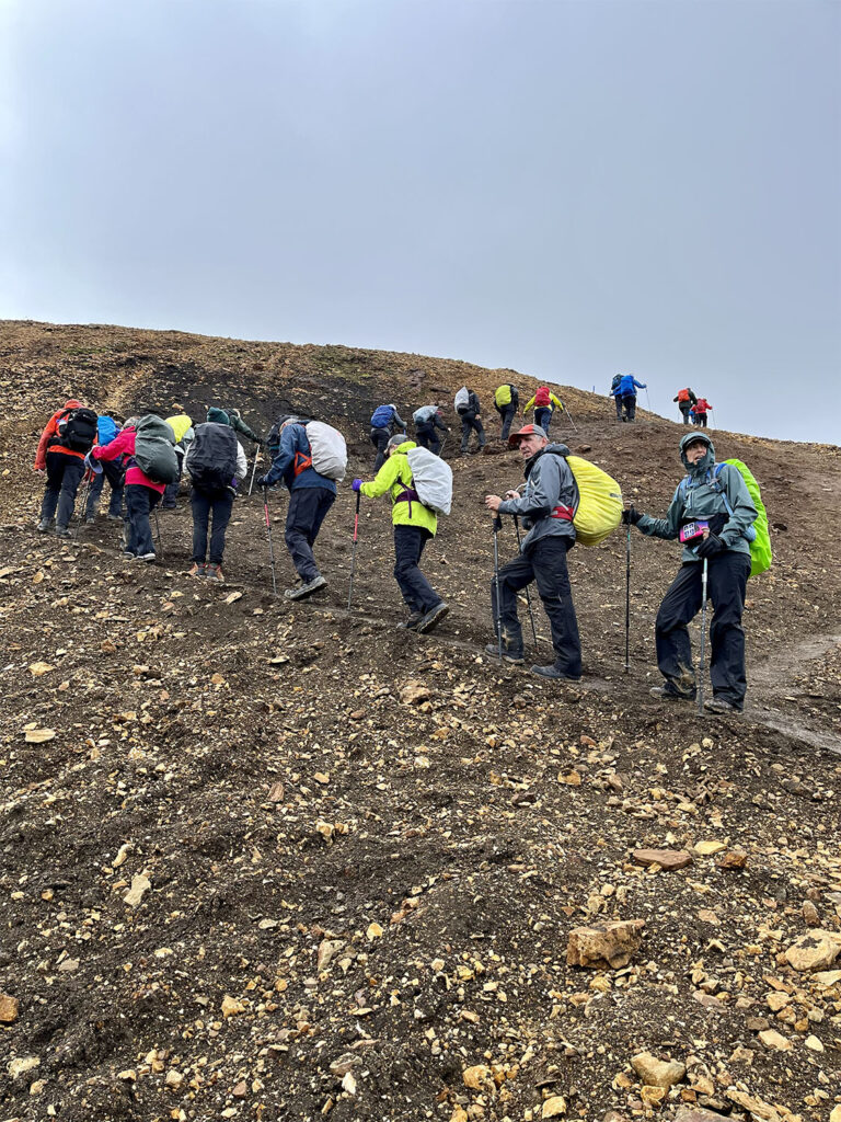
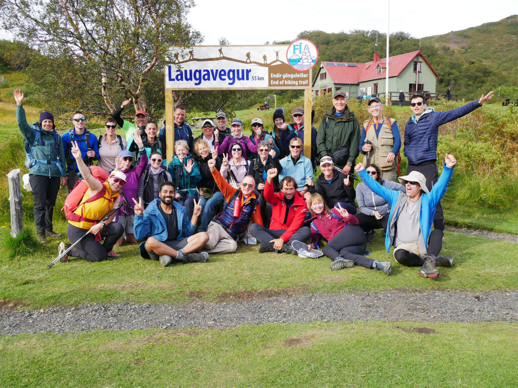
Our tour group was initially meant to include 14 hikers and one guide. However, due to severe weather on the first day, our group was merged with another, resulting in a combined party of 28 hikers and two guides. While I was initially concerned that the larger group might slow our pace, the arrangement turned out to be ideal. Víla led from the front while Ales took up the rear as a sweep, allowing everyone to walk at their own rhythm and spread out over nearly half a mile. The camaraderie within the group was remarkable. We shared the trail with a vibrant mix of adventurers: 10 Americans, 8 Brits, 6 Canadians, as well as travelers from Belgium, France, Australia, and Scotland.


Day 1 Landmannalaugar to Hrafntinnusker Hut

Miles hiked: 7.5 elevation gain: 1,750 ft, elevation loss: 325 ft

We spent three nights in Reykjavík at an Airbnb before embarking on the Laugavegur Trek. On Monday morning, our adventure began with a predawn wake-up call at 5:30 AM. Most of our gear had been packed the night before, so by 6:15 we were suited up in rain gear and walking the three blocks downhill to the BSI bus terminal, carrying our hiking backpacks and a 70-liter Patagonia Black Hole duffel.

At the terminal, a clearly marked sign indicated the meeting point for all Icelandic Mountain Guides tours. We were greeted by our guides and directed to load our non-essential gear into a separate transport vehicle, which would head directly to the Hrafntinnusker Hut. Soon after, we boarded our highland bus and began the 3.5-hour journey to Landmannalaugar, the official starting point of the Laugavegur Trail deep in Iceland’s remote highlands. This rugged region is accessible only by specially outfitted buses capable of river fording, or by 4×4 vehicles.

Roughly an hour into the drive, we stopped in the town of Selfoss for a brief bathroom and coffee break at a local bakery. The rain, which had begun earlier that morning, continued steadily as we left the paved highway and transitioned onto gravel and F-roads. While the route is known for its spectacular scenery, the persistent downpour and low visibility masked much of the dramatic landscape, likely costing us more than a few postcard-worthy photo opportunities. Along the way, our bus crossed several rivers before finally reaching Landmannalaugar around 11:00 AM.

Upon arrival, we had an hour to organize our gear, eat the provided packed lunch, and, for those interested, take a dip in the area’s renowned hot springs (we opted not to). With the rain still falling, we ate lunch huddled in a cramped tent to stay dry. Landmannalaugar serves as a popular base for both multi-day treks and shorter day hikes, with a sizable campground and well-frequented geothermal pool.

 
Start of the Laugavegur Trek in Landmannalaugar

At noon, we officially set out on the trail under gray skies and a steady drizzle. Clad in full rain gear with covers on our packs, we began the 7.5-mile (12 km) ascent to the Hrafntinnusker Hut, the highest point along the trek at 3,743 feet. The trail’s opening stretch climbs through the Laugahraun lava field, alive with geothermal activity—steam vents hissing, and pools bubbling from beneath the earth. Beyond the lava field, we entered a realm of vividly colored rhyolite mountains, their hues muted slightly by the weather.

 
Geothermal area along the first few miles of the Laugavegur Trek
Rhyolite mountains along the Laugavegur Trek

Around 2 PM, the rain finally relented and the sun broke through the clouds, revealing breathtaking views in all directions. We quickly shed a few layers and pressed on through more geothermal terrain, followed by a shimmering obsidian field and then a patch of lingering snow. The obsidian sparkled in the sunlight, creating a surreal contrast against the white snow and vibrant mountains.

As we approached Hrafntinnusker, we passed a sobering memorial to a 25-year-old Israeli hiker who tragically perished on the trail in late June 2004—just one kilometer from the hut. Disoriented by a sudden blizzard, he succumbed to exposure. It was a stark reminder of how quickly conditions can change in the highlands—and one of the reasons we chose to go with a guided tour.

 
A lot of elevation gain on the first day
Obsidian field
Crossing a snowfield
Approaching the Hrafntinnusker Hut

We arrived at the hut by 4:30 PM, where our duffels were already waiting for us. In my opinion, Hrafntinnusker offered the most stunning views of all of the huts—but also the least comfortable facilities. The toilets were pit-style, though housed together in a single structure. Colin and I claimed sleeping spots on the hut’s upper level, on mattresses laid across the floor. It was far preferable to the crowded lower level, where even the provided beds felt packed in.

That evening, Víla and Ales prepared a hearty lamb stew that hit the spot after a long, wet day. After dinner, Colin and I hiked up a nearby ridge to watch the sun set over the mountains—a golden finale to an otherwise gray day. Later, we passed some time with a few games of cribbage. I turned in early, but Colin, unable to sleep, ventured outside and captured some beautiful photos of the moon rising over the surrounding peaks.

Golden hour view from the Hrafntinnusker Hut
Sunset from a ridge nearby the Hrafntinnusker Hut

A final note for future trekkers: if you’re a light sleeper, earplugs are essential. There will inevitably be a few enthusiastic snorers in every hut.


Day 2 Hrafntinnusker Hut to Lake Alftavatn Hut

Miles hiked: 7.4. elevation gain: 1,000 ft, elevation loss: 2,600 ft

We awoke to a stunning sunrise that bathed the landscape in golden light. The air was crisp and cold—likely in the upper 30s—but the tranquility of the hut and surrounding camp area made for a peaceful, serene start to the day. I took a short walk through the quiet morning to capture a few photos before breakfast.

At 8:00 AM, we gathered in the hut for a hearty meal of fresh fruit and oatmeal, accompanied by a generous spread of toppings: dried fruit, chocolate chips, peanut butter, Nutella, yogurt, and Iceland’s signature Skyr. After breakfast, our guides laid out provisions for packing lunch: assorted breads and wraps, deli meats, cheeses, cucumber slices, hummus, peanut butter and jelly, along with fruit and cookies. Colin and I had also brought a substantial stash of Zone bars, which made for perfect trail snacks.

 
Sunrise view from the Hrafntinnusker Hut

We set off around 9:30 AM, bound for the Lake Álftavatn Hut—7.4 miles (12 km) away. While I had read that the first day was considered the most challenging due to its continuous elevation gain, I personally found this stage of the trek the most difficult. The terrain was relentlessly undulating, marked by steep, jarring descents that, while not overly taxing on the lungs, were punishing on the knees. To alleviate the strain, Colin resorted to walking backward on some of the steeper downhills—a clever if unconventional strategy.

The trail crossed gently rolling basalt hills and passed beneath several delicate snow bridges near Reykjafjöll Mountain. A short but demanding ascent led us up to the Jökultungur plateau, where we paused to admire sweeping views of the route we had already traveled. From this high vantage point, we were also treated to an awe-inspiring panorama of three glaciers: Tindfjallajökull, Eyjafjallajökull, and Mýrdalsjökull. Eyjafjallajökull, of course, being the now-infamous volcano whose 2010 eruption brought European air travel to a halt.

 
Looking back at the Hrafntinnusker Hit
Undulating terrain between the Hrafntinnusker Hut and Lake Alftavatn
Snowbridges

As we crossed the plateau, the landscape ahead began to open up. In the distance lay the Álftavatn Valley—green and black mountains framing a wide, still lake. Though I’ve never seen The Lord of the Rings, several fellow hikers likened the dramatic view to Mordor—rugged, haunting, and beautiful all at once.

 
Lake Alftavatn Valley

We paused for lunch overlooking the valley, then began the long, steep descent toward the lake. Before reaching the hut, we encountered our first river crossing: the Grashagakvísl River. A cable strung across the current offered extra stability, though the crossing was still brisk and invigorating.

 
First river crossing

We arrived at the Lake Álftavatn Hut around 3:45 PM, after approximately six and a quarter hours on the trail. The facilities here were a step up in some ways: the bathrooms featured flush toilets and were immaculately clean, and the kitchen area was modern and well-equipped. However, the sleeping arrangements left something to be desired. All 28 of us were packed into a single room that doubled as the dining area, with narrow, twin-sized sleeping pads arranged in bunked rows. Fortunately, Colin and I managed to snag a lower bunk.

This hut also offered hot showers—a rare luxury on the trail. At 500 ISK (about $3.75 USD) for five minutes, it was worth every krona.

Dinner that evening was a flavorful fish stew served over rice, prepared by Víla and Ales. I took dish duty while Colin socialized, learning the rules of a Monopoly card game from two fellow trekkers. Later, we played a game of cribbage before turning in early once again.

That night, I fell asleep quickly to the chorus of some twenty people snoring—a surprisingly soothing white noise that didn’t bother me in the least.

 
Looking back at the Lake Alftavatn Hut from the lake

Day 3 Lake Alftavatn Hut to Botnar Hits in Emstrur

Miles hiked: 10.0 elevation gain: 825 ft, elevation loss: 1,025 ft

This morning followed a familiar routine: a warm breakfast of oatmeal accompanied by an array of toppings, followed by assembling our packed lunches from the generous spread laid out by the guides. Just as we were preparing to depart, I had a brief moment of panic—my hiking boots were missing. Since boots aren’t permitted inside the huts, everyone leaves theirs in the shared mudroom entrance, and it can get a bit chaotic. After a frantic search, I found mine outside, just as a fellow hiker was about to slip them on. Her boots, nearly identical in brand but a different model, had caused the confusion. Crisis averted.

Our route today covered approximately 10 miles (16 km), with our destination being the Botnar Huts in Emstrur. We set off around 9:30 AM, heading east toward the Hvanngil chasm. About 20 minutes into the hike, we encountered our first river crossing of the day: the Bratthálskvísl River. It was considerably wider than the river we’d crossed the previous day, though still relatively shallow and easy to navigate.

 
Looking out at Lake Alftavatn from the Hut in the early morning
View between the Lake Alftavatn Hut and the Hvanngil Hut

We reached the Hvanngil Hut around 10:40 AM and paused briefly for a bathroom break. This hut is often used as an alternative to the Lake Álftavatn Hut when accommodations there are full. After departing Hvanngil, we crossed the Kaldaklofskvísl River via a footbridge. Not long afterward, we encountered another river, the Bláfjallakvísl, which required wading through ice-cold water—it was, in my opinion, the coldest crossing of the entire trek.

 
Kaldaklofskvisl River

From there, we entered the black sand desert—an expansive, flat stretch of volcanic soil, stark and otherworldly. Our final river crossing of the day was at the Innri-Emstruá River, where a dramatic waterfall tumbles beneath a sturdy bridge used by both hikers and highland vehicles. We stopped here for lunch, enjoying the sound of rushing water and the rugged views before pressing on.

 
Our lunch spot along the Innri-Emstrua River
Continuing along the black sand desert

Back in the desert landscape once more, we eventually took a short detour to visit the awe-inspiring Markarfljótsgljúfur Canyon. Carved over 2,000 years ago by catastrophic glacial flooding caused by an eruption of the infamous Katla volcano (which lies buried beneath the Mýrdalsjökull glacier), the canyon plunges 656 feet deep into the earth. It was a humbling reminder of the raw, ancient forces that have shaped this land.

 
Markarfljótsgljúfur Canyon

We arrived at the Botnar Huts in Emstrur around 3:30 PM. The site consists of three separate sleeping cabins, each accommodating 20 hikers. A separate building houses modern bathroom facilities, including flush toilets and coin-operated hot showers. At this stop, our larger trekking party split back into its original two groups, with each group occupying its own cabin. 

Sleeping arrangements here were basic but functional: two long bunk platforms lined with mattresses side-by-side, without any separation. Colin and I managed to grab spots on the lower level, which felt a bit more grounded and slightly more spacious.

Dinner that evening was a standout—perfectly grilled salmon served with a side of camaraderie. Seconds were enthusiastically enjoyed by all.

Approaching the Bodnar Huts at Emstrur

Day 4 Emstrur to Þórsmörk

Miles hiked: 12.0 elevation gain: 1,575 ft, elevation loss: 2,325 ft

Today marked both the final leg of our trek and the longest in terms of distance. With a full day ahead, we opted for a simple breakfast of muesli to minimize cleanup. We set out a bit earlier than usual, hitting the trail at 9 AM. Our ultimate destination was the Básar Cabins, located just beyond Þórsmörk, the official endpoint of the Laugavegur Trek. The day’s journey would span approximately 12 miles.

The trail began with a descent toward the Syðri-Emstrua River, which we crossed via a footbridge before climbing once again to a higher plateau. There, we paused at a stunning gorge adorned with gracefully curved basalt columns—a perfect spot for a mid-morning snack. Gazing down into the ravine, we could see two rivers winding through the rock, both fed by meltwater from the Mýrdalsjökull and Eyjafjallajökull glaciers.

 
Crossing the Syðri-Emstrua River
Hiking along the plateau
Basalt column formations

As we pressed on, the landscape gradually transformed. The terrain grew greener, and soon we were walking among trees—an exciting sight after days of volcanic desert. Iceland’s only native tree, the white birch, lined our path. We paused atop a bald hill for lunch, taking in expansive views in every direction.

 
Our lunch view

After lunch, we began our descent toward the Þrönga River—our final river crossing of the trek. Though not particularly deep, its current was swift, so our guides instructed us to cross in pairs or trios. On the other side, we entered a lush, forested area, and after another 30 minutes of hiking, we reached Þórsmörk—Thor’s Valley—the symbolic end of the Laugavegur Trail. We commemorated the moment with a group photo in front of the sign, but our journey wasn’t quite over.

 
The finish line in view
Crossing the Þrönga River
A group photo at the completion of the Laugavegur Trek

We continued on for another two miles to reach the Básar Cabins, crossing several footbridges over the braided Krossá River and walking along a gravel road with magnificent glacier views. The Básar Cabins were, without a doubt, the most comfortable accommodations of the entire trek—a fitting end to our adventure. Our sleeping quarters were located upstairs, with each of us enjoying the luxury of our own twin bed. Hot showers were freely available, and the spacious dining and kitchen area even featured a high-speed dishwasher—a much-celebrated amenity.

That evening, Víla and Ales treated us to a spectacular farewell dinner: roasted lamb, corn, salad, and potatoes, with a delicious salmon appetizer. It was a warm, celebratory end to an unforgettable journey.


Day 5 Day Hike in Þórsmörk, return to Reykjavik

Miles hiked: 3.0

This morning unfolded at a leisurely pace. Coffee wasn’t served until 8 AM, followed by a hearty, fully cooked breakfast of eggs, bacon, toast, pancakes, and pudding. We needed to vacate the cabin by 10 AM, but our departure from Þórsmörk wouldn’t come until the once-daily bus to Reykjavík departed at 3 PM.

Because we hadn’t arrived in Þórsmörk until 5 PM the previous day, our group was scheduled for an optional morning hike in the surrounding area. Despite the less-than-ideal weather and concerns about strong winds—which were fortunately delayed until later in the day—most of the group chose to participate. In fact, by that afternoon, park authorities began evacuating all hikers from Þórsmörk due to worsening conditions.

Ales led us on a roughly three-mile hike, which proved to be quite strenuous but rewarding. Our destination was a breathtaking canyon—likely Hvannargil—its dramatic rock formations and verdant cliffs well worth the effort. We returned to the cabin around 1 PM, where we enjoyed “lambwiches” made from the leftover roasted lamb from the previous night’s farewell dinner.

 
Þórsmörk hiking
View of the glacier and the Krossa River as we hike back to the Basar Cabins

At 3 PM, the bus arrived to collect us. After a brief return loop to Þórsmörk to pick up additional hikers, we began the rugged journey back toward Reykjavík via the F-249. The route required multiple river crossings, and as we descended from the Highlands, the wind began to intensify. By the time we reached Route 1—the main paved Ring Road—the rain had begun to fall heavily. Along the way, we made stops in Hella and Hvolsvöllur to drop off fellow travelers

We arrived at the BSI bus terminal in Reykjavík around 7:30 PM, officially concluding our unforgettable Icelandic Highlands adventure. But our journey wasn’t over just yet—we still had another week to explore the Snæfellsnes Peninsula and the stunning southern coast of Iceland.

 
Strong winds created a dust storm on our drive out of the highlands

Leave a Comment

Your email address will not be published. Required fields are marked *